Multi-day backpacking creates navigation requirements that day hiking apps were never designed to solve. Gaia GPS has 50+ map layers including USGS topographic maps at 1:24,000 scale, slope angle shading for avalanche risk assessment, and offline downloads for any region - features that professional mountain guides and search and rescue teams use because the stakes of navigation failure in remote terrain are genuine. CalTopo is the desktop planning standard used by SAR professionals: multi-page map printing, slope angle at high resolution, collaborative sharing for team trips. AllTrails Plus covers the community intelligence layer - trail conditions, water source status, and campsite reviews - that pure navigation apps cannot replicate from professional map data alone.
After testing 7 backcountry navigation apps on Pixel 8 and Samsung Galaxy S24 running Android 15, on multi-day routes in varied terrain during 2025 and early 2026, I found four that consistently serve backpackers beyond the day hike range.
Who this is for: Backpackers who spend 2 or more nights on trail, who travel beyond reliable cellular coverage, and who need accurate topographic navigation, waypoint management, and pre-trip route planning tools. If you do primarily day hikes, the casual hiking guide covers your needs. For thru-hiking named trails like the AT or PCT, the thru-hiking guide addresses your specific requirements.
What Backpackers Need That Day Hike Apps Don't Provide
Overnight backcountry travel requires three capabilities that casual hiking apps handle inadequately.
High-Resolution Topographic Detail
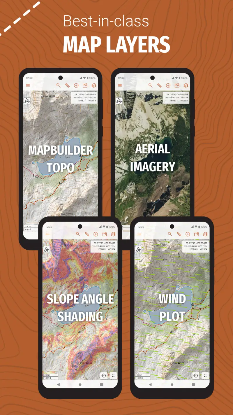
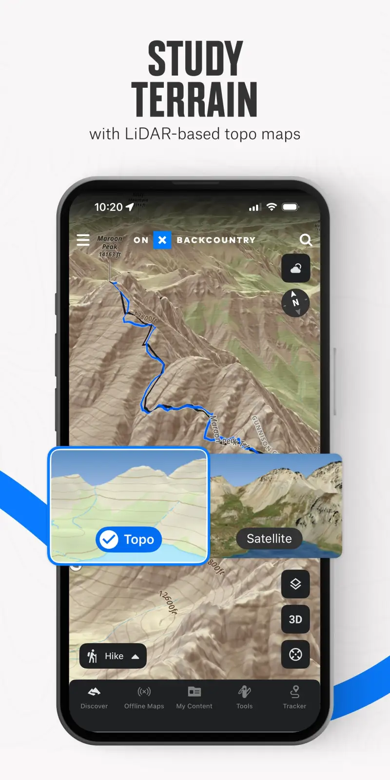
A USGS 1:24,000 scale topographic map shows elevation contours at 10-foot intervals, enabling backpackers to assess cliff bands, identify water drainage patterns, read ridgeline routes, and navigate through terrain without maintained trails. AllTrails' topographic display is adequate for finding established trails; it is insufficient for planning a cross-country route or navigating through a whiteout when the trail disappears. Gaia GPS's USGS topo layer at full resolution provides the detail level that serious backcountry navigation requires. The slope angle shading layer adds color-coded steepness overlays that help assess avalanche risk and route difficulty before committing to a line.

Offline Functionality With Zero Signal Dependency
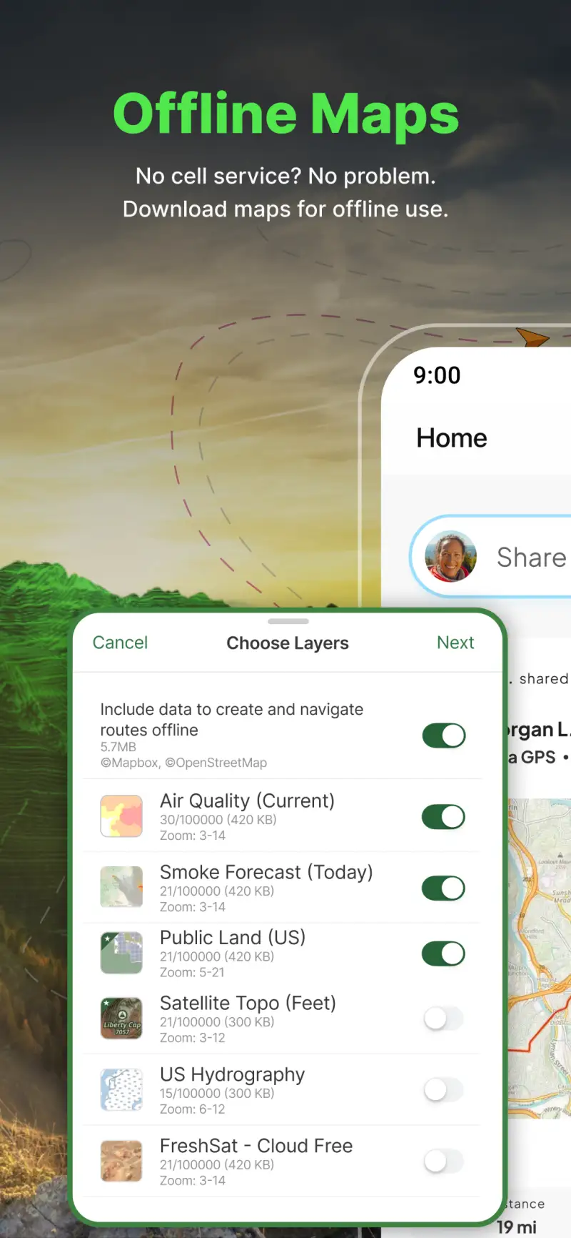
Backcountry terrain has no cellular coverage almost by definition - the remote valleys, high ridgelines, and dense wilderness areas where backpackers travel are precisely the areas that mobile networks do not reach. An app that requires a connection to display your position, download map tiles, or access trail data is functionally useless in the backcountry. Downloading offline maps before departure is the single most critical preparation step for any backpacking trip, and apps that make this difficult or expensive create real safety risks for users who skip the step.
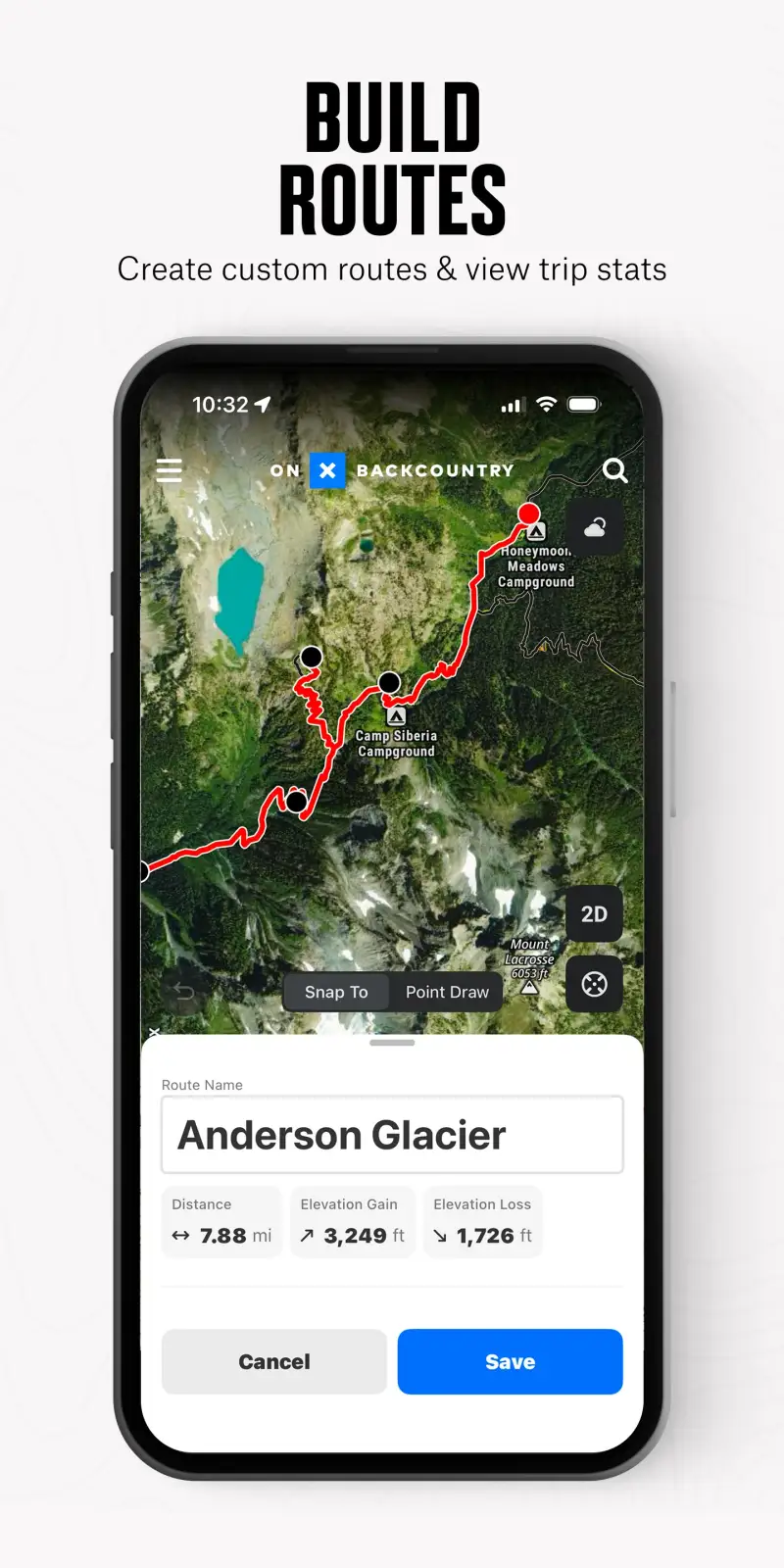
Waypoint Management for Multi-Night Routes
A three-night backpacking trip requires navigation to specific water sources, established campsites, permit zones, road crossings, and resupply points - none of which are obvious from a trail map alone. Marking waypoints for each night's campsite, tracking the planned water source locations, and managing the day-by-day itinerary in app requires waypoint tools that trail discovery apps lack. Gaia GPS handles waypoint creation and management directly. FarOut handles it specifically for named long trails (covered in the thru-hiking guide). For backpackers on unnamed routes, Gaia GPS's waypoint tools are the correct solution.
Gaia GPS - Best Backcountry Navigation App

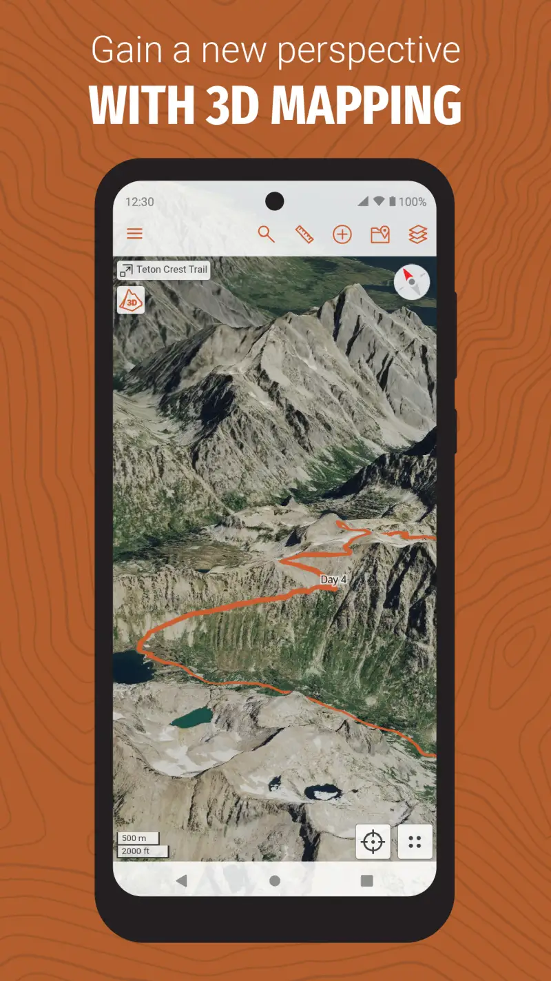
Gaia GPS is the professional standard for serious backcountry navigation, and its institutional adoption - professional mountain guides, SAR teams, ski patrol - reflects the depth of capability that backpackers in remote terrain need. The 50+ map layers include USGS topographic maps at 1:24,000 scale, satellite imagery updated weekly, slope angle shading, public land boundaries, wildfire data, snow depth overlays, and air quality maps. No other consumer hiking app approaches this map layer depth.
The 2026 update added support for T-Mobile's direct-to-cell satellite technology, maintaining connectivity in areas beyond any terrestrial cellular network. Garmin inReach integration allows sending and receiving messages and triggering SOS from within the Gaia GPS interface without switching apps - a meaningful safety upgrade for backpackers who carry inReach devices.
What Gaia GPS does well
- 50+ map layers: USGS 1:24,000 topo, satellite imagery, slope angle shading, public land boundaries, wildfire data, snow depth, weather overlays; no competitor matches this map layer depth for serious backcountry use
- USGS 1:24,000 topographic maps: highest available detail for US backcountry navigation; 10-foot contour intervals enable off-trail route-finding and technical terrain assessment
- Slope angle shading: color-coded steepness overlay for avalanche risk assessment; critical for backpackers in mountainous terrain, not available in AllTrails or Komoot
- Offline map downloads for any region, maintained without signal once downloaded
- Waypoint creation and management for multi-night route planning
- Live tracking with contact sharing for safety communication
- Garmin inReach integration for satellite messaging and SOS from within the app
- T-Mobile direct-to-cell satellite support added in 2026
Where Gaia GPS falls short
The learning curve is steeper than any other app in this guide - first-time Gaia GPS users typically need several practice sessions before feeling comfortable with layer switching, offline map downloading, and waypoint management during a real backcountry situation. The Outside Inc. acquisition in 2021 has introduced sign-in requirement bugs that users consistently report, particularly problematic when already in the backcountry where re-authentication without cellular coverage is impossible. Pricing through the Outside+ bundle at $89.99 per year bundles Gaia GPS with Outside magazine content and other properties that dedicated hikers typically do not want - the standalone Gaia GPS price is less clear than it was pre-acquisition. Community trail reviews and discovery features are minimal compared to AllTrails.
Pricing: $89.99/year Outside+ bundle (includes Gaia Premium + Trailforks Pro + Outside digital)
Subscribe to Gaia GPS and practice downloading offline maps for a familiar local area before relying on it in genuinely remote terrain. The offline map download workflow - selecting a region, choosing detail level, downloading before departure - needs to become automatic before it functions reliably under the time pressure of a pre-trip preparation session.
AllTrails Plus - Best Community Intelligence Layer

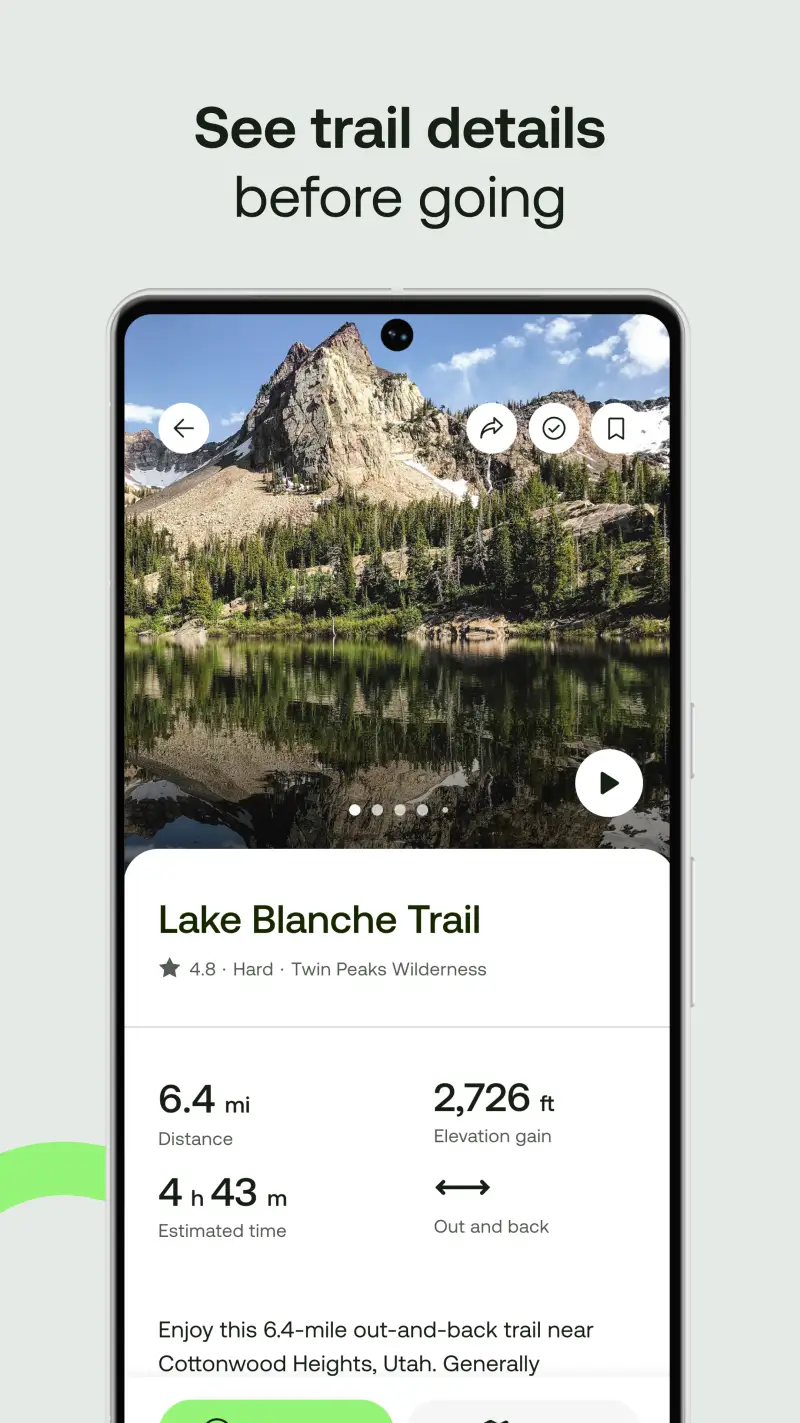
However, Gaia GPS's professional map layers do not replace the community condition intelligence that backpackers need before committing to a specific route. AllTrails Plus addresses the pre-trip research layer: recent reports on water source status, campsite conditions, trail washouts, and permit requirement changes come from hikers who completed the same route days or weeks before your planned trip. This community data changes real planning decisions in ways that a topographic map cannot.
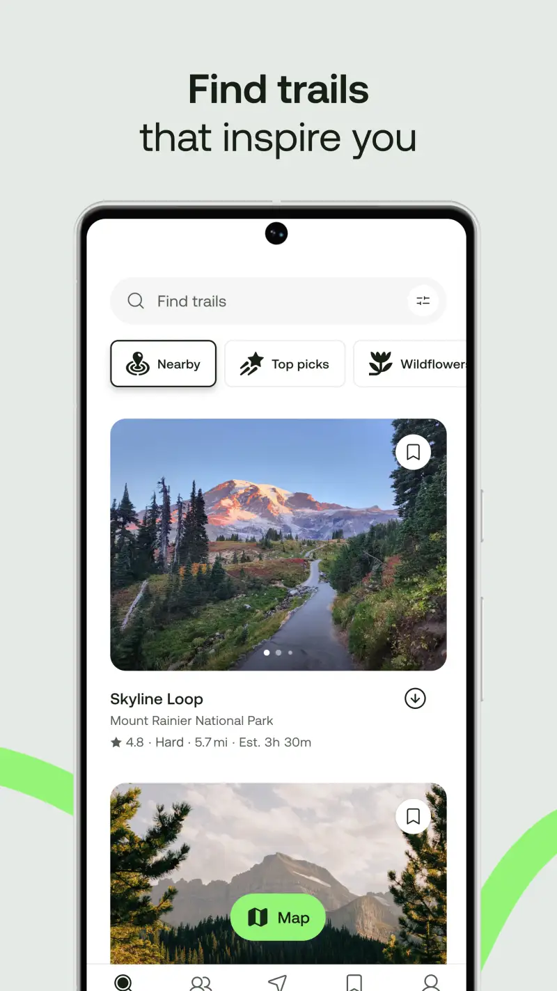
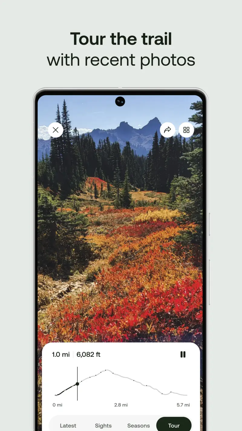
The 450,000+ trail database with difficulty ratings, photos, and condition reports also handles the route discovery phase that most backpacking trips require. Identifying candidate routes, comparing elevation profiles, checking permit requirements, and reading recent experience reports from other backpackers all happen in AllTrails before any navigation tools are needed. Downloading the offline map for the specific trail sections removes the signal dependency for basic navigation.
What AllTrails Plus does well
- Community condition reports: recent visitor notes on water source status, trail obstacles, campsite conditions, and permit changes; the community intelligence that professional topo maps cannot provide
- 450,000+ trail database: route discovery with difficulty ratings, elevation profiles, photos, and user reviews; the planning research layer before committing to a specific route
- Offline maps (Plus): download trail map for navigation without signal; wrong-turn alerts at trail junctions; live location sharing with emergency contacts
- 3D trail preview: view the terrain in three dimensions before departure; useful for assessing technical sections and adjusting your planned route
- Permit and regulation information, increasingly essential for popular national park and wilderness areas
- Weather overlays and condition alerts for planned hike dates
Where AllTrails Plus falls short
AllTrails' topographic detail is insufficient for serious off-trail navigation - it is a trail-following tool, not a backcountry navigation tool. Backpackers who plan cross-country routes, navigate through complex mountainous terrain, or travel off established trails need Gaia GPS for topographic precision that AllTrails cannot provide. Battery consumption in navigation mode is consistently cited as severe; backpackers relying on their phone as a primary navigation device need external battery packs specifically to offset AllTrails' power draw. The $35.99 per year Plus subscription gate on offline maps remains the platform's most criticized policy.
Pricing: Free (discovery, signal-dependent) / $35.99/year Plus (offline maps, wrong-turn alerts, live sharing) / $79.99/year Peak
Subscribe to AllTrails Plus at $35.99 per year for the offline maps and community condition reports. Use it specifically for pre-trip route research and as a secondary navigation layer during the hike. Run Gaia GPS as your primary navigation tool for technical terrain or off-trail sections.
CalTopo - Best Pre-Trip Planning Tool
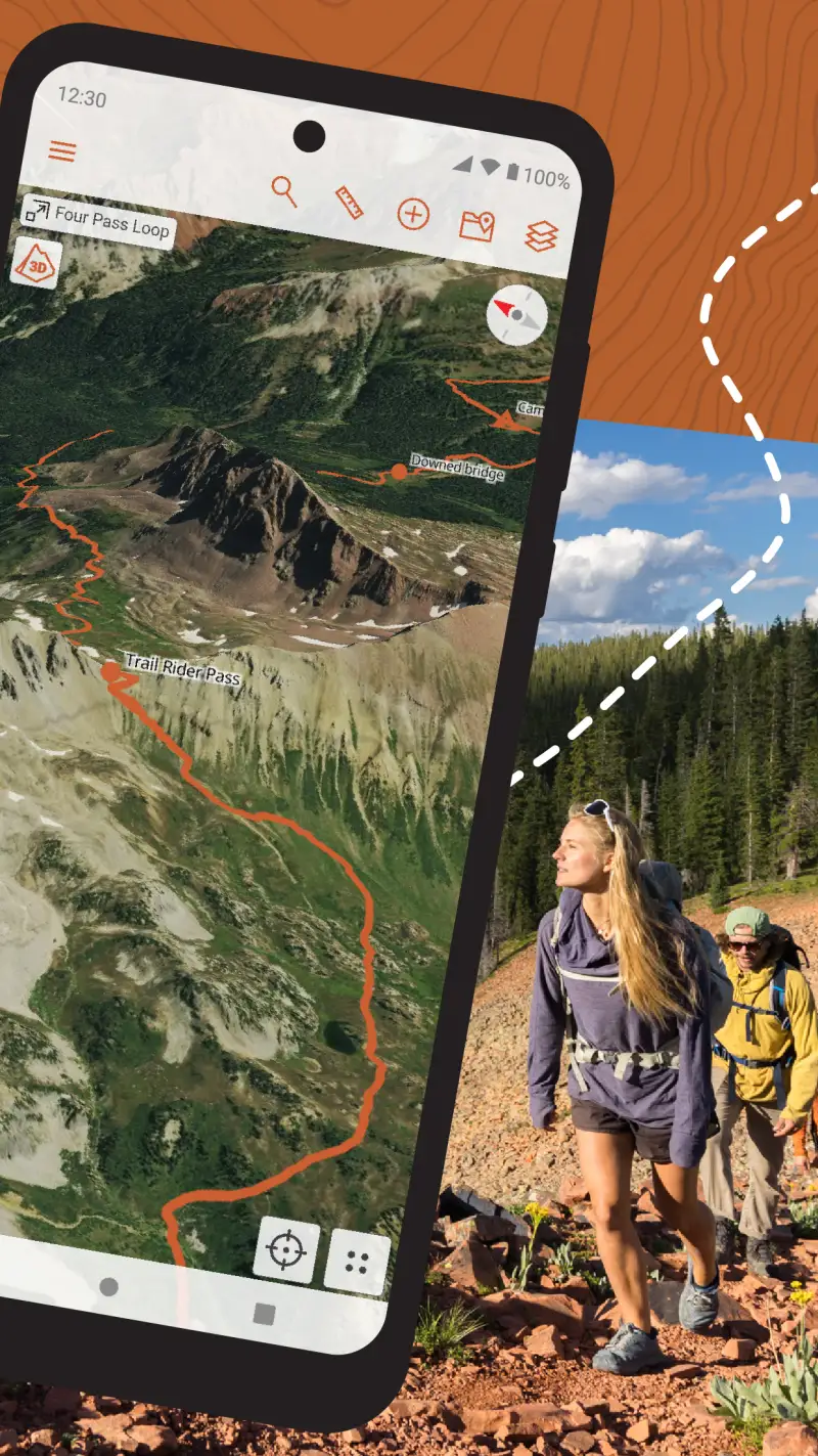
Building on the field navigation tools, CalTopo addresses the desktop trip planning phase that both Gaia GPS and AllTrails handle less precisely. The web-based mapping platform is the professional standard for pre-trip route planning: multi-page map printing for paper backup navigation, high-DPI slope angle shading at resolution above what Gaia GPS provides, collaborative map sharing for group trips, and parcel data for routes that cross private land. For planning a technically complex backpacking trip at home before departure, CalTopo's desktop tools are more powerful than any mobile app.
The planning workflow most backpackers develop: plan in detail on CalTopo desktop, export the route to Gaia GPS for field navigation, and carry printed CalTopo map pages as a redundant non-battery-dependent backup. This combination uses each tool at its strongest phase rather than asking one app to do everything.
What CalTopo does well
- Multi-page map printing: print high-resolution paper maps covering your planned route as a non-electronic backup; the only app in this guide with professional print quality for route coverage
- Advanced slope angle shading: higher resolution than Gaia GPS for avalanche terrain assessment; used by professional avalanche educators and mountain guides specifically for this capability
- Collaborative map sharing: share and edit maps with trip partners and trip leaders; essential for group backpacking where route planning involves multiple people
- Route creation with detailed elevation profiles and terrain analysis
- Parcel and land ownership data for routes crossing private land
- Forest Service maps, scanned USGS topos, and custom overlay support
Where CalTopo falls short
The mobile app is notably inferior to the desktop experience - CalTopo is fundamentally a web-based desktop planning tool with a mobile companion, not a field navigation app. Multiple users report slow data loading and frequent crashes in the Android app. The interface has a steep learning curve comparable to Gaia GPS; neither app is appropriate for hikers who want immediate intuitive navigation. For field use, Gaia GPS is the stronger tool; CalTopo's value is specifically in the desktop planning phase before departure.
Pricing: Free (web access, basic tools) / $20/year Mobile (offline maps on Android) / $50/year Pro (high-DPI printing, Sentinel imagery, parcel data)
Subscribe to CalTopo Pro at $50 per year if you plan technically complex backcountry routes and want the highest precision desktop tools. Use it specifically at home for trip planning, then export routes to Gaia GPS for field navigation. Add the $20/year mobile tier only if you specifically want offline CalTopo access in the field alongside Gaia GPS.
onX Backcountry - Best for US Land Access and Property Data
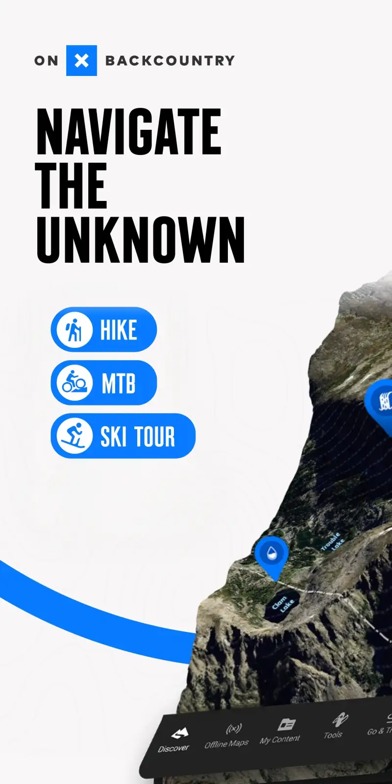
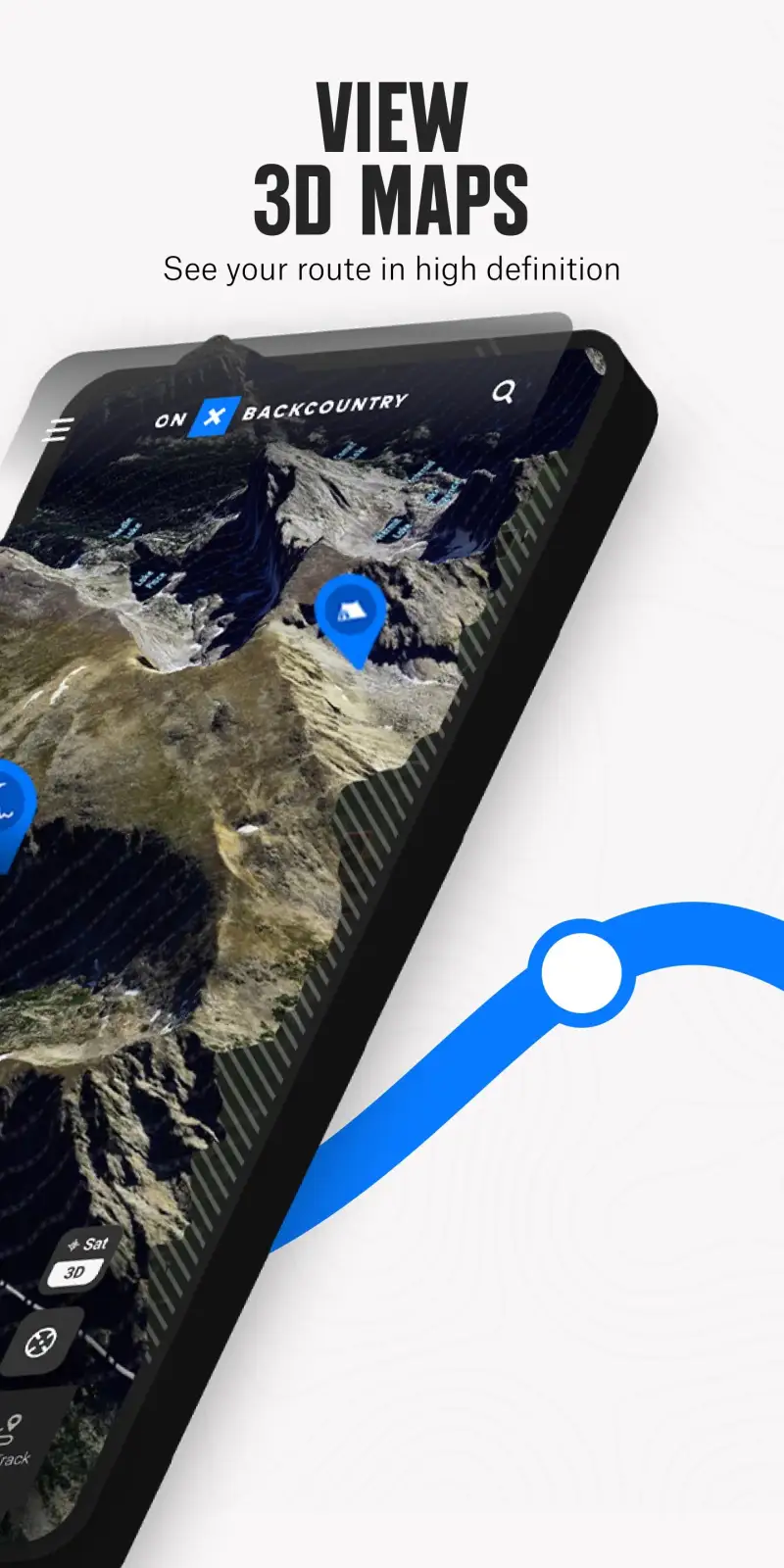
Unlike the topographic navigation focus of Gaia GPS and CalTopo, onX Backcountry differentiates through land ownership and property boundary data that matters specifically for US backpackers accessing remote terrain via private land corridors. The 650,000+ miles of trails with detailed descriptions, combined with property boundaries showing exactly who owns the land you are crossing, serves backpackers in the American West who often need to navigate easements and public-private land mosaics to access wilderness trailheads.
The avalanche forecast integration and slope angle shading make onX Backcountry relevant for winter and shoulder-season backpackers in mountainous terrain. 4,000+ ski routes and avalanche data position it as a more sport-specific alternative to Gaia GPS for US backcountry users where land access context is a genuine planning concern.
What onX Backcountry does well
- Property boundaries and landowner data (Elite tier): know who owns the land you are crossing; uniquely valuable for US backpackers accessing remote terrain via private land and easements
- 650,000+ trail miles: detailed route descriptions with guidebook-quality adventures covering hiking, backpacking, and trail running in North America
- Avalanche forecast integration and slope angle shading for winter backcountry safety assessment
- Unlimited offline maps (Premium and above) for full coverage without signal
- 4,000+ ski routes for combined hiking and backcountry ski planning
Where onX Backcountry falls short
The property data focus and land access orientation make onX Backcountry significantly less useful outside the United States - for international backpackers or US users hiking in national park wilderness where land ownership is not a navigation variable, the primary differentiator provides no value. Gaia GPS has deeper map layer selection; AllTrails has more community trail reviews. The Elite tier at $99.99 per year is the most expensive option in this guide. Backpackers outside the US should default to Gaia GPS instead.
Pricing: Free (basic maps, 1 offline map) / $29.99/year Premium / $99.99/year Elite (property data)
Subscribe to onX Backcountry Premium at $29.99 per year if you regularly access remote US terrain where land ownership boundaries affect your route choices. Subscribe to Elite at $99.99 per year when property and landowner data specifically changes your planning decisions. Skip it entirely for international hiking.
Which App Fits Your Backpacking Setup
| App | Price | Best For | Offline Maps |
|---|---|---|---|
| Gaia GPS | $89.99/yr Outside+ | Backcountry navigation, 50+ map layers | Yes |
| AllTrails Plus | $35.99/yr | Community conditions, trail discovery | Yes |
| CalTopo | $50/yr Pro | Desktop trip planning, map printing | $20/yr Mobile tier |
| onX Backcountry | $29.99/yr Premium | US land access, property data | Yes |
Standard backpacking stack
Subscribe to Gaia GPS via Outside+ and AllTrails Plus. Use Gaia GPS as your primary navigation tool in the field with offline USGS topo maps downloaded before departure. Use AllTrails Plus for pre-trip research, trail discovery, and condition reports. This combination covers both precision navigation and community intelligence.
Planning complex or technical backcountry routes
Add CalTopo Pro at $50 per year for detailed desktop planning. Build your route on CalTopo, print paper map backup pages, export the route to Gaia GPS for field navigation. Run AllTrails Plus for community conditions alongside. The three-app combination is the most thorough pre-trip preparation available.
US backpackers accessing remote terrain via private land
Subscribe to onX Backcountry Elite at $99.99 per year for the property boundary data. Pair with AllTrails Plus for community trail conditions. Use Gaia GPS if you need the 50+ map layer depth that onX Backcountry does not match.
Budget: minimum spend for safe backcountry navigation
Subscribe to Gaia GPS only. Download USGS topo offline maps before every trip. Use AllTrails free for pre-trip discovery with the understanding that offline maps require Plus. Carry a printed paper map as backup - download and print USGS topo sheets free from the USGS website before departure.