Your carrier's $15/day roaming plan doesn't cover the moment your phone loses signal at kilometer 180 of a hiking route in rural Portugal. Neither does it help when you're driving through rural Thailand and Google Maps insists you "continue straight" off a dirt track. After testing five offline maps apps across Japan, Southeast Asia, Europe, and East Africa — with intentional data blackouts on every trip — the pattern is clear: the right offline maps app depends entirely on how you travel. Hikers and road trippers need fundamentally different tools, and the app most travelers default to (Maps.me) has declined so sharply that it now actively misleads them.
Five apps solve this problem in 2026. Each wins a specific scenario.
What Makes a Great Offline Maps App
Offline maps apps fail travelers in predictable ways. Before looking at the apps, the criteria that actually matter in the field:
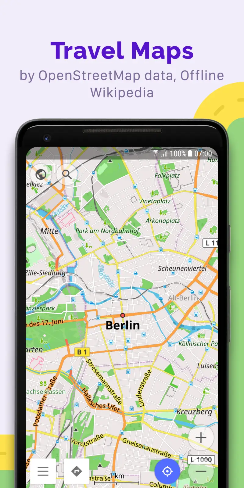
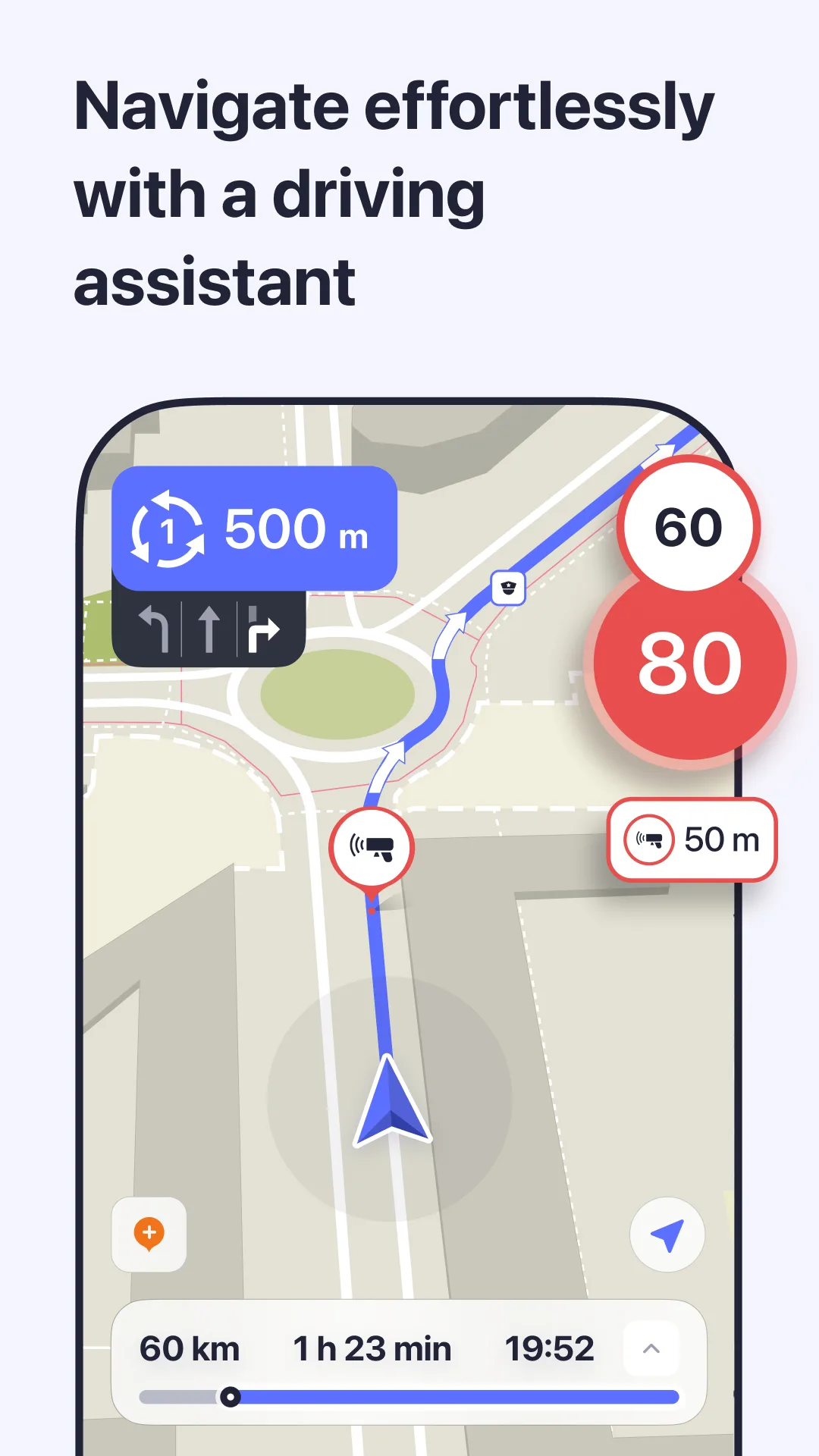
Offline completeness separates genuinely useful apps from compromises. Some apps offer offline driving but disable walking, transit, and cycling without data. Google Maps offline is driving-only — a fact many travelers discover too late. OsmAnd, Organic Maps, and HERE WeGo all navigate offline on foot. That distinction decides whether an app works in car-free cities or on trails.
Map data source determines accuracy in the places that matter most. Google and HERE use proprietary commercial data maintained by survey fleets. OpenStreetMap (the source behind OsmAnd and Organic Maps) is maintained by 9 million+ contributors worldwide, often producing more accurate data in rural Asia and Africa than commercial alternatives. The tradeoff: commercial data is typically more current on major European and North American roads.
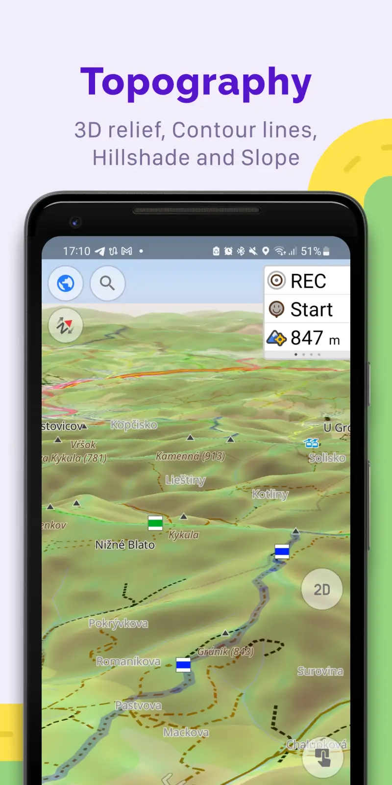
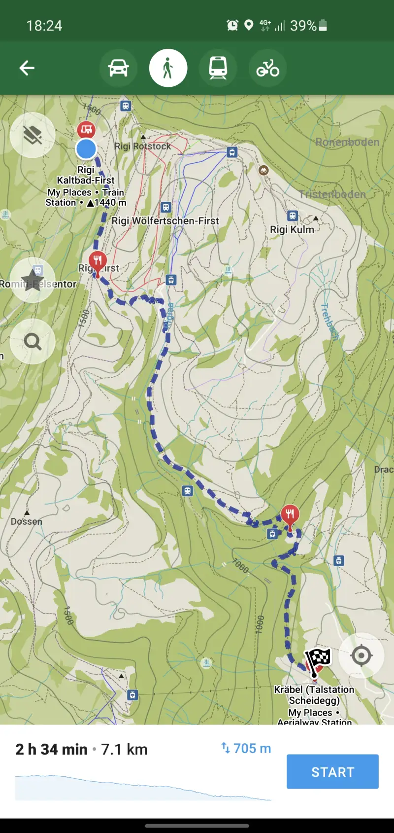
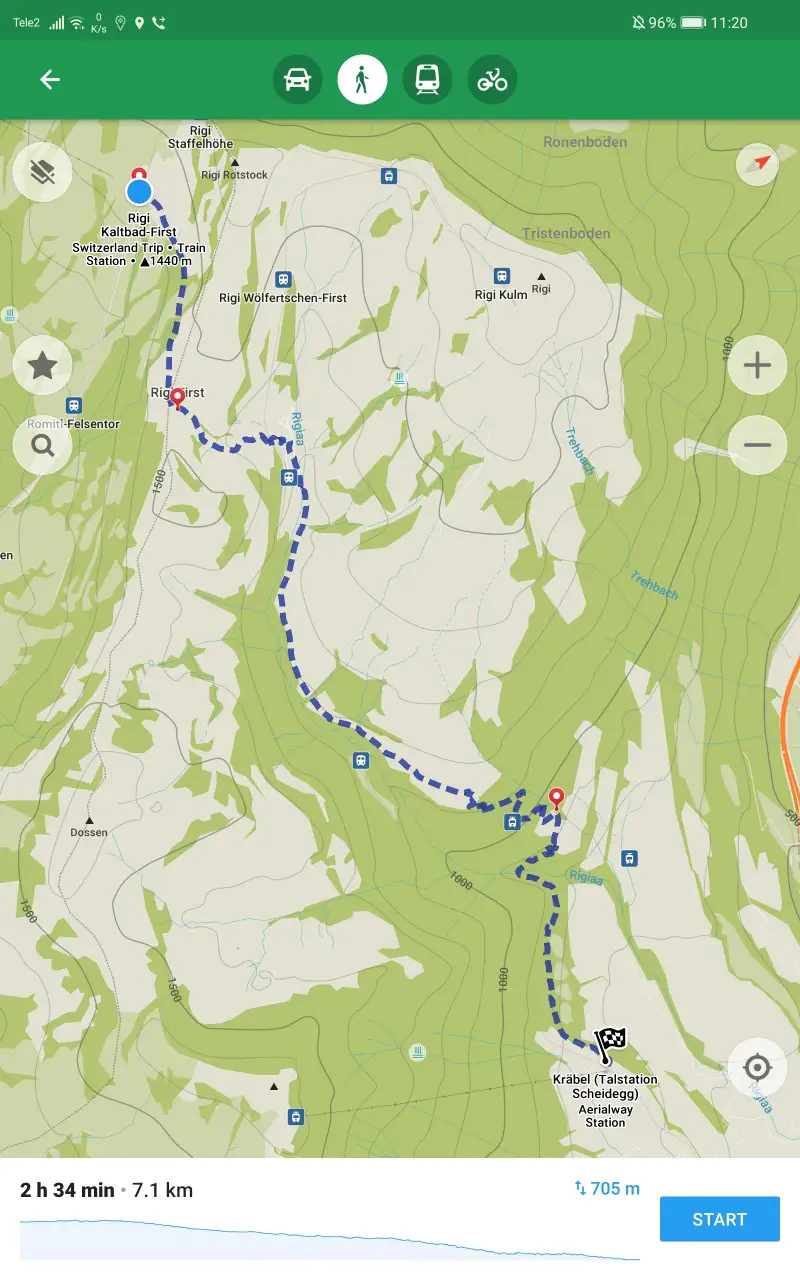
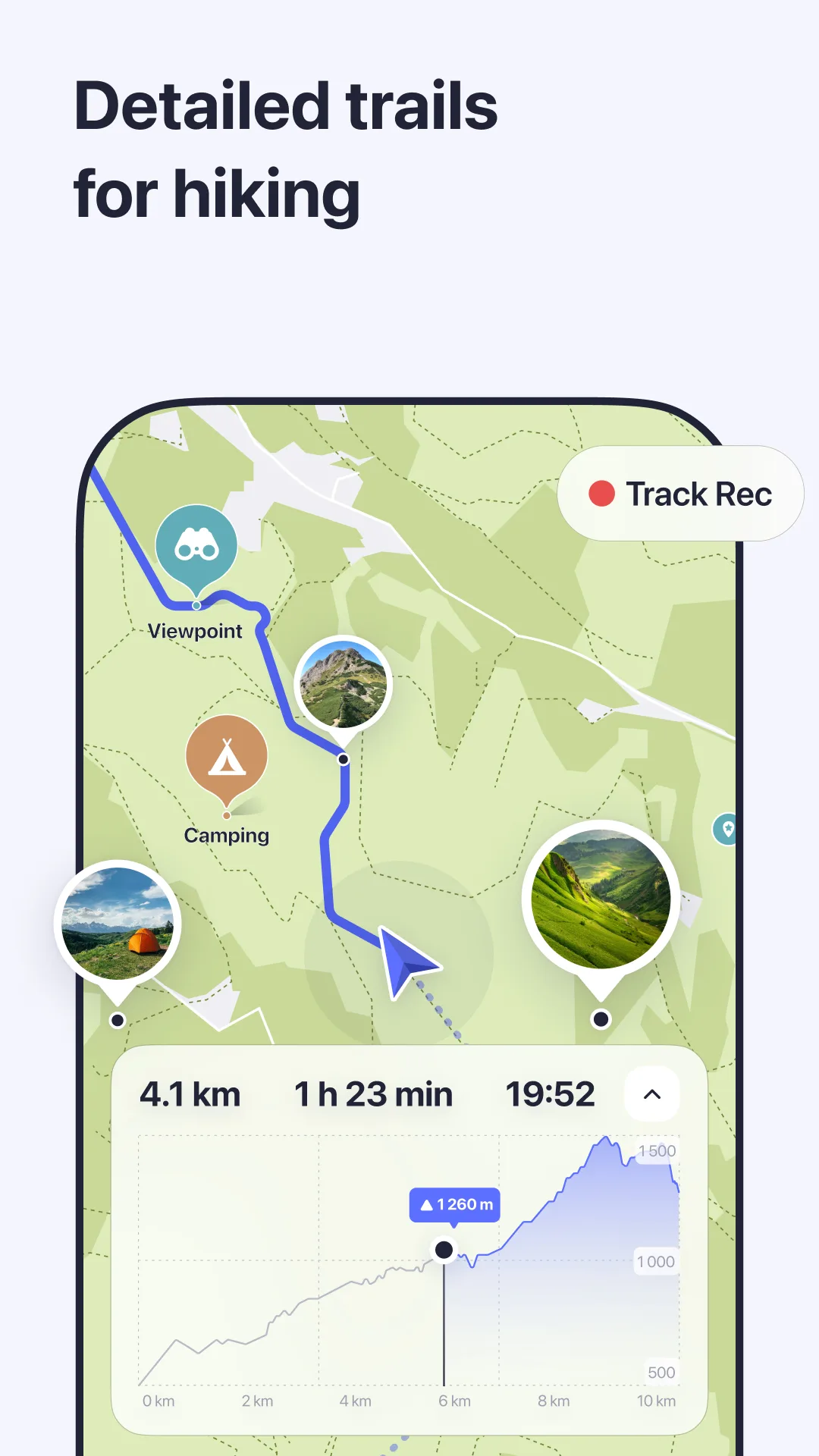
Hiking capability is either present or absent — there is no middle ground. Contour lines, GPX import, and slope visualization are OsmAnd exclusives in this comparison. No other app comes close for trail navigation.
Download limits and expiry create invisible friction. Maps.me's free tier caps downloads at 10 regions. Google Maps offline expires in 15 days and must be renewed with a Wi-Fi connection. Organic Maps has no download limit and no expiry — a genuinely critical advantage for multi-country trips.
Storage footprint matters for budget Android devices. OsmAnd Germany: ~950 MB. Sygic Germany: ~1.5 GB. Organic Maps Germany: ~650 MB. On a 64 GB phone with a full Europe trip, that 900 MB difference per country adds up quickly.
How We Tested
Testing ran across four trip types between November 2025 and April 2026: backpacking through Thailand and Japan with deliberate airplane-mode days to force offline reliance; a road trip from Lisbon to Porto using exclusively offline navigation; a hiking segment in the Serra da Estrela mountains in Portugal testing trail navigation and GPX accuracy; and urban transit testing in Berlin and Tokyo comparing transit coverage across apps. Tested on Pixel 8 Pro and Samsung Galaxy S24+, both running Android 15.
Each app was installed with full country downloads before each trip segment, then network access was disabled for the duration of the test.
OsmAnd - Best for Hiking and Off-Road Navigation
OsmAnd is not the most approachable app in this comparison. The interface has 11 distinct settings menus and a learning curve steep enough that many users abandon it before discovering what it actually does. That would be a mistake for anyone who hikes, cycles long distances, or travels in regions where commercial map data is thin.
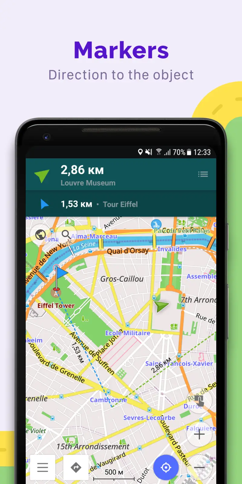
The contour line system alone justifies the app for serious hikers. Download the Hillshade + Contour Lines plugin — a separate optional download — and you get color-coded slope gradient overlays, elevation profiles along any route, and waymarked hiking trails displayed with OSMC symbols (the international trail marking system). Navigate to a trailhead, import a GPX track from AllTrails or Wikiloc, and OsmAnd navigates along it offline. No other app in this test does all three.
The free tier on Android is limited to 7 map downloads — each map update also counts as a download, which is the catch most users hit first. Maps+ at $9.99/year removes the limit and is essentially required for multi-country use. OsmAnd Pro at $29.99/year adds 3D maps, Android Auto support, and hourly map updates via OsmAnd Live. For most travelers, Maps+ is the right tier.
POI accuracy in Asia and Africa is the strongest of any app tested. Japan, Southeast Asia, Morocco, and East Africa all performed well — areas where local OSM communities have contributed ground-truth data that commercial mapping vehicles never reach.
What OsmAnd does well
- Contour lines, hillshading, slope gradient overlay — essential for mountain navigation
- GPX track import and navigate-by-track for pre-planned hiking routes
- 7+ routing profiles: car, motorcycle, bicycle, pedestrian, boat, 4x4, public transport
- Offline Wikipedia and Wikivoyage articles for POI context
- Avoid road surfaces, tollways, unpaved roads in routing settings
- OsmAnd Live: hourly map updates (Pro tier) — critical for areas with fast-changing road infrastructure
- Android Auto support on Pro tier
Where OsmAnd falls short
- UI is the worst in this comparison — menus are deep and non-intuitive; expect 30 minutes of setup before first use
- Free tier limited to 7 downloads; updates consume the quota
- Contour lines are a separate download (adds 100-400 MB per region)
- No speed cameras built-in by default
- Slower map rendering than Organic Maps on low-end hardware
Pricing: Free (7 downloads); Maps+ $9.99/year (unlimited); OsmAnd Pro $29.99/year. Install OsmAnd if you are hiking, cycling long distances, or traveling anywhere off paved roads.
Organic Maps - Best Free App for Backpackers
Organic Maps is the direct fork of the pre-2020 Maps.me codebase — built by the same developers who built Maps.me before the 2020 acquisition changed everything. It does what Maps.me used to do, except better, completely free, and without the ownership controversy. The 10 petabytes of map data downloaded by users in 2025 alone indicate how quickly the backpacker community has migrated.
The defining feature is what the app does not require: no account, no subscription, no data connection, no download limits, no expiry. Download all of Japan (roughly 800 MB), all of Thailand (250 MB), and all of Portugal (80 MB) before departure, and they work indefinitely. The biweekly OSM updates mean rural Southeast Asia and East Africa are often more accurate here than in commercial apps — local contributors maintain the data with ground-truth knowledge.
Navigation covers driving, walking, cycling, and hiking offline — no mode requires internet. For backpackers who move between cities on foot, this matters every time they arrive at a train station with no SIM plan yet active. The Wikipedia integration works offline for landmark lookup, which provides useful context at historical sites without burning data.
The 2025 CoMaps fork created some uncertainty in the community — a group of contributors split over governance concerns. Both projects continue active development; Organic Maps itself shipped 13 releases in 2025. The situation is worth monitoring but has not materially affected either app's quality as of April 2026.
What Organic Maps does well
- 100% offline: driving, walking, cycling, hiking — no exceptions, no degraded modes
- Unlimited downloads, no expiry, no account required
- Biweekly OSM updates — typically accurate in rural Asia and Africa
- GPX and KML import for pre-planned hiking routes
- Wikipedia offline for landmark context
- Battery-efficient: no background data transfers
- Clean, fast Material Design interface — best UI of the OSM apps
Where Organic Maps falls short
- No public transit routing (HERE WeGo is the only offline app with meaningful transit)
- No contour lines or slope visualization (OsmAnd for serious hiking)
- No speed camera alerts
- No real-time traffic
- CoMaps fork creates some community uncertainty about long-term direction
Pricing: Free, donation-supported. No subscription, no ads. Install Organic Maps before any trip with offline stretches.
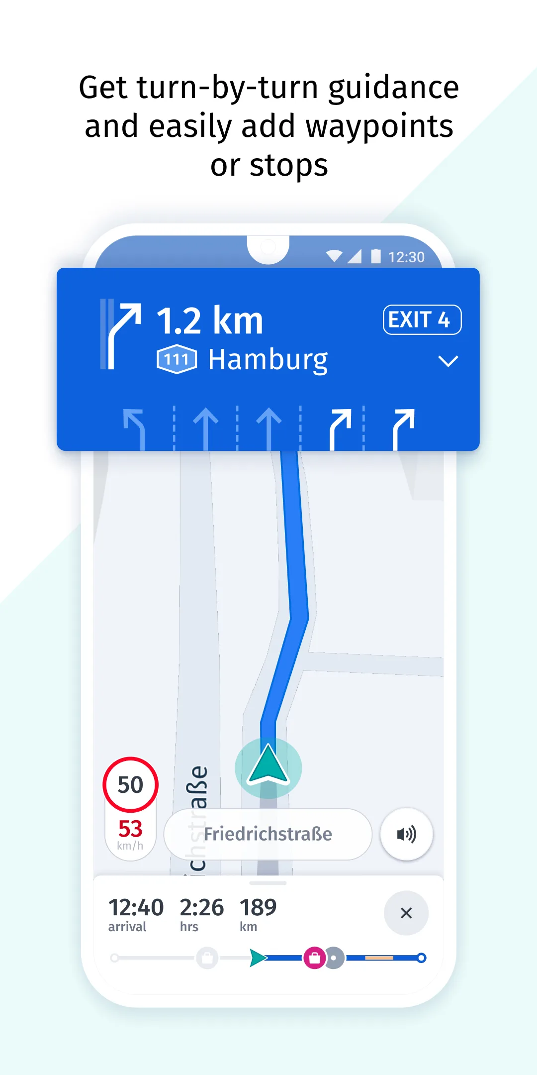
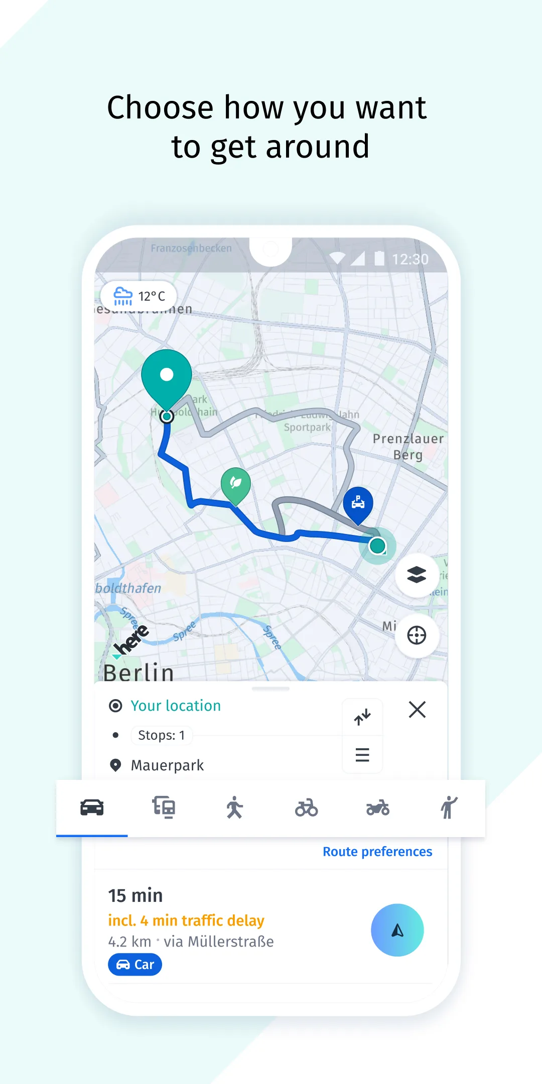
HERE WeGo - Best for Public Transit and European Driving
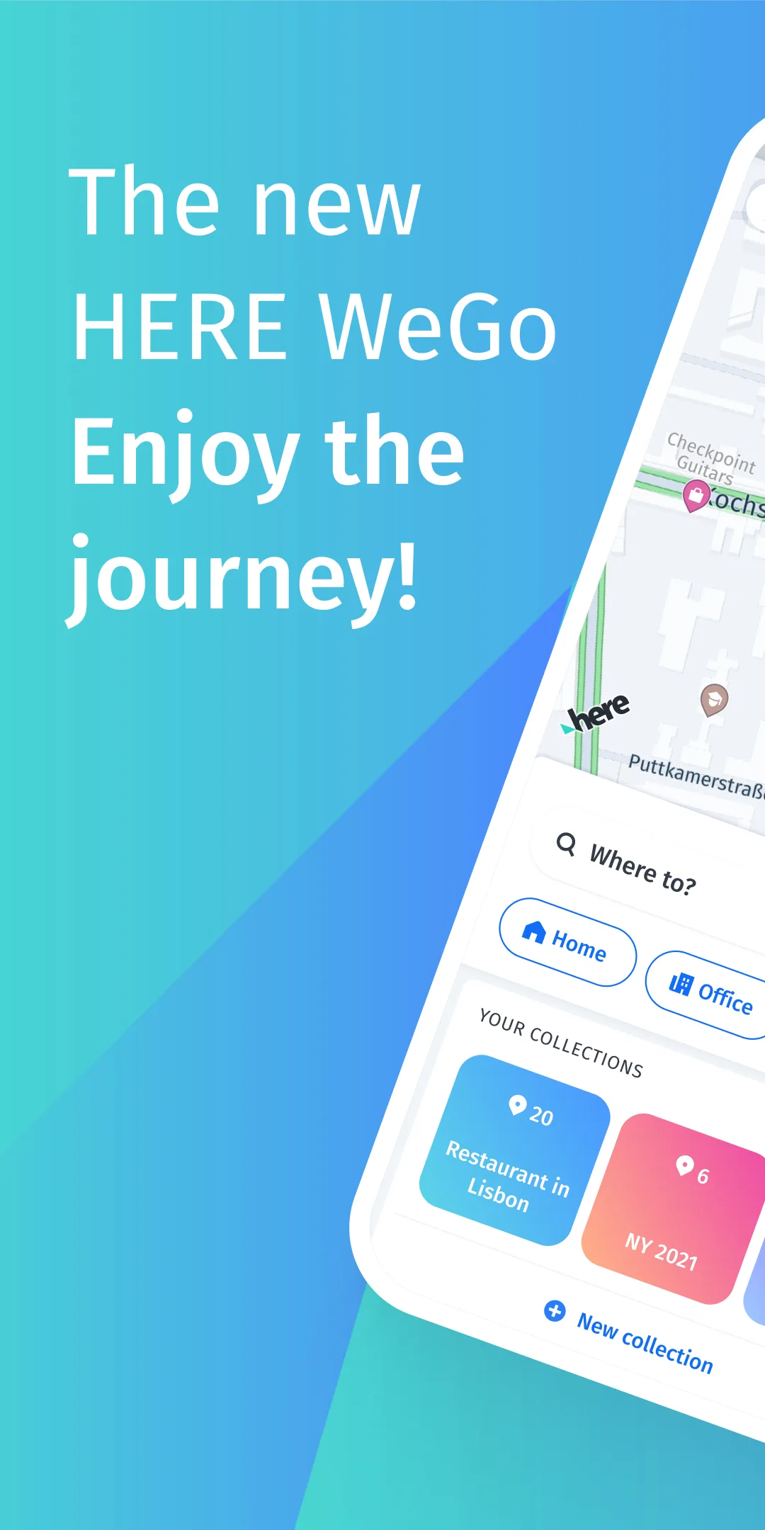
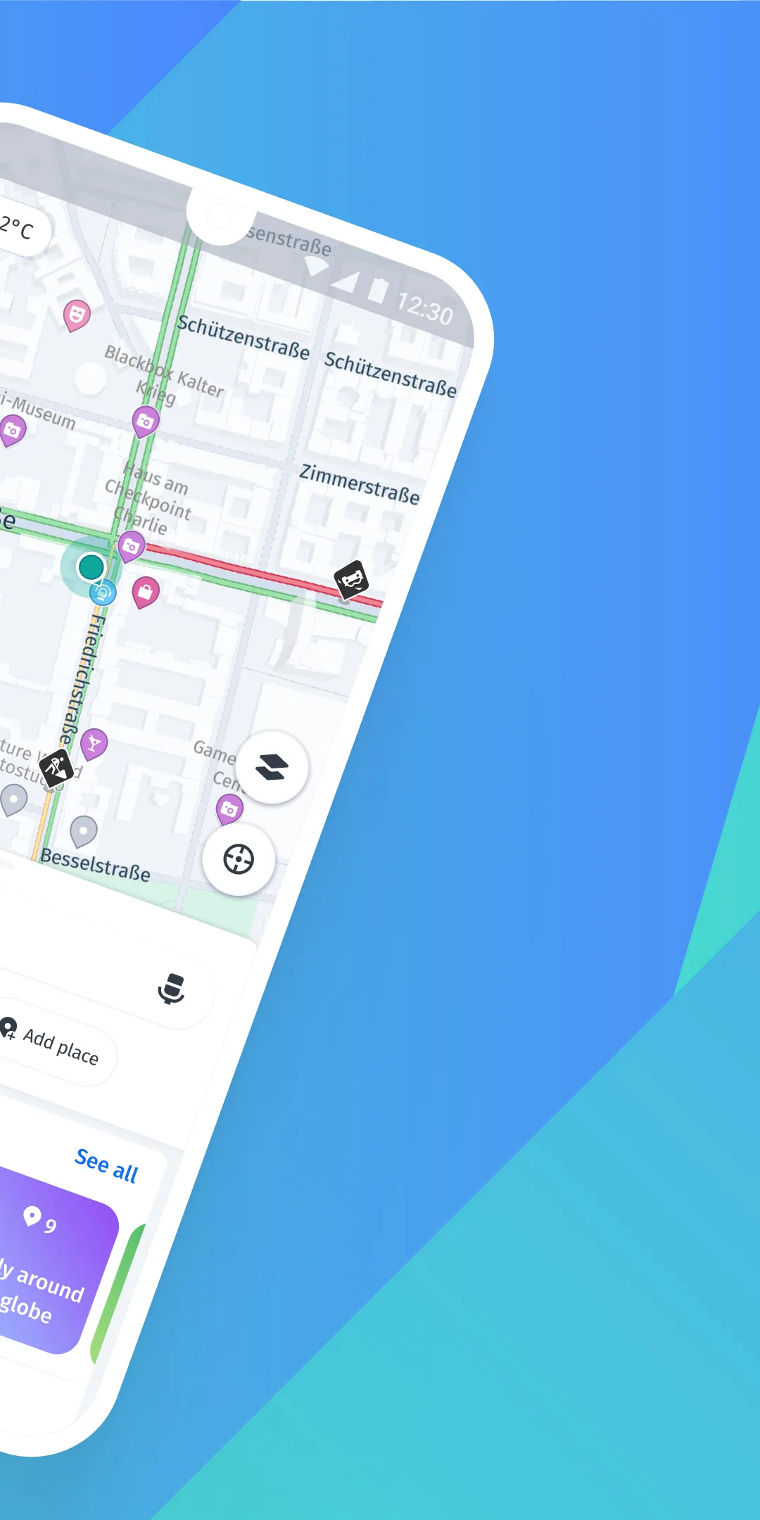
HERE Technologies is one of three global mapping data providers alongside Google and TomTom — the same platform powering in-car navigation in BMW, Audi, and Mercedes vehicles. HERE WeGo brings that professional map data to a free consumer Android app with one capability no other offline app in this comparison matches: offline public transit in 1,900+ cities worldwide.
That transit coverage is the reason HERE WeGo belongs in this list. OsmAnd has partial offline transit. Organic Maps has none. HERE WeGo downloads subway, bus, and tram schedules for entire cities and navigates them offline. In Berlin, it correctly routed U-Bahn connections without any data. In Bangkok, it handled BTS Skytrain and MRT connections offline. That functionality is genuinely unique.
For driving, the professional HERE map data produces lane-level guidance, speed limit warnings, and parking information at destinations that OSM-based apps typically lack. Speed camera alerts are available (basic level) even on the free tier.
The critical gap is East Asia. HERE WeGo has no offline maps for Japan, South Korea, or China — a licensing restriction that makes it unsuitable as a primary navigation app for those destinations. For a 10-day Japan itinerary, this eliminates HERE WeGo entirely. For a European trip, it is often the strongest free option.
What HERE WeGo does well
- Offline public transit in 1,900+ cities — unique capability in this comparison
- Professional HERE map data: lane guidance, turn restrictions, parking finder
- Covers Europe, North America, Southeast Asia, Africa with good accuracy
- Free speed camera alerts (basic level) — no subscription required
- 3D building models in major cities
- Multi-stop waypoint routing
- Clean UI; better than OsmAnd for non-technical users
Where HERE WeGo falls short
- No offline maps for Japan, South Korea, or China — a complete disqualifier for East Asia travel
- No GPX import or hiking trail support
- Weaker than OSM apps in rural Asia and Africa
- No cycling-specific routing
- Larger download size than OSM apps (~1.3 GB for Germany vs. 650 MB for Organic Maps)
Pricing: Completely free — HERE Technologies monetizes via automotive partnerships, not consumer subscriptions. Install HERE WeGo for European road trips and city travel where transit coverage matters.
Sygic - Best for Road Trips and Dedicated Driving


Sygic built its reputation as a premium dedicated GPS navigator before phone-based navigation was mainstream. The TomTom-powered maps, lane-level guidance, and Real View AR overlay justify that reputation in 2026. No app tested came closer to replicating the experience of a standalone GPS unit.
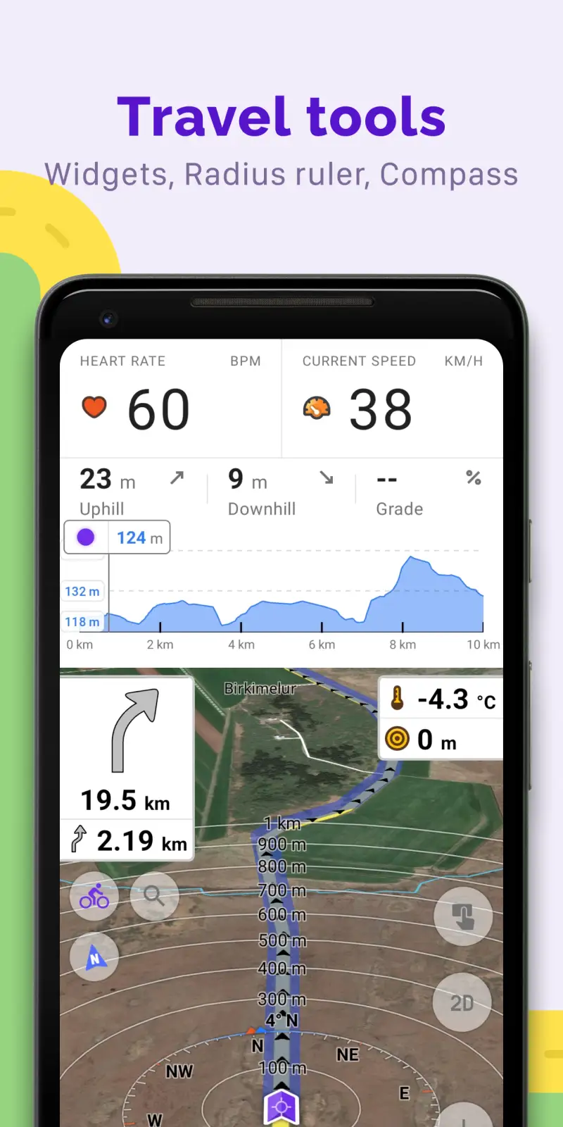
The Real View AR mode overlays navigation arrows on a live camera feed — useful at complex motorway interchanges where abstract 2D maps fail. The lane assistant shows exact lane assignments at multi-lane junctions, not just a general arrow. For drivers doing 800+ km road trips through unfamiliar motorway systems, these features reduce cognitive load meaningfully.
Speed camera integration on Premium+ is the strongest of any app tested. The database updates continuously online and covers fixed camera locations offline. For drivers on speed-camera-heavy motorways in France, Spain, and Eastern Europe, this is a legitimate safety and cost-saving feature.
The free tier provides functional offline driving navigation — voice guidance, POI search, pedestrian navigation — but speed cameras and live traffic are behind Premium+. At $19.99/year, Premium+ is the best value for drivers who take four or more road trips annually. The per-trip cost amortizes quickly.
Sygic does not serve backpackers or hikers. No GPX support, no trail data, no transit routing. It is a driving app, and it is the best driving app in this comparison.
What Sygic does well
- TomTom maps with lane-level guidance and turn lane visualization
- Speed camera database: real-time updates on Premium+, fixed cameras offline
- Real View AR overlay at complex junctions
- Head-up Display (HUD) mode — projects on windshield for premium driving rigs
- Android Auto support on Premium+
- SD card storage for offline maps (critical on devices with limited internal storage)
- Best driving UI of any app tested — clean, 3D, logical menu structure
Where Sygic falls short
- No hiking, cycling, or transit routing — strictly a car navigator
- Privacy: account required, usage data collected
- Larger download sizes than OSM apps (~1.5 GB Germany vs. 650 MB Organic Maps)
- Speed cameras require Premium+ subscription; free tier misses the main selling point
- OSM apps often outperform TomTom in rural developing-world coverage
Pricing: Free (core driving); Premium+ $19.99/year (speed cameras, live traffic, Android Auto, HUD). Install Sygic for any road trip where speed cameras and lane guidance matter.
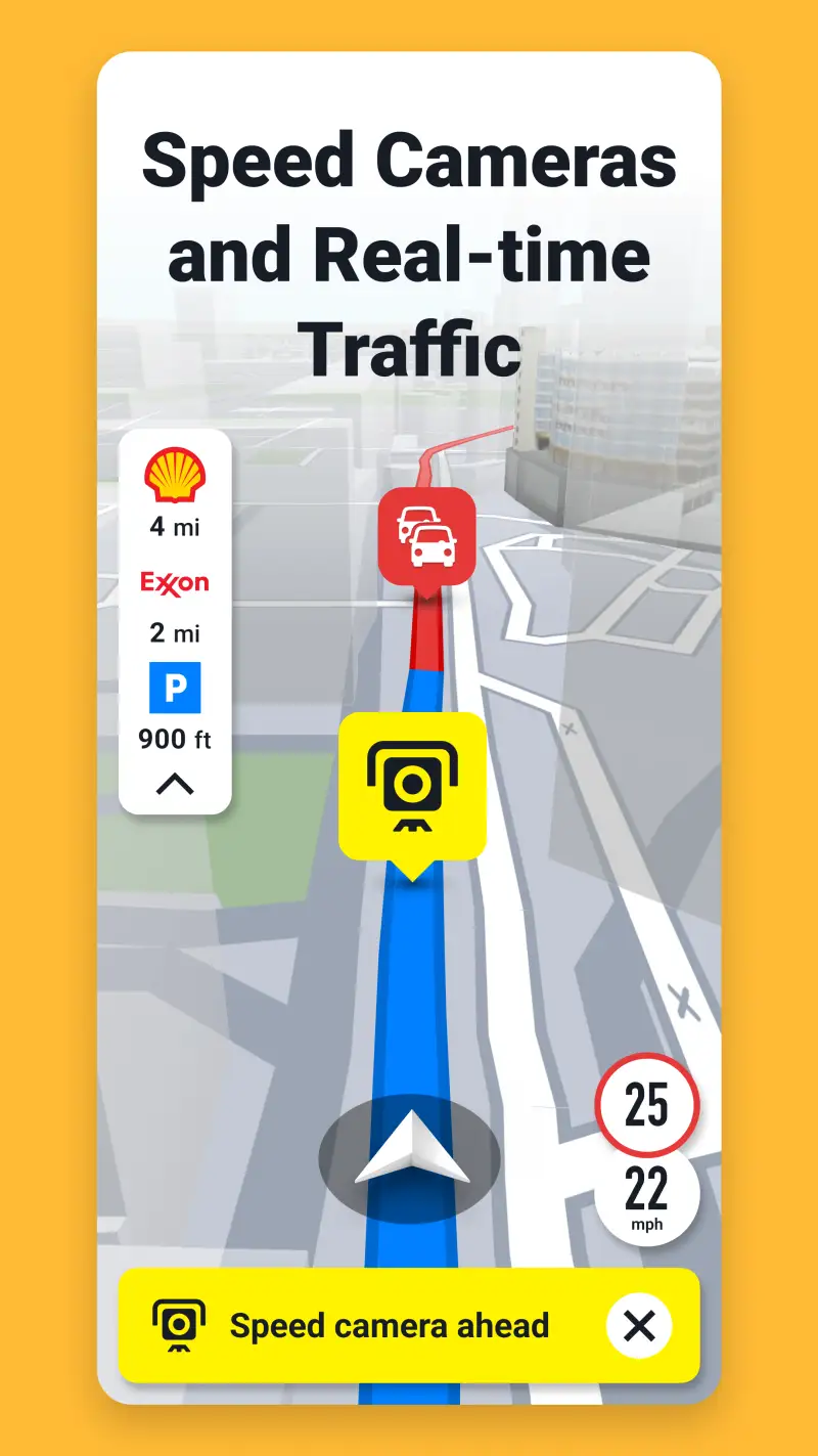
Maps.me - Once the Best, Now a Cautionary Tale

Maps.me is in this article because 50 million Android installs mean millions of travelers still open it at the airport. They should know what changed.
From 2013 to 2019, Maps.me was the definitive offline maps app for budget travelers: the fastest OSM renderer, the most intuitive interface, completely free, and unlimited downloads. The January 2021 sale to Daegu Limited (a company with documented links to FTX and cryptocurrency payment processing) changed everything. The company monetized in May 2023 with a subscription paywall — the free tier now allows only 10 region downloads. The open-source community forked the pre-acquisition codebase into Organic Maps immediately after the sale. That fork is now the better app in every measurable dimension.
The Google Play rating has declined from 4.7 to 4.1 since 2020. Trustpilot shows 1.4/5 — reflecting post-acquisition user sentiment. The OSM community has documented cases where Maps.me data submissions degraded OpenStreetMap data quality. These are not minor concerns.
What Maps.me does well (still)
- Familiar interface for long-term users
- Booking.com hotel integration for in-app accommodation search
- Large installed base means ongoing content and guide support
- Good POI density in European tourist areas
Where Maps.me falls short
- Free tier capped at 10 map region downloads
- Subscription required for unlimited access: ~€35.99/year
- Ownership chain involves cryptocurrency processing entities
- OSM community trust severely eroded
- No contour lines, no GPX meaningful import
- Organic Maps is a direct fork that does everything better, for free
Pricing: Free (10 regions); subscription ~€35.99/year for unlimited. The recommendation: uninstall Maps.me and install Organic Maps. Same map data, better app, no subscription, no controversy.
Which Offline Maps App Do You Actually Need
The right answer depends on how you travel.
Backpacker or budget traveler: Organic Maps. Unlimited downloads, no account, no expiry. Covers the entire use case for city walking and light hiking.
Hiker or trail runner: OsmAnd + Maps+ ($9.99/year). Contour lines, GPX navigation, slope overlays. Nothing else comes close for off-trail use.
Road trip driver: Sygic Premium+ ($19.99/year) if you want speed cameras and lane guidance. HERE WeGo (free) if your trip stays outside East Asia.
City traveler using public transit: HERE WeGo. No other offline app covers 1,900+ cities with downloadable transit schedules.
East Asia traveler: OsmAnd or Organic Maps. HERE WeGo and Sygic both have significant data gaps for Japan, South Korea, and China.
The safe default: Install both Organic Maps (always-on offline) and OsmAnd (hiking trips). Together they cost nothing and cover every scenario except dedicated driving — which is where Sygic or HERE WeGo come in.
Tested April 2026. Apps verified against live Google Play listings. Pricing and features subject to change.