Trail runners split their app needs between performance tracking and navigation - two requirements that general running apps and general hiking apps each serve only halfway. Strava Premium ($79.99/yr) brings Outdoor Maps (formerly Fatmap's 3D terrain visualisation) alongside its 120M+ user segment competition infrastructure, making it the most complete performance-plus-terrain platform for trail runners who are already in the Strava ecosystem. Gaia GPS - bundled with Outside+ at $89.99/yr - provides the deepest backcountry navigation for runners who go where cell coverage disappears: offline high-resolution topo, GPX race course import, and breadcrumb navigation across complex trail junctions. AllTrails Pro ($29.99/yr) bridges the gap for runners whose needs sit between Strava's performance focus and Gaia's backcountry depth - trail discovery, offline maps, surface conditions, and basic GPS tracking within a platform that 50M+ outdoor athletes already use.


After testing these platforms on Pixel 8 and Samsung Galaxy S24 running Android 15, specifically for trail running contexts across race course preview, backcountry navigation, and community trail discovery in 2025-2026, I found that the right app depends on whether performance data or navigation capability matters more to your running.
Who this is for: Trail runners who run on natural terrain - singletrack, mountain paths, forest roads - and need apps that understand both navigation and performance in off-road contexts. Road runners will find the running apps guide more directly applicable.
What Trail Runners Need That Road Running Apps Don't Provide
Trail running creates navigation and terrain requirements that road running apps are not designed to address.
Offline Topo Navigation for No-Signal Terrain
A road runner with a dead GPS app can follow roads back to the start. A trail runner mid-route in remote terrain without functioning navigation faces a genuinely difficult situation. Offline map capability - downloading high-resolution topo before leaving cell coverage - is a safety requirement for runners going into backcountry terrain, not a convenience feature. Gaia GPS, designed explicitly for this scenario, provides better offline topo quality than either Strava or AllTrails. However, for runners staying on established trail networks with maintained signage, AllTrails Pro's offline capability is sufficient.
Elevation and Grade Data From Terrain
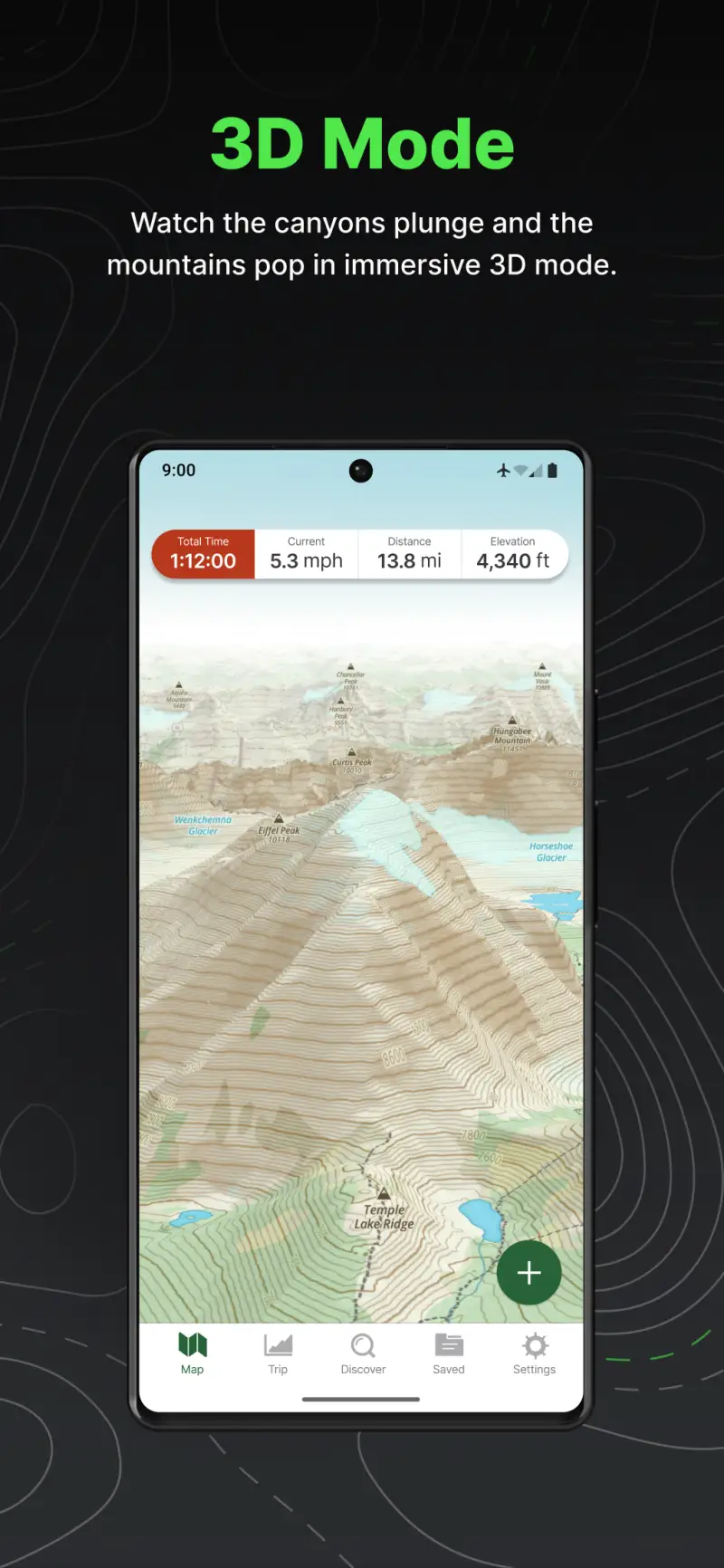
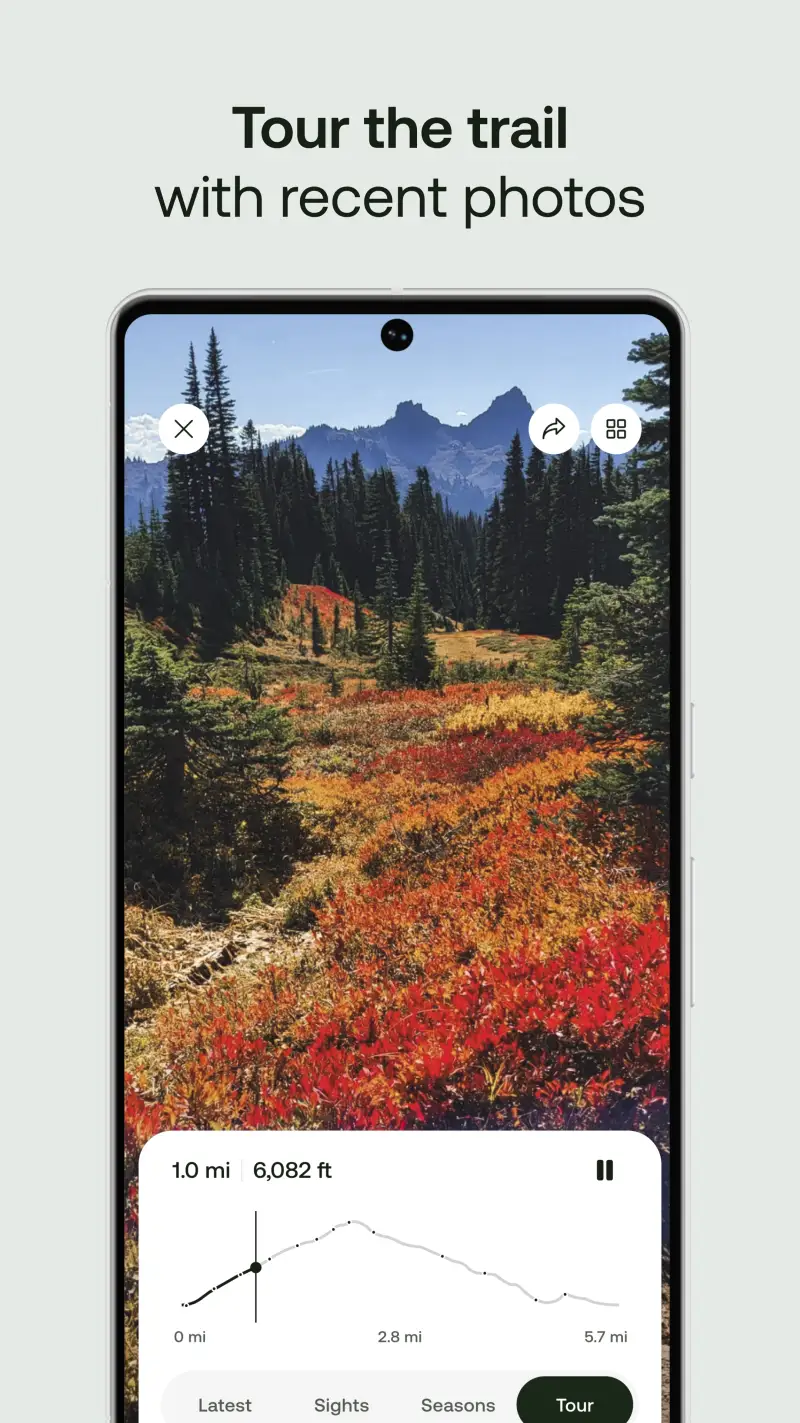
Trail running performance is measured in vertical gain and loss as much as horizontal distance. A 10-mile trail run with 3,000 feet of elevation gain is a fundamentally different training stimulus than a flat 10-mile road run. Apps that display elevation profile, grade percentage at each segment, and cumulative gain/loss allow trail runners to plan training load more accurately than distance or time alone. Strava's elevation data and segment analysis, combined with Outdoor Maps' 3D terrain preview, serve this need for performance-oriented runners.
Trail-Specific Route Discovery and Conditions
Road runners navigate roads; trail runners navigate trail networks where route choice, surface type, and current conditions determine whether a planned run is possible. AllTrails' database of 400,000+ trails with user-reported conditions, difficulty ratings, and recent visitor reports provides trail discovery and condition intelligence that Strava's performance focus and Gaia's navigation focus both underserve.
Strava - Best for Trail Running Performance and Segment Competition
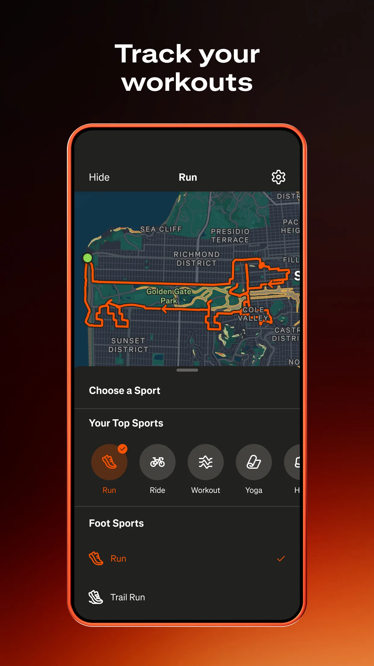
Strava is where trail runners track performance against their own history and against the broader running community, and the 2024 Outdoor Maps integration added the terrain context that trail running specifically needs. The 3D terrain visualisation - showing elevation profiles in photorealistic mountain rendering - allows runners to preview race courses or new routes in terrain context before committing to a run, which is genuinely useful for race preparation where course knowledge affects pacing strategy.
Trail running segments on Strava operate identically to road segments but on trail terrain: descents, climbs, and technical sections all have KOM/QOM leaderboards populated by the local trail running community. For runners competing for segment records on local trails - a common motivator for regular trail runners - Strava's segment infrastructure is the most developed in any running platform by a significant margin.
What Strava does well
- 3D terrain preview (Outdoor Maps): trail course preview in 3D terrain rendering before running; particularly valuable for race course preparation where previewing technical sections aids pacing and mental preparation
- Segment competition on trails: KOM/QOM leaderboards on virtually every established trail segment globally; local trail running community context that makes regular routes competitively engaging
- 120M+ athlete community: the largest fitness tracking platform; trail running segments are densely populated and leaderboards are competitively meaningful even in less urban areas
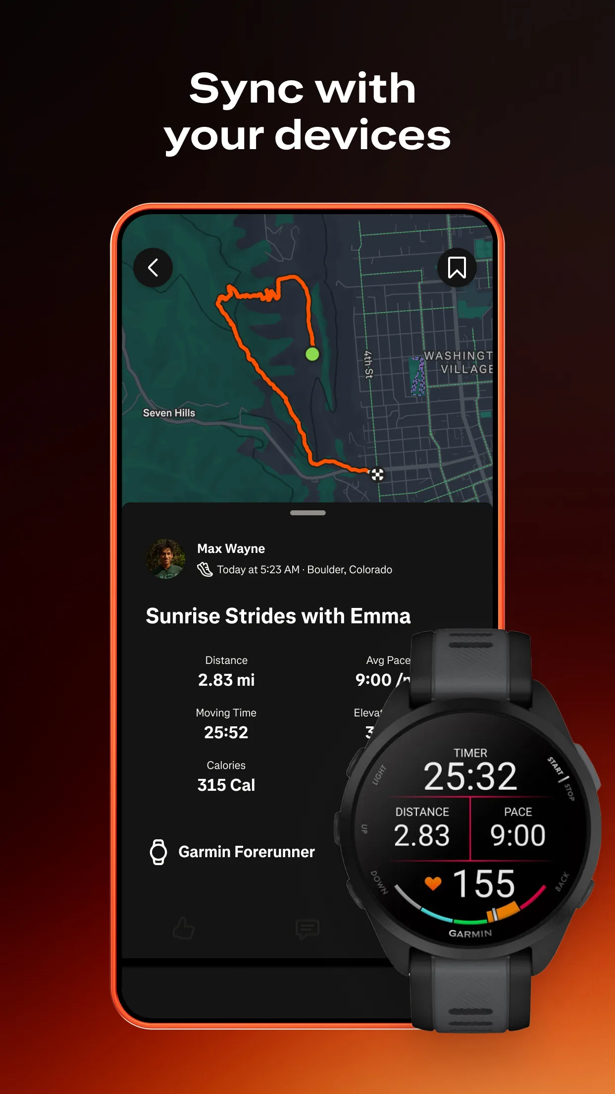
- Broad device connectivity: automatic upload from Garmin, Apple Watch, Suunto, COROS, and virtually every running GPS device; the performance data hub that aggregates across the runner's device ecosystem
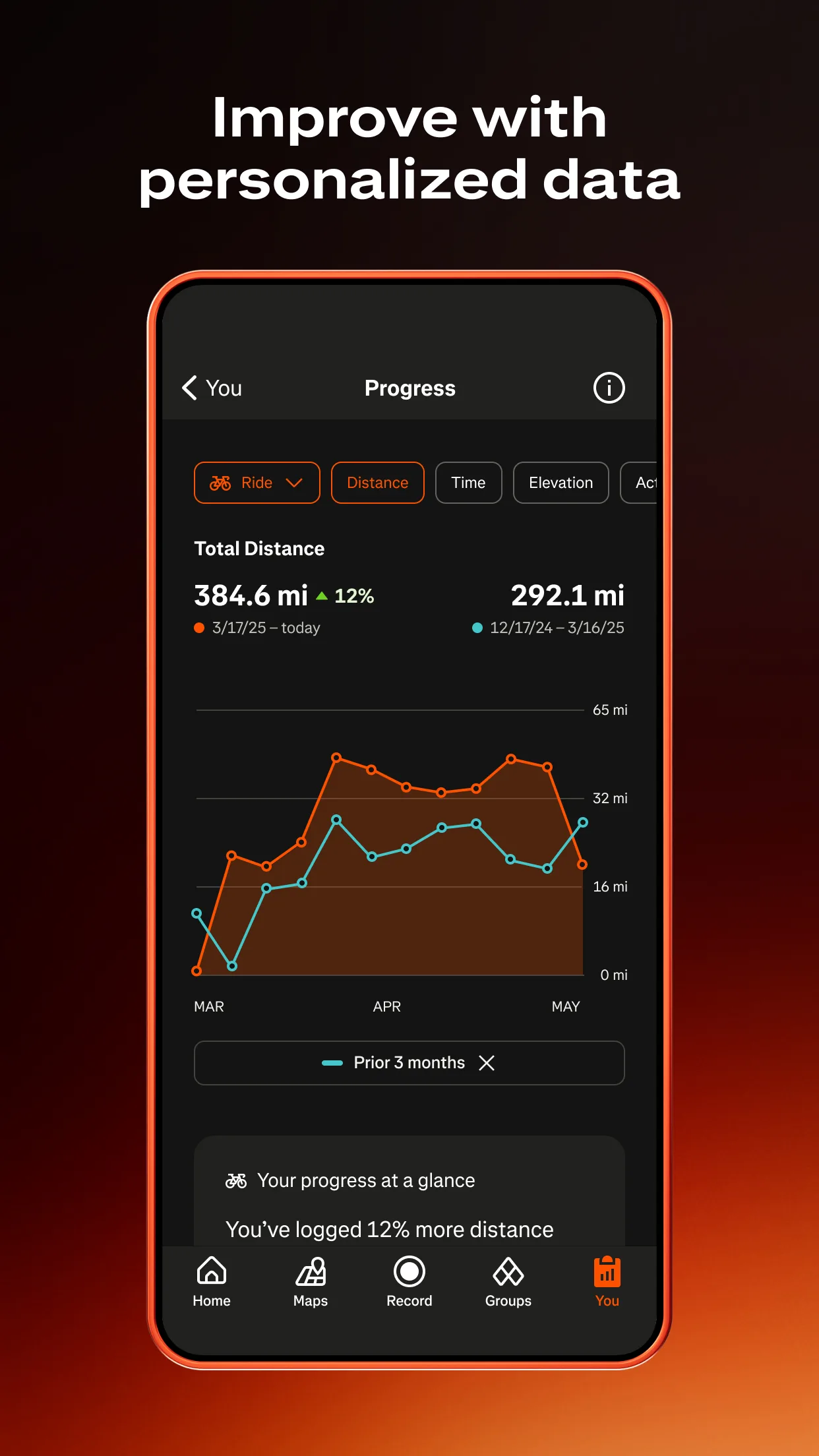
- Training load analysis: fitness and freshness estimates, weekly volume tracking, intensity distribution for athletes managing structured trail running training
Where Strava falls short
Strava is not a navigation app - trail runners who need turn-by-turn guidance in complex trail networks cannot rely on Strava for active navigation during runs. Offline functionality is more limited than Gaia GPS for genuine backcountry terrain, where downloading high-resolution topo and relying on it as the primary navigation tool is sometimes necessary. No trail conditions or crowdsourced surface reports; a Strava segment tells you how you performed on a trail but not whether that trail is currently flooded or snow-covered.
Pricing: Free (basic GPS tracking and segments) / $79.99/year or $9.99/month Premium (Outdoor Maps 3D terrain, detailed analytics, training load)
Already using Strava Premium for running? The Outdoor Maps integration adds trail-specific terrain value without additional cost. New to trail running apps? Strava free provides GPS tracking and segment data; upgrade to Premium when race course preview and detailed training analytics become relevant.
Gaia GPS - Best for Backcountry Navigation and Remote Trail Running

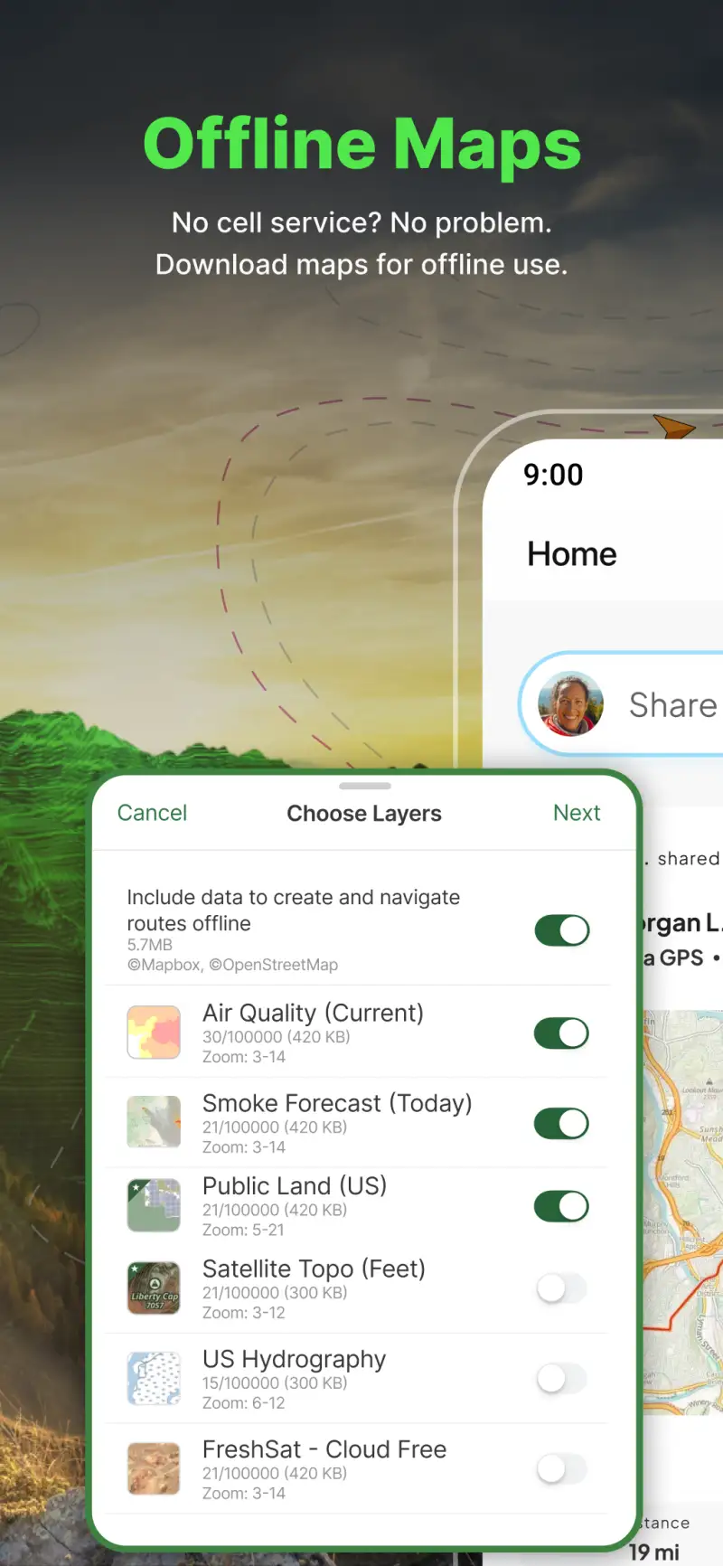
However, Strava's trail running value concentrates in performance tracking rather than navigation. Gaia GPS, bundled into Outside+ ($89.99/yr alongside Outside Magazine, Trail Runner, Backpacker, and other publications), provides the backcountry navigation depth that trail runners in remote terrain need. High-resolution USGS topo download for offline use, GPX race course import that displays course files on topo for pre-run terrain analysis, and breadcrumb navigation for complex trail junctions serve runners who go where established singletrack ends and unmarked terrain begins.
The Outside+ bundling model changed Gaia GPS pricing significantly: pure Gaia GPS Premium is no longer sold separately as of 2024. Runners who want Gaia GPS specifically must subscribe to Outside+ at $89.99/yr - more expensive than either Strava Premium or AllTrails Pro, but the bundle includes publications (Trail Runner, Backpacker, Ski) that runners interested in the broader outdoor sport context may find valuable alongside the mapping tool.
What Gaia GPS does well
- Offline high-resolution topo: download USGS topographic maps at multiple scales before entering no-signal terrain; the navigation tool for backcountry trail runners where AllTrails' and Strava's offline functionality is insufficient
- GPX race course import: load race GPX files and view them on topo for pre-race course analysis; particularly useful for trail running races where course knowledge directly affects pacing strategy on unfamiliar terrain
- Breadcrumb navigation: follow a GPS trace along complex trail junctions without requiring cellular connectivity; the active navigation tool for routes where trail signage is absent or unreliable
- Slope angle shading: useful for mountain runners in terrain where avalanche risk is relevant - the feature that makes Gaia GPS essential for any snow-season mountain running
- Multiple map layers: USGS topo, satellite imagery, and weather overlay available simultaneously; more map layer flexibility than competing platforms
Where Gaia GPS falls short
Gaia GPS is a navigation and mapping tool, not a performance tracking platform - segment competition, training load analysis, and social performance features do not exist. Outside+ bundling at $89.99/yr means paying for publications and content beyond Gaia GPS itself, which may or may not represent value depending on whether the bundled magazines are relevant. Trail discovery (finding new trails based on community recommendations, conditions, and difficulty ratings) is weaker than AllTrails; Gaia GPS shows you the terrain but not what other runners have said about specific trail experiences.
Pricing: Included in Outside+ subscription at $89.99/year (not available separately)
Backcountry trail runner, mountain runner, or ultramarathon competitor preparing for races on remote terrain? Outside+ ($89.99/yr) is worth the cost if Gaia GPS navigation is a consistent need. For runners who primarily stay on established trail networks with signage, AllTrails Pro at $29.99/yr provides offline maps at lower cost.
AllTrails Pro - Best for Trail Discovery and Accessible Offline Maps


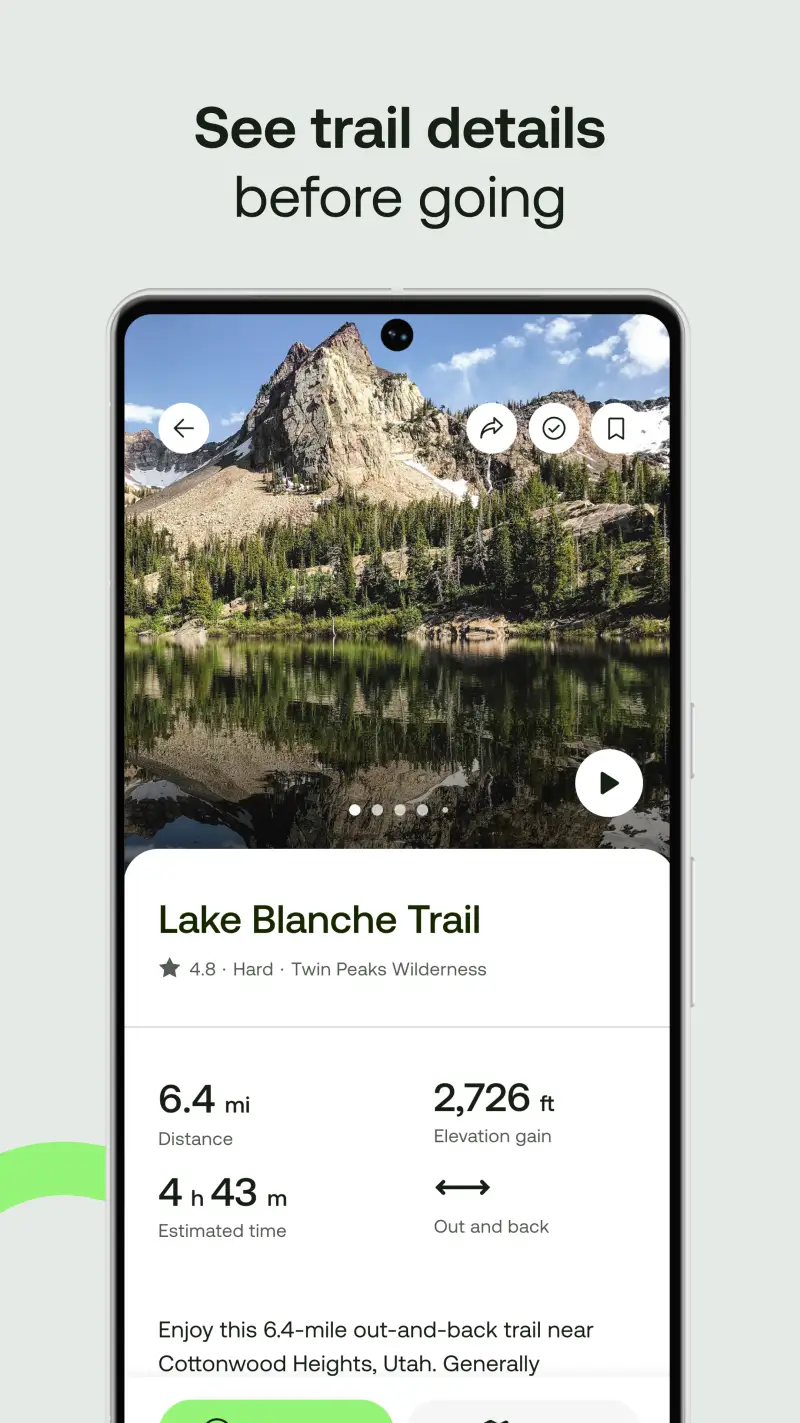
Additionally, most trail runners do not run in technical backcountry terrain where Gaia GPS is necessary - they run on established trail networks where the primary needs are finding new trails, understanding current surface conditions, and having offline maps as backup for unfamiliar routes. AllTrails Pro ($29.99/yr) serves this context with the most developed trail discovery platform among the three reviewed: 400,000+ trails with user-reported conditions, difficulty ratings, and recent visitor photos, accessible to 50M+ outdoor athletes who have made AllTrails the most widely used trail database globally.
The conditions reporting system - AllTrails users post recent conditions with tags like "muddy", "snowy", "clear trail" - gives trail runners the surface intelligence needed to decide whether a planned route is currently runnable or better postponed until conditions improve. This is the same function that Trailforks' condition reports serve for mountain bikers, adapted for the broader running and hiking community.
What AllTrails Pro does well
- 400,000+ trails with community conditions: the most comprehensive trail discovery database for established trail networks; user-reported conditions from recent visitors give runners current surface intelligence before committing to a route
- $29.99/yr pricing: the most affordable Pro tier among the three platforms reviewed; accessible entry point for trail runners who want offline maps and detailed trail data without Strava or Outside+ subscription costs
- 50M+ user community: the largest outdoor trail database community globally; popular trails have dozens of recent condition reports and route reviews providing detailed local knowledge
- Route planning and saving: save planned routes for offline access before arriving at a trailhead; create custom routes combining trail segments within the planning tool
- AllTrails+ live tracking: share real-time location with a designated contact during runs; safety feature for solo runners on remote trails
Where AllTrails Pro falls short
AllTrails is a trail discovery and navigation platform, not a performance tracking app - there are no segment leaderboards, training load analysis, or competitive performance context comparable to Strava. The offline map quality for genuinely remote backcountry terrain is below Gaia GPS's high-resolution topo standard; runners going off-trail or into terrain without established signage need Gaia GPS rather than AllTrails. Performance data from AllTrails runs can be exported to Strava, but the integration requires manual steps rather than automatic upload.
Pricing: Free (basic trail browsing) / $29.99/year Pro (offline maps, conditions map, Pro-only filters, AllTrails+ live tracking)
Trail runner who primarily runs on established trail networks and wants affordable offline maps plus trail discovery? AllTrails Pro ($29.99/yr) is the right starting point. Combine with Strava free for segment performance tracking. Upgrade to Gaia GPS (Outside+, $89.99/yr) only when backcountry terrain with absent signage becomes a regular running context.
Which App Fits Your Trail Running Setup
| App | Annual Cost | Best For | Navigation Depth | Performance Analytics |
|---|---|---|---|---|
| Strava Premium | $79.99/yr | Performance + segments + 3D terrain | Moderate | Best |
| Gaia GPS (Outside+) | $89.99/yr | Backcountry navigation + offline topo | Best | None |
| AllTrails Pro | $29.99/yr | Trail discovery + conditions + affordable offline | Good | Basic |
Trail runner focused on performance and segment competition
Subscribe to Strava Premium ($79.99/yr) for Outdoor Maps 3D terrain and full segment analytics. Use AllTrails free for trail discovery when planning new routes. Total: $79.99/yr.
Mountain runner or ultramarathon competitor on remote terrain
Subscribe to Outside+ ($89.99/yr) for Gaia GPS backcountry navigation and GPX race course import. Add Strava free for ride logging and segment data on established trails. Total: $89.99/yr.
Trail runner wanting affordable all-around coverage
Subscribe to AllTrails Pro ($29.99/yr) for offline maps and trail discovery. Add Strava free for segment performance tracking. Total: $29.99/yr - the most cost-effective complete coverage stack.