AllTrails has 60 million+ registered users and 450,000+ trails in its database because it answers the casual hiker's actual question better than any competitor: where should I hike this weekend, and what will it be like when I get there? Community reviews, photos, difficulty ratings, and dog-friendly filters tell you more about a trail before you leave than a topo map ever could. Komoot creates routes rather than finding them, generating a surface-aware hiking path from your start point with turn-by-turn voice navigation. Wikiloc has 76 million community-contributed trails worldwide, often covering regional paths in areas where AllTrails has limited data, with free offline maps that AllTrails locks behind a subscription.
After testing 8 hiking apps on Pixel 8 and Samsung Galaxy S24 running Android 15, across day hikes in varied terrain in 2025 and early 2026, I found these three serve casual hikers across the full range from park trail walks to all-day mountain routes - each solving a distinct problem the others do not.
Who this is for: Hikers who typically do day hikes or half-day walks on established trails, who want to discover new routes, read reviews before going, and navigate safely on the trail. If you do multi-day overnight backpacking, the backpacking guide covers your specific navigation needs more accurately. For thru-hiking long trails like the AT or PCT, see the thru-hiking guide.
What Casual Hikers Need From a Trail App
Day hiking creates three requirements that differ meaningfully from urban navigation or performance sport apps.
Reliable Trail Discovery With Honest Reviews
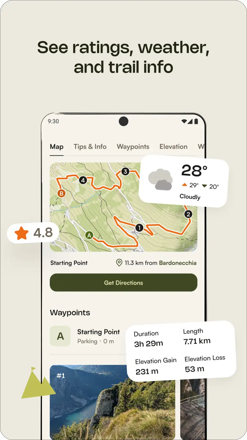
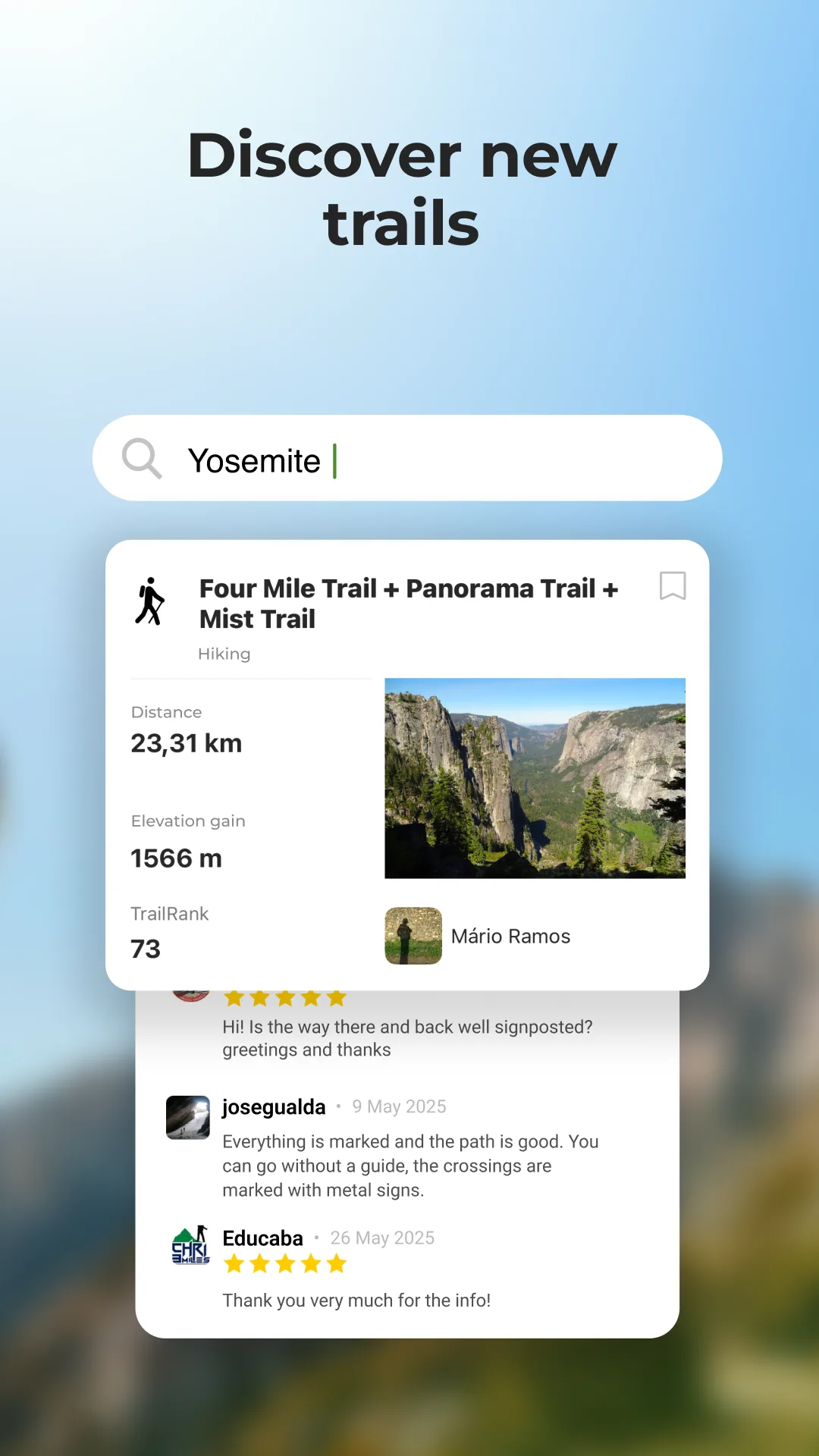
Finding a trail is the starting problem. A database that tells you a trail exists is only useful if it also tells you whether it is currently passable, how crowded it gets on weekends, whether dogs are permitted, and what the footing is like after rain. AllTrails' community review system - with photos, condition reports, and user ratings from recent visitors - answers these questions better than any other platform. Hikers who plan routes from trail data alone, without checking recent community conditions, often arrive to find a trail washed out, snow-covered, or far more technical than the difficulty rating suggested.
Offline Navigation That Works Without Signal
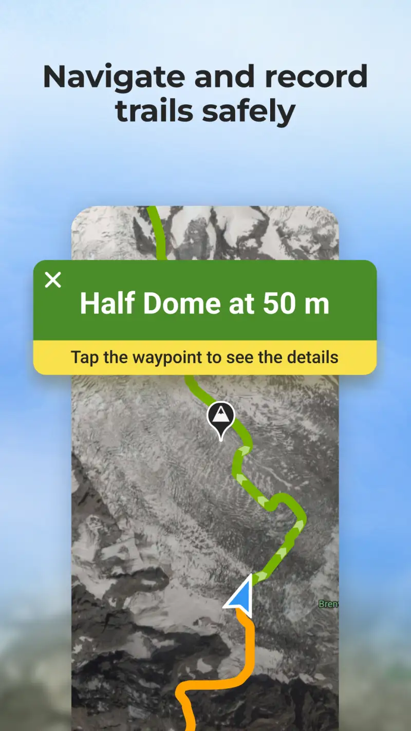
Most trail systems have poor or no cellular coverage precisely in the areas where navigation matters most - remote valleys, dense forest, high ridgelines. An app that requires signal to display your location on a map is a liability on any hike beyond a popular park trail in an urban area. AllTrails Plus and Wikiloc's free offline maps both address this. Download the trail map before leaving home; the 3 minutes of preparation prevents the most common day hiking navigation failure.
Correct Difficulty Assessment for Your Fitness Level
Trail difficulty ratings vary widely in quality across apps. AllTrails' ratings combine elevation gain, distance, and technical terrain into a curated scale with community verification; Komoot's difficulty system uses sport-specific routing that distinguishes between hiking and trail running terrain. Both are more reliable than self-reported difficulty on apps without editorial curation. A beginner who chooses a trail marked "moderate" on an app with poor rating standards may encounter terrain well beyond their ability.
AllTrails - Best for Trail Discovery and Community Reviews

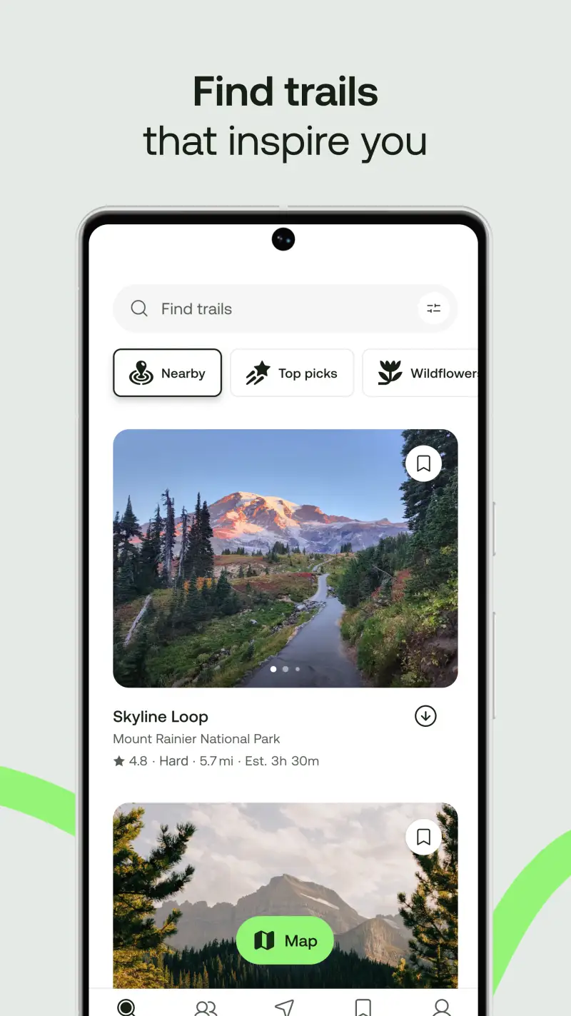
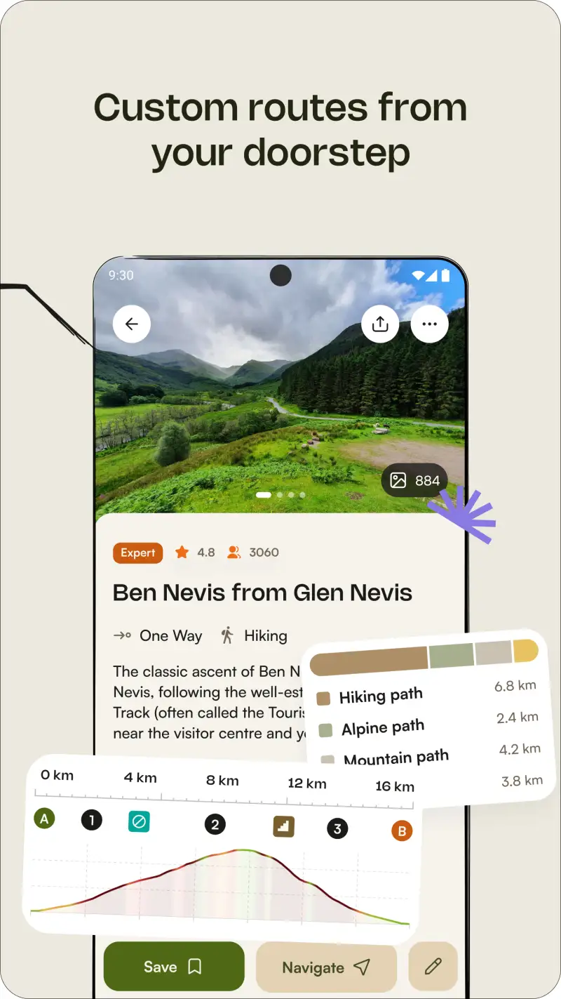
AllTrails is the trail discovery standard for casual hikers, and the data supports why. The 60 million+ user base generates condition reports, photos, and reviews on even relatively obscure local trails - the community intelligence that makes pre-hike planning reliable rather than speculative. Filters for dog-friendly trails, accessible trails, kid-friendly routes, and seasonal features like waterfalls or fall color cover the specific criteria that casual hikers actually search by, not just distance and elevation gain.
The Plus tier at $35.99 per year adds offline map downloads, wrong-turn alerts, and live location sharing - the three features that upgrade AllTrails from a discovery tool into a navigation tool for areas with limited cellular coverage. I tested the offline maps on several routes and found them reliable at maintaining GPS position without signal; the wrong-turn alerts functioned correctly at trail junctions in forested terrain. For casual hikers who occasionally venture into areas with spotty coverage, Plus is the appropriate upgrade once the free tier proves useful.
What AllTrails does well
- 450,000+ trails with community reviews: the largest curated trail database available; condition reports, photos, and difficulty ratings from recent visitors provide pre-hike intelligence no competitor matches at this scale
- Specific trail filters: dog-friendly, kid-friendly, accessible, waterfall, wildflower, fall foliage, birding, and more; filters beyond just distance and elevation that match how casual hikers actually choose trails
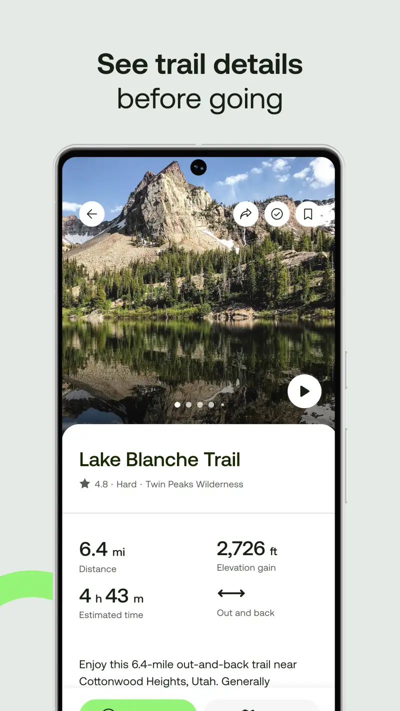
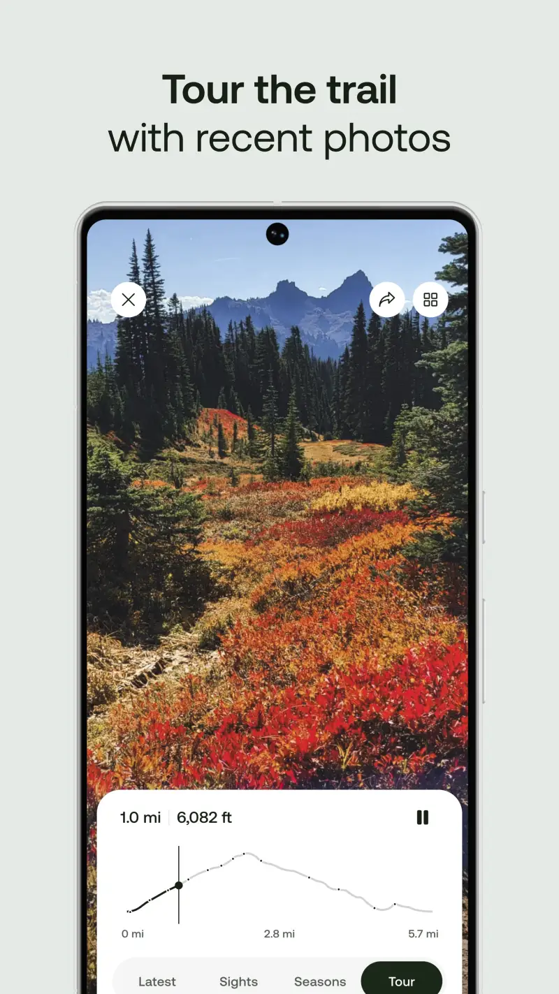
- 3D trail previews (Plus): view the elevation profile and terrain in three dimensions before committing to the hike; useful for casual hikers assessing whether a route matches their current fitness
- Permit and regulation information on popular trails, increasingly essential as high-use trails implement booking systems
- Live location sharing (Plus): send real-time GPS position to a contact throughout the hike; the safety feature casual solo hikers most need
- AI smart route creation (Peak at $79.99/yr): modify existing trails to be shorter, less steep, or more scenic using AI routing
Where AllTrails falls short
Offline maps require the Plus subscription at $35.99 per year - consistently the most-criticized AllTrails policy, as the hiking community broadly argues that offline navigation is a safety feature that should not sit behind a paywall. Battery drain in navigation mode is severe; multiple users in 2025-2026 reviews report phones dying mid-trail, which is a serious safety concern when the phone is also the primary communication device. The free tier requires signal for navigation, which makes it unreliable on trails beyond suburban park networks. AllTrails' database also mixes official maintained trails with unofficial community-created tracks without consistently distinguishing them, occasionally directing hikers onto routes that have fallen into disrepair.
Pricing: Free (discovery, signal-dependent navigation) / $35.99/year Plus (offline maps, wrong-turn alerts, live sharing) / $79.99/year Peak (AI routing, plant ID, heatmaps)
Download AllTrails free today and search for trails in your area before your next weekend hike. Subscribe to Plus at $35.99 per year once you start hiking in areas beyond reliable cellular coverage - the offline maps are worth the cost specifically for that use case.
Komoot - Best for Route Creation and Navigation
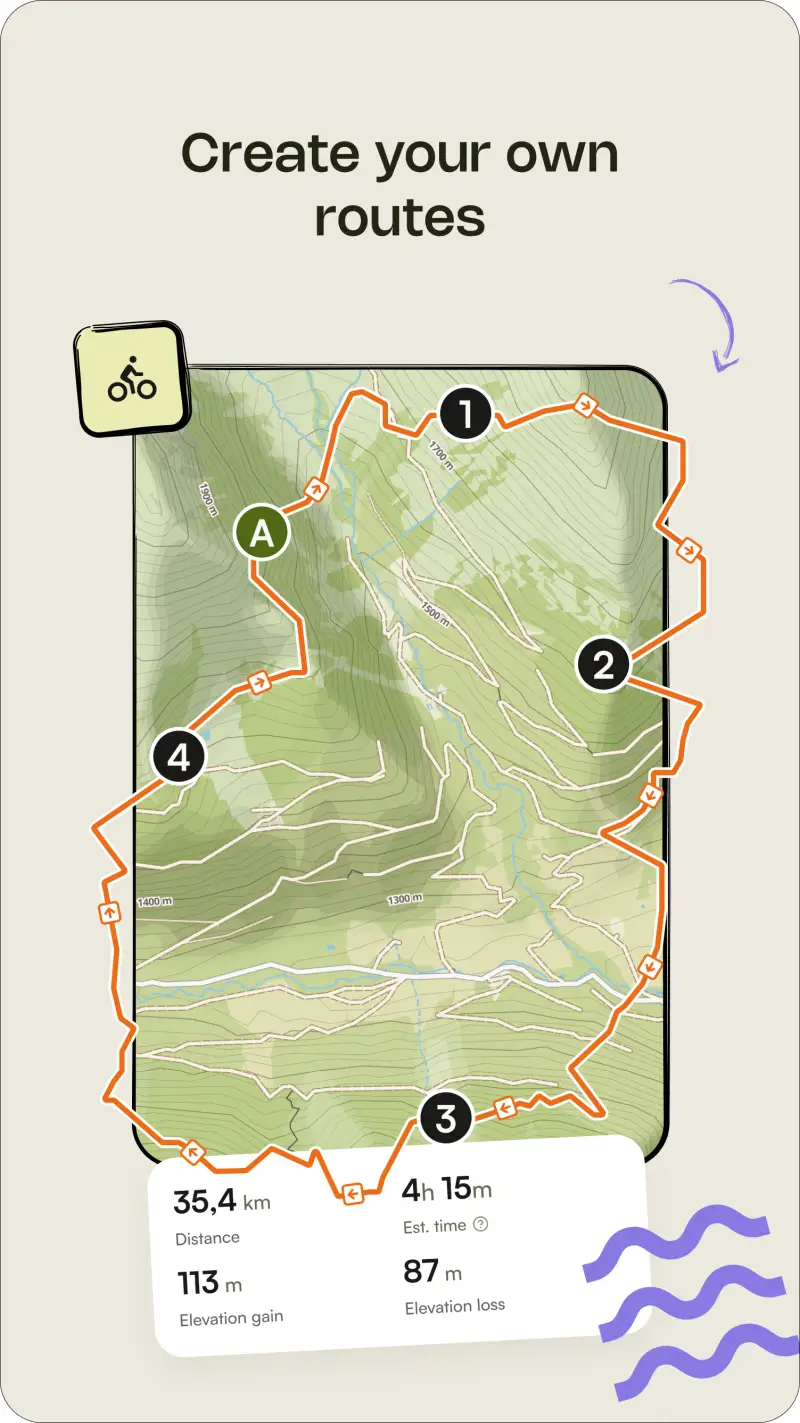
However, AllTrails finds routes better than it creates them. Komoot addresses the route creation gap directly: its sport-specific routing engine generates a hiking path from your start point that avoids mountain bike singletrack and car roads, shows the surface breakdown on the elevation profile, and delivers turn-by-turn voice navigation with junction-specific instructions on the trail. For casual hikers who want to create a loop from their front door rather than drive to a trailhead, Komoot's routing approach is more practical than AllTrails' trail database model.
The elevation profile with gradient percentage per segment lets you assess every climb before committing to the route. Surface breakdown shows where the path is well-maintained footpath versus dirt track versus rough terrain. For hikers planning a route in an unfamiliar area, this pre-departure information changes how you evaluate a potential walk without requiring a separate map research step.
What Komoot does well
- Sport-specific routing: generates hiking-specific routes that avoid vehicle roads and mountain bike-specific terrain; turn-by-turn voice navigation with junction-specific instructions works reliably on hiking paths
- Elevation profiles with surface breakdown: see gradient percentage and surface type for every section of a planned route; assess whether a route matches your current fitness and footwear before departing
- 40 million+ community routes: particularly dense coverage in Europe across the Alps, Black Forest, and Dolomites; strong for UK and Scandinavian hiking regions
- One local region free forever - adequate for hikers who stay within a single geographic area without purchasing the worldwide bundle
- Offline map downloads for areas without cellular signal, available in both the free local region and the worldwide purchase
- Clean interface and best visual design in the hiking app category
Where Komoot falls short
The 2023 Bending Spoons acquisition and the 2025 decision to move Garmin and Wahoo device sync behind a Premium subscription at approximately €59.99 per year generated significant community backlash from users who previously synced free. Komoot's trail database is notably less comprehensive than AllTrails in North America; casual hikers in the US or Canada will find fewer community routes and reviews than their European counterparts. For hikers who want trail discovery with community photos and condition reports rather than custom route creation, AllTrails serves better. Komoot has no community condition reporting - you cannot check whether a route is currently passable from recent visitor notes.


Pricing: Free (one local region, offline maps included) / ~€59.99/year Premium (all regions, device sync, multi-day planning)
Download Komoot free and explore the pre-built hiking routes in your local region before buying anything. Purchase the worldwide regions if you hike across multiple areas or travel to new locations regularly. Consider the Premium subscription specifically if Garmin or Wahoo device sync is a specific need.
Wikiloc - Best for Free Offline Maps and International Coverage


Additionally, Wikiloc fills a gap that both AllTrails and Komoot leave open for hikers on a tight budget or those exploring regions with limited app coverage: genuinely free offline map downloads without any subscription requirement. The 76 million community-contributed trails worldwide often cover regional paths in Eastern Europe, Latin America, Southeast Asia, and rural areas globally where AllTrails has sparse data. For a casual hiker visiting a destination outside the UK, France, or the US, Wikiloc frequently has community routes available where AllTrails returns few or no results.
The free offline map functionality is Wikiloc's strongest differentiation. Download the trail map before leaving home, and Wikiloc maintains your GPS position without signal for the entire hike - the same core offline capability that AllTrails charges $35.99 per year for. Wikiloc also includes AR peak identification, which points your camera at a mountain and labels visible summits - a genuinely useful feature for casual hikers learning to read the terrain they are walking through.
What Wikiloc does well
- Free offline maps: download trail maps without a subscription; the core capability that AllTrails charges $35.99 per year for, available at zero cost from day one on Wikiloc
- 76 million community trails: the largest trail database by raw count; particularly strong in regions where AllTrails has limited coverage, including Central and Eastern Europe, Latin America, Southeast Asia, and rural areas globally
- AR peak identification: point your camera at mountains and see labeled summit names in augmented reality; useful for orientation and learning the geography of unfamiliar terrain
- Device sync to Garmin, Suunto, Apple Watch, and COROS watches for automatic activity upload
- Live tracking sharing for family and friends during the hike
- GPS track recording with real-time elevation, distance, and speed display
Where Wikiloc falls short
The 76 million community trails include significant quantities of duplicates, inaccurate GPS tracks, and routes that have changed or become impassable since they were uploaded. Quality control is substantially weaker than AllTrails' curated database - the sheer volume of trails makes consistent curation impossible, and a beginner following a Wikiloc trail that was uploaded 5 years ago may find the route no longer matches reality. Trail descriptions are often minimal - many entries are GPS tracks only, without written notes about difficulty, current conditions, or navigation hazards. The navigation interface is less refined than AllTrails or Komoot.
Pricing: Free (offline maps, basic navigation) / ~$29.99/year Premium (enhanced features, full filter access)
Download Wikiloc free immediately for the offline map capability alone. Use it as a free navigation layer alongside AllTrails for discovery: find the trail on AllTrails, then download the route to Wikiloc for offline GPS navigation. This combination provides AllTrails' community intelligence and Wikiloc's free offline navigation at a combined cost of zero.
Which App Fits Your Day Hiking Style
| App | Price | Best For | Free Tier Useful? |
|---|---|---|---|
| AllTrails | Free / $35.99/yr Plus | Trail discovery, community reviews | Yes (signal required) |
| Komoot | Free (1 region) / ~€59.99/yr | Route creation, turn-by-turn navigation | Yes (one region) |
| Wikiloc | Free / ~$29.99/yr | Free offline maps, international coverage | Yes (full offline) |
First hike in a new area
Download AllTrails free and search for trails matching your preferred difficulty, duration, and features. Read the 5 most recent reviews to check current conditions. Subscribe to Plus at $35.99 per year once you hike where cellular coverage is unreliable.
Creating a route from your home or a specific start point
Download Komoot free and use the route creation tool to generate a hiking loop from your location. The free local region covers route planning without requiring purchase; buy the worldwide bundle at the point when you travel to new regions.
Hiking internationally on a limited budget
Download Wikiloc free and download offline maps for your destination region before departure. Use AllTrails free alongside it for trail discovery where coverage is available. This combination provides offline navigation and the widest possible trail database at zero cost.
Most complete free setup
Install AllTrails free for discovery and trail research. Download Wikiloc free for offline navigation. Use Komoot free for route creation within your local region. All three apps together cost nothing, and together they cover trail discovery, offline GPS navigation, and custom route planning for casual day hiking anywhere in the world.