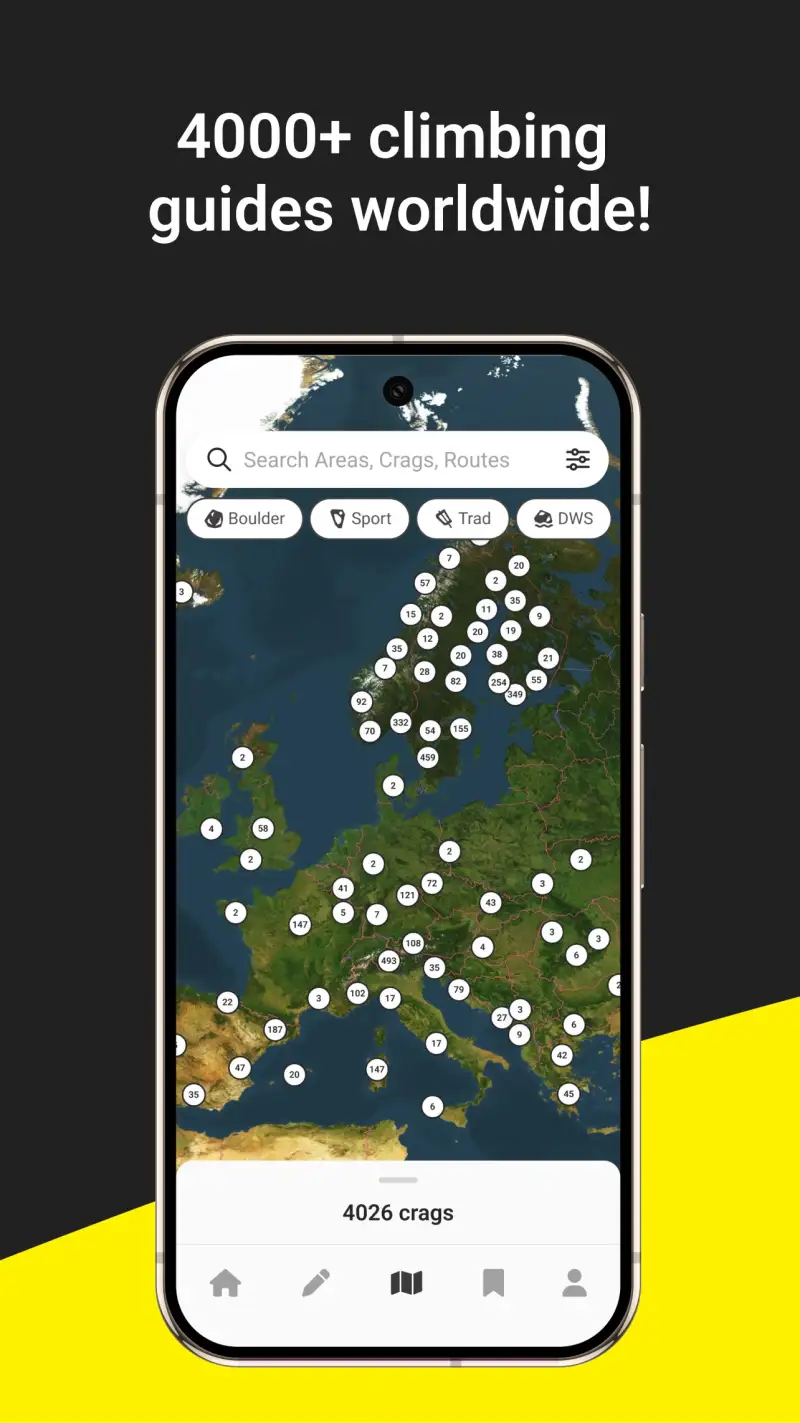
Rock climbers carry two kinds of information needs onto a crag: before the approach, they need route grades, topo diagrams, access notes, and recent conditions; on the wall, they need offline data when cell service disappears. Mountain Project, owned by REI since 2018, is the de facto standard for US climbing areas - 200,000+ routes, free offline access, and community trust built across 20+ years of crowdsourced data. The Crag holds the largest global climbing database at 4M+ routes across 180+ countries, making it irreplaceable for international travel and European crags where Mountain Project coverage thins significantly. 27 Crags, launched in Finland in 2012, covers 300,000+ routes across 40+ countries with curated quality that prioritises route description accuracy over raw database scale - particularly strong in Scandinavia, Spain, France, and Central Europe.
After testing these 3 climbing apps on Pixel 8 and Samsung Galaxy S24 running Android 15, specifically for outdoor sport, trad, and bouldering contexts across 2025-2026, I found that the right choice depends almost entirely on where you climb rather than which interface you prefer.
Who this is for: Outdoor rock climbers - sport, trad, and bouldering - who need route information, offline crag access, and personal tick logging. Indoor climbers or gym-only athletes will find these platforms largely irrelevant to their training context.
What Rock Climbers Need From a Climbing App
Route databases and tick loggers share a structure, but the features that matter vary by how and where you climb.
Route Database Coverage for Your Climbing Area
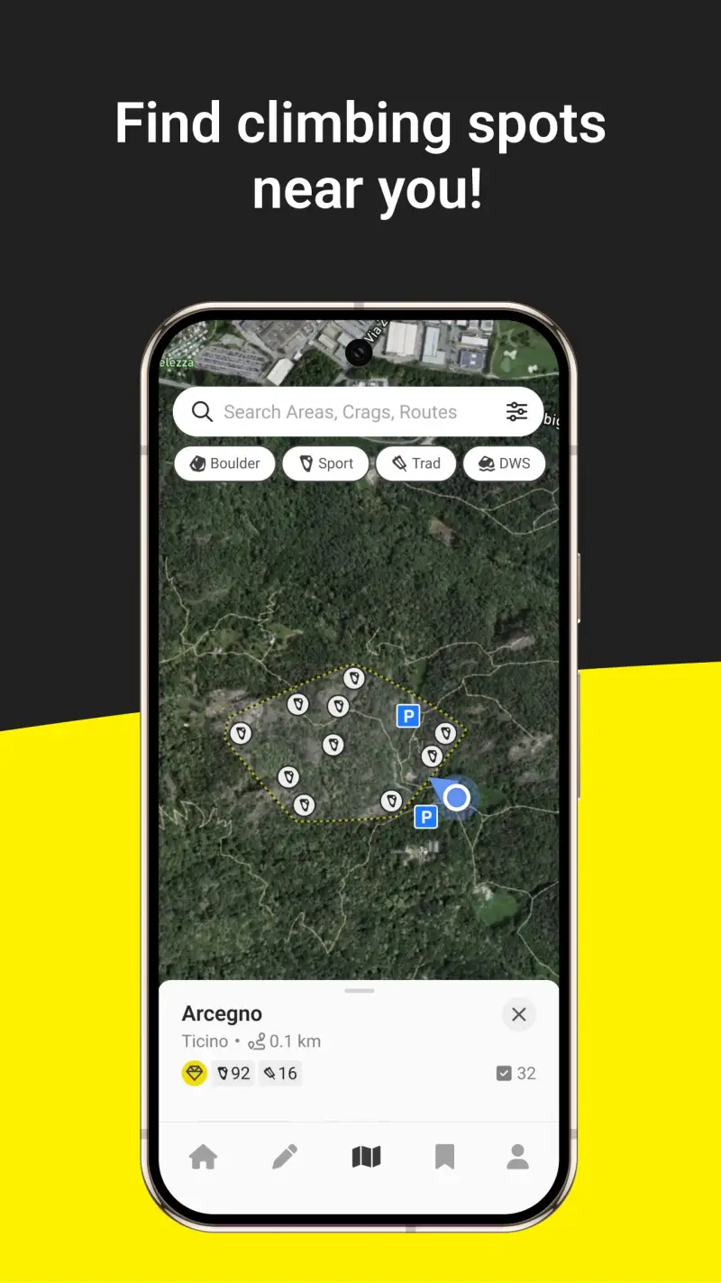
The single most important variable in choosing a climbing app is whether the app covers your local crags and international destinations well. Mountain Project dominates US coverage - if you climb in Yosemite, Red Rocks, the Gunks, or Smith Rock, Mountain Project's community has built and maintained the most trusted data there. The Crag covers international destinations where Mountain Project data is sparse or absent - climbing in Kalymnos, Fontainebleau, or the Dolomites typically requires The Crag's 4M-route global database or 27 Crags' curated European depth. Checking both apps for your planned destinations before committing to one is worthwhile; coverage quality varies by region in ways that no summary can fully capture.
Offline Access Before and During the Approach
Cell service at crags is frequently absent or unreliable. Offline maps and route data download before leaving civilization is a functional requirement, not a convenience feature. Mountain Project offers offline downloads free - an advantage over The Crag's Premium tier (~$25/yr) offline requirement. 27 Crags also requires its $29.99/yr premium for offline access. Climbers who are not willing to pay for either premium tier have a clear choice: Mountain Project for US climbing, or a combination of free-tier browsing in The Crag and 27 Crags for international research supplemented by printed topos at the crag.
Tick List and Personal Log Fidelity
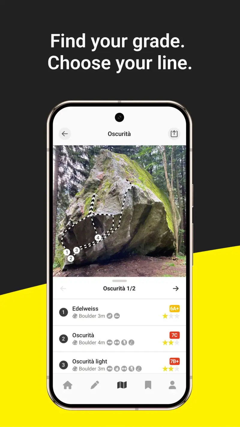
A climbing tick list - your logged record of routes completed with date, grade, style, and notes - becomes valuable over years of climbing history. Style tracking matters: whether a route was onsighted (led without prior information or falls), flashed (onsighted having seen others climb it), or redpointed (led clean after prior attempts) is the vocabulary that serious climbers use to describe their performance history. Mountain Project, The Crag, and 27 Crags all support this style vocabulary; the differences are in statistics depth and how tick data is presented back to the climber over time.
Mountain Project - Best for US Climbing and Free Offline Access
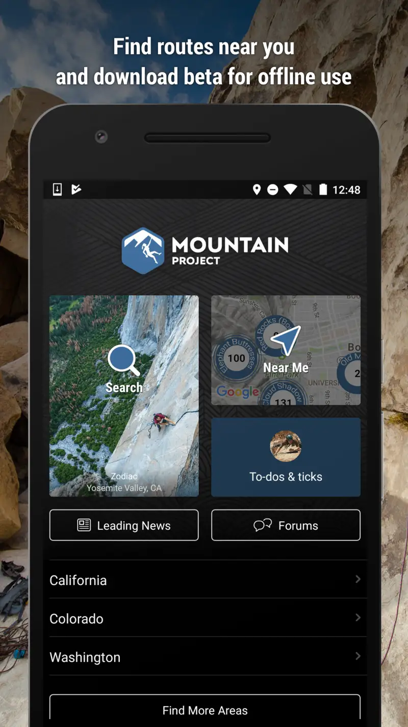
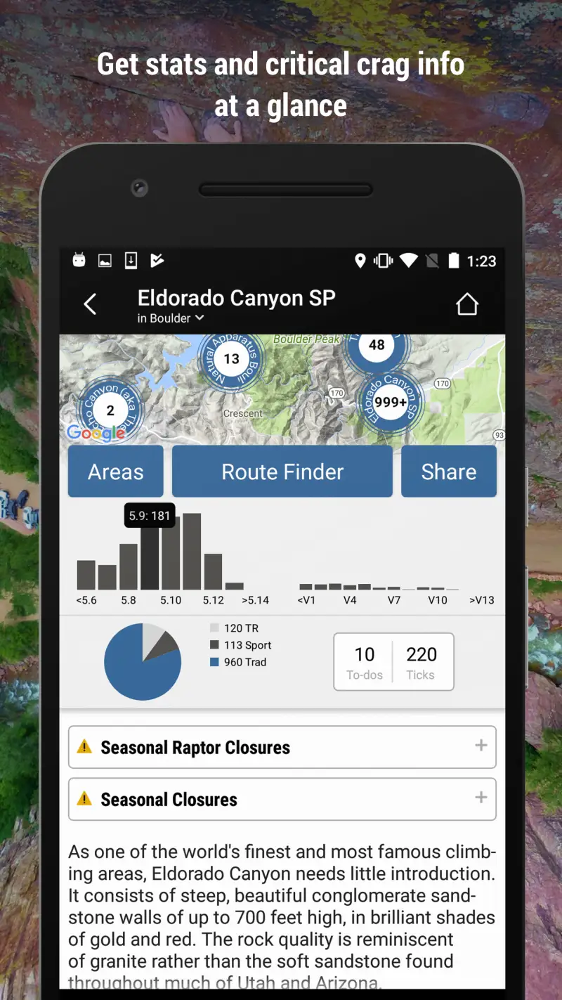
Mountain Project is where most US climbers start and where most US climbing areas have their most complete, community-trusted data. The 200,000+ route database is skewed heavily toward North American crags - particularly the established sport and trad destinations in the US and Canada - and the combination of 45,000+ iOS reviews and REI's resources maintaining data quality makes Mountain Project the reference climbers check before visiting any established US crag.
The offline feature that distinguishes Mountain Project from its competitors in the free tier: you can download entire climbing areas - including route topos, approach descriptions, and community photos - without paying anything. For a climber heading to Red Rocks or Yosemite, Mountain Project's offline mode covers all essential information at zero cost. This single feature makes it the default choice for US climbers who want crag access without a subscription.
What Mountain Project does well
- Free offline downloads: entire area downloads available at no cost; the feature that The Crag and 27 Crags charge premium tiers for, Mountain Project provides free for all users
- Most trusted US database: 200,000+ routes built across 20+ years of community contribution; the standard reference for established North American climbing areas
- Tick list with style logging: onsight, flash, redpoint, fell/hung logging for sport and trad; lead and top-rope distinction; route notes per tick
- Area guides: approach directions, parking coordinates, access notes, and permit information; camping and services nearby
- REI platform stability: unlike community-built apps that may lose funding, Mountain Project benefits from REI's operational support; the database is unlikely to disappear or paywall its features
- 45,000+ iOS reviews at 4.7 stars: the largest and highest-rated climbing app; broad community trust validated at scale
Where Mountain Project falls short
International coverage is the platform's clear limitation - US-first development means that European, Asian, and South American crags often have sparse or missing route data. Climbers visiting Kalymnos, the Verdon Gorge, or Railay Beach will find Mountain Project inadequate without The Crag or 27 Crags supplementation. Route descriptions in less-traveled US areas also rely on community contributions that may be sparse or outdated - the quality gradient between heavily-trafficked crags and obscure locals areas is significant. No social performance features like Strava segments or competitor comparison; the focus is on route research and personal logging.
Pricing: Free - all features including offline maps
The baseline climbing app for any US climber. Download Mountain Project and download your local area before every crag visit. Add The Crag (free tier) for any international destination where Mountain Project data is thin.
The Crag - Best for International Climbing and Global Database
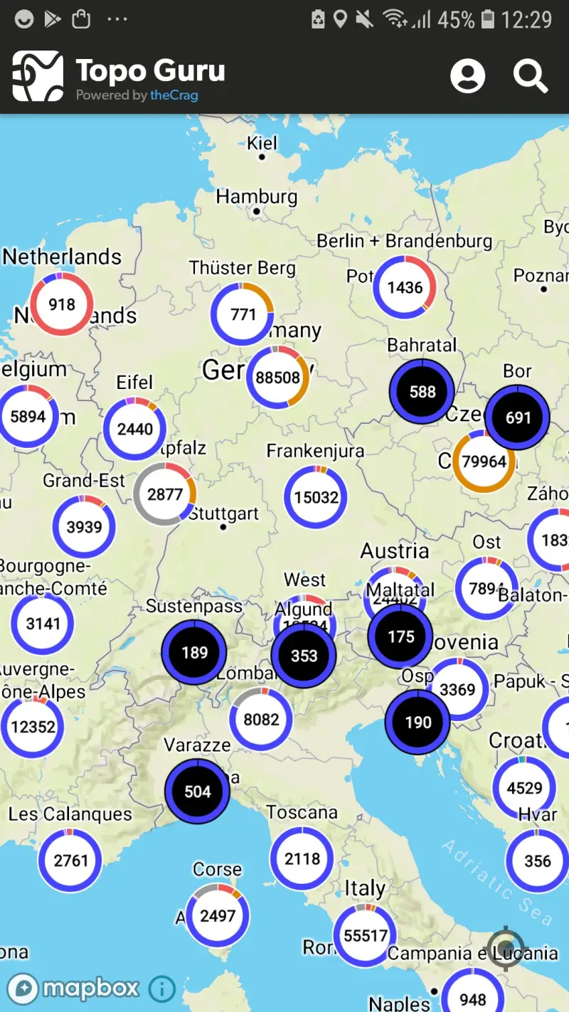
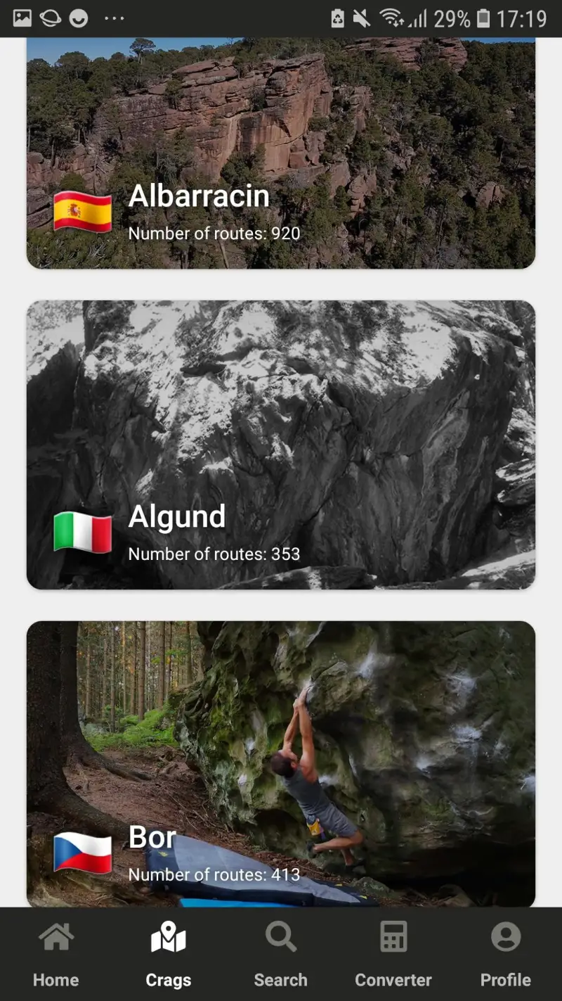
However, Mountain Project's US strength inverts for international climbing. The Crag's 4M+ routes across 180+ countries represent the largest climbing database in the world by significant margin - roughly 20 times Mountain Project's route count, with particularly strong coverage in Europe, Australia, and South America where the project's Australian origins and international community have built dense regional data. For climbers visiting established international destinations, The Crag often provides the only comprehensive digital route database available.
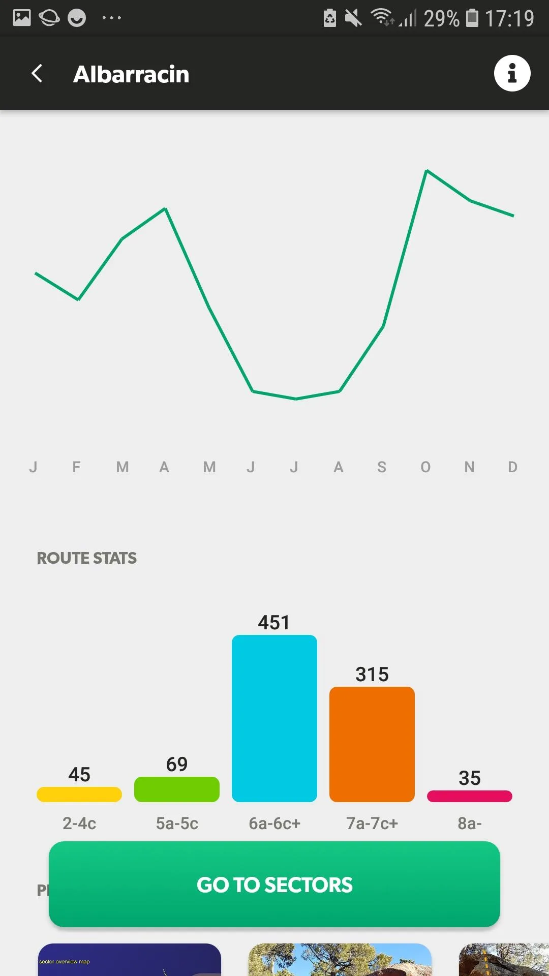
The grade conversion system handles climbing's fragmented grading vocabulary meaningfully: French numeric grades (6a, 6c+, 7b), Yosemite Decimal System (5.10c, 5.12a), British E-grades, Australian grades, UIAA numerics, and V-grades for bouldering are automatically converted when browsing routes from different grading traditions. For international climbers who learned grades in one system and encounter routes graded in another, this automatic conversion removes a routine confusion.
What The Crag does well
- 4M+ routes across 180+ countries: the largest climbing database globally; irreplaceable for international climbing travel where Mountain Project coverage is thin or absent
- Grade conversion across systems: French, YDS, British, Australian, UIAA, and V-scale auto-conversion; removes the mental arithmetic of converting between grading traditions when traveling internationally
- Personal statistics beyond tick count: grade pyramid (how many routes at each grade), most active areas, style breakdown, climbing frequency over time; more detailed statistics than Mountain Project's basic tick list
- Strong European coverage: Kalymnos, Fontainebleau, the Dolomites, Frankenjura, Siurana - the European destinations that require The Crag specifically because Mountain Project data does not reach them
- Guidebook integration: premium area data in some regions links to published guidebook content; higher quality than community-only route descriptions in established climbing areas
Where The Crag falls short
Offline access requires The Crag Premium (~$25/yr) - the free tier provides browsing and tick logging but not area downloads for crag-side use without cell service. Data quality varies more across the 4M-route database than Mountain Project's more moderated 200,000 - the scale that makes The Crag globally comprehensive also means that route descriptions in less-trafficked areas can be sparse, inaccurate, or missing photos. US coverage is functional but less community-trusted than Mountain Project; climbers climbing primarily in the US typically find Mountain Project's US data more reliable for established American crags.
Pricing: Free (basic features) / ~$25/year Premium (offline access, advanced statistics, enhanced tick features)
International climbers or anyone climbing outside the US: subscribe to The Crag Premium (~$25/yr) for offline access on international trips. The grade conversion and 4M-route global database justify the cost for anyone who climbs in Europe, Asia, or South America regularly.
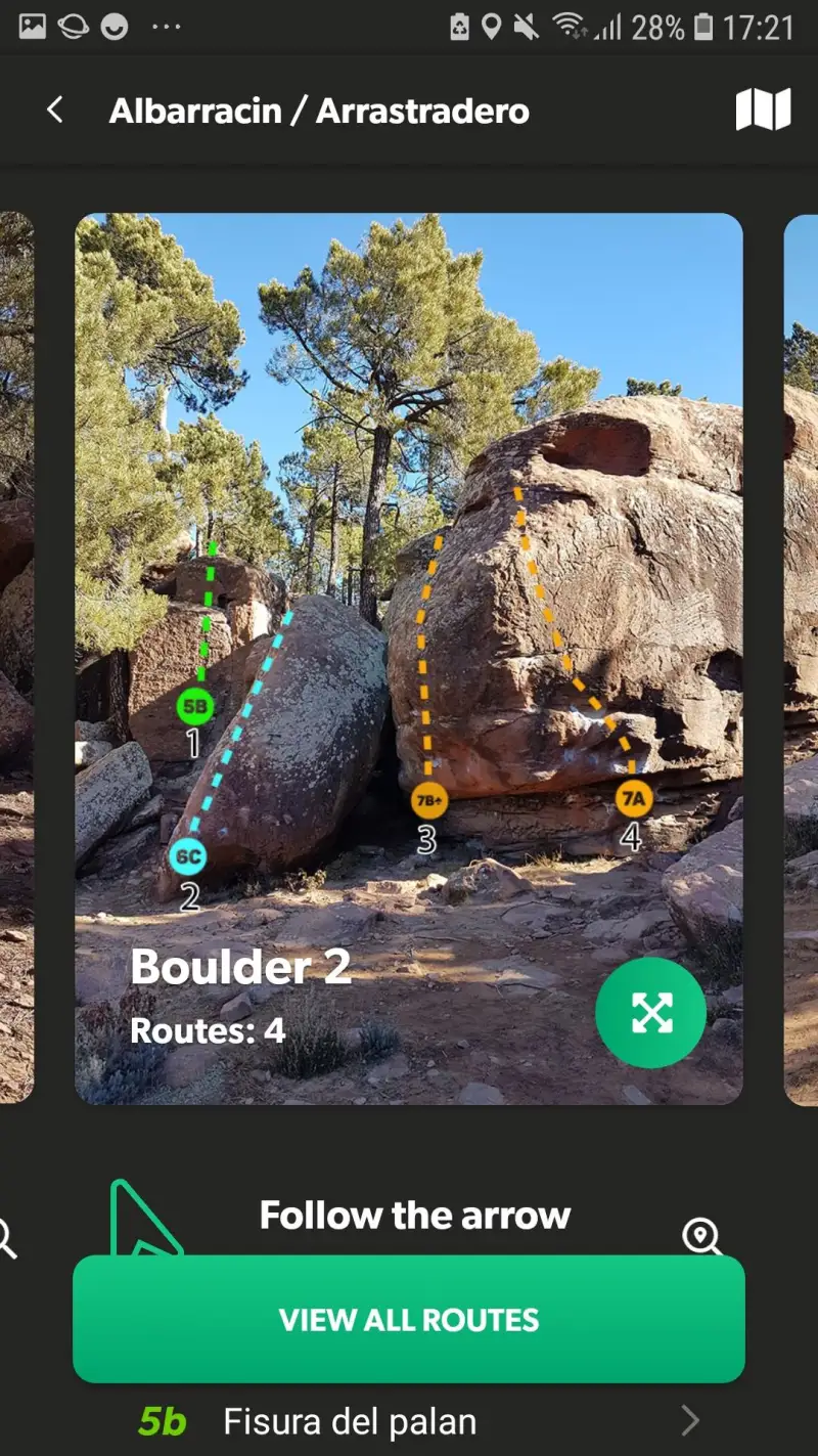
27 Crags - Best for European Climbing Travel and Curated Quality
Additionally, The Crag's global scale comes at a quality cost - 4M routes means variable description quality across the database. 27 Crags approaches the same European climbing market with a different priority: curated route quality over total route count. With 300,000+ routes across 40+ countries, 27 Crags focuses on routes where data is vetted, descriptions are thorough, and local context is accurate - particularly strong in Finland, Norway, Sweden, Spain, France, and Czech Republic, where the platform's Scandinavian origins and active local communities have built particularly high-quality area data.
The trip planning feature distinguishes 27 Crags from both Mountain Project and The Crag: multi-crag itinerary planning for climbing travel, including distance between areas, accommodation proximity, and seasonal condition data, allows climbers planning a week-long climbing trip through multiple Spanish crags to organise logistics in-app rather than across multiple resources.
What 27 Crags does well
- Curated data quality in European crags: route descriptions from local climbing communities with accuracy standards that distinguish it from The Crag's scale-over-quality approach; particularly reliable in Scandinavia, Spain, France, and Central Europe
- Multi-crag trip planning: itinerary planning for climbing travel - sequence crags, estimate distances, plan accommodation; the trip-planning feature unavailable in Mountain Project or The Crag at this depth
- Mountaineering alongside sport and trad: alpine climbing objectives alongside sport and trad routes; relevant for climbers in areas where the two disciplines overlap (Dolomites, Norwegian walls, Alpine approaches)
- Condition reports from local climbers: recent visit notes with local context; particularly valuable in European crags where seasonal conditions and weather patterns differ significantly from US climbing
Where 27 Crags falls short
27 Crags covers 300,000+ routes - comprehensive for its target European regions but significantly smaller than The Crag's 4M global database. Outside core European coverage areas, 27 Crags data thins quickly; climbers traveling to Asia, South America, or non-European destinations will find The Crag more useful. Offline access requires the $29.99/yr Premium tier, same as The Crag. The platform's user base is smaller than Mountain Project or The Crag, which means less community-generated content (photos, comments, recent conditions) in any given area.
Pricing: Free (basic features) / $29.99/year Premium (offline access, advanced trip planning, detailed area info)
Planning a climbing trip to Scandinavia, Spain, or Central Europe? 27 Crags Premium ($29.99/yr) provides the best curated European crag data and trip planning tools. Combine with The Crag free tier for global route browsing on international trips beyond 27 Crags' core coverage areas.
Which App Fits Your Climbing Setup
| App | Annual Cost | Best For | US Coverage | International Coverage |
|---|---|---|---|---|
| Mountain Project | Free | US climbing + free offline | Best | Limited |
| The Crag | ~$25/yr (Premium) | Global + international | Good | Best (4M routes) |
| 27 Crags | $29.99/yr (Premium) | European climbing travel | Limited | Strong (Europe) |
US-based climber climbing primarily domestic crags
Use Mountain Project free as your primary app - download area maps before every crag visit using the free offline feature. Add The Crag free tier for any international trips where Mountain Project data is thin; subscribe to The Crag Premium (~$25/yr) if you travel internationally more than once per year.
International climber or frequent Europe traveler
Subscribe to The Crag Premium (~$25/yr) as your primary database for international destinations. Add 27 Crags Premium ($29.99/yr) if you are planning multi-crag European trips and want the curated quality and itinerary planning features. Keep Mountain Project free for US crags.
Climber planning a specific European climbing trip
Download 27 Crags and evaluate whether its coverage for your specific destination - Kalymnos, Costa Blanca, Frankenjura, Flatanger - meets the quality standard you need. If 27 Crags coverage is strong for your area, subscribe to Premium ($29.99/yr) for offline access. If not, use The Crag Premium as the global fallback.