Trail running creates a navigation and tracking combination that neither pure hiking apps nor pure running apps fully address. AllTrails' 450,000+ trail database identifies which trails allow running and shows elevation profiles before you commit to a route; Strava's 195 million users generate heatmap data showing where other runners actually go in any region, revealing local singletrack networks that do not appear in official databases. Gaia GPS provides offline topographic navigation for technical mountain routes where trail running overlaps with backcountry hiking. Komoot's sport-specific routing generates trail-appropriate routes from any start point with turn-by-turn navigation.
After testing 8 apps on Pixel 8 and Samsung Galaxy S24 running Android 15, on trail running routes across varied terrain in 2025-2026, I found four that serve trail runners across the full spectrum from local forest park runs to mountain ultras.
Who this is for: Runners who train primarily on trails, singletrack, and off-road terrain, from recreational trail runners doing 10-20 km weekend routes to competitive athletes preparing for trail ultras. If you run primarily on road with occasional trail sessions, the recreational runners guide or serious runners guide covers your primary training stack. For the overlap between trail running and ultra training, see the ultra running guide.
What Trail Runners Need Beyond Running Apps and Hiking Apps
Trail running sits at the intersection of two app categories, and the gap between them creates specific requirements neither fully serves.
Runnable Route Discovery With Elevation and Surface Data
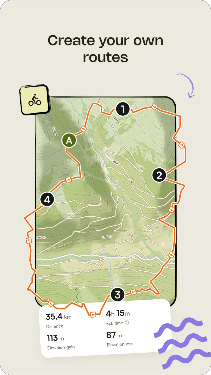
AllTrails is designed for hikers, and its difficulty ratings use hiking pacing logic - what is a strenuous day hike is an accessible trail run. A trail runner planning a 2-hour mountain run needs elevation data in distance-per-minute terms, surface information distinguishing technical rocky singletrack from smooth doubletrack, and difficulty assessment calibrated to running pace rather than walking pace. Komoot's trail running routing mode addresses this by generating sport-specific routes that optimize for runnable terrain. AllTrails provides the trail discovery database; the distance and elevation judgments require calibration to your specific running fitness.
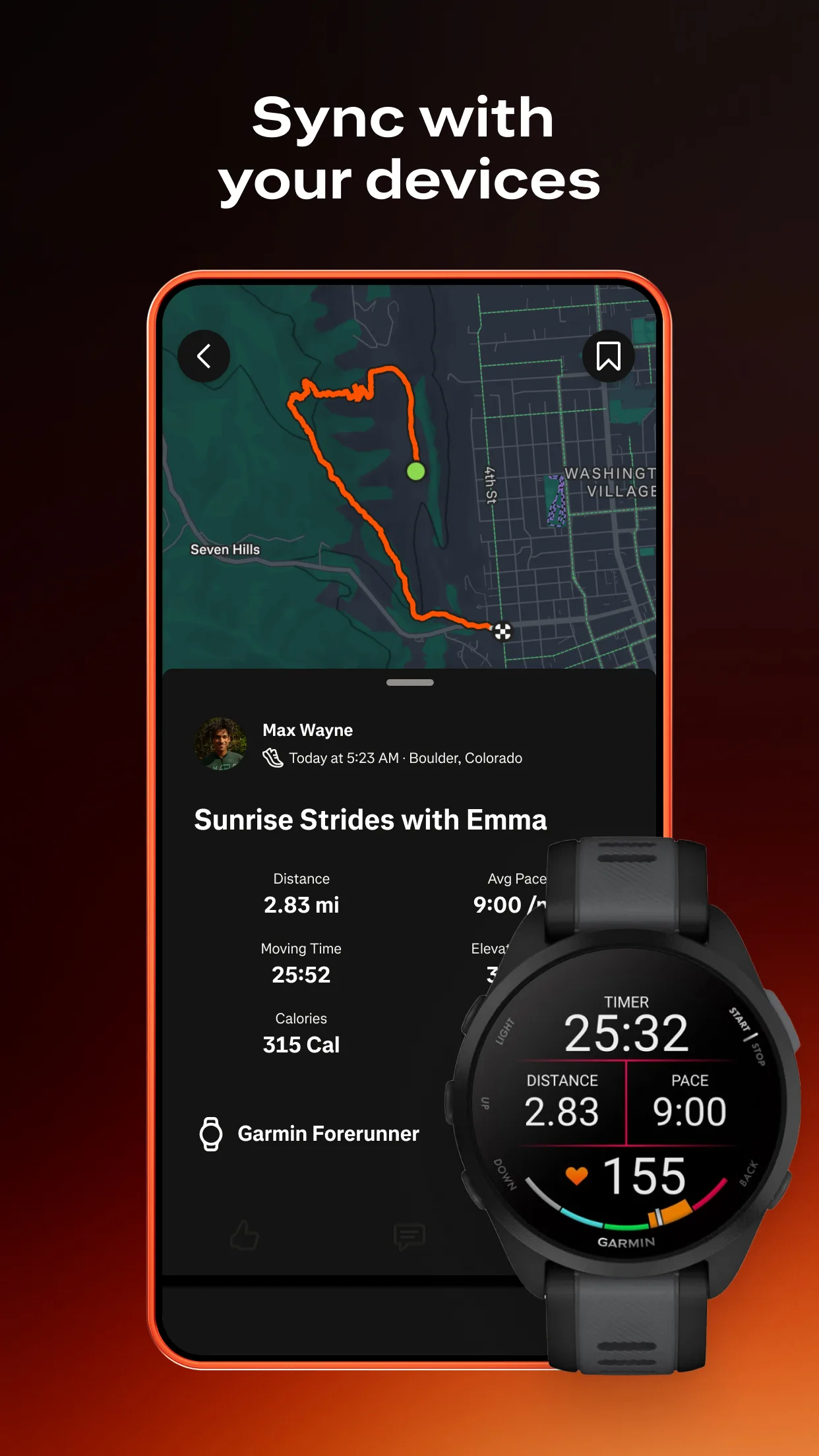
Performance Tracking That Goes Beyond GPS Distance
Trail running performance is measured differently from road running. Vertical kilometer - climbing 1,000 meters in the shortest horizontal distance - is a standard training benchmark. Vert.run tracks it directly. Strava's segments on named climbs function as informal KOM challenges on popular trails. For runners building toward a trail race with specific elevation requirements, tracking weekly vert alongside distance gives a more accurate load picture than distance-only metrics.


Navigation That Functions Without Cellular Signal
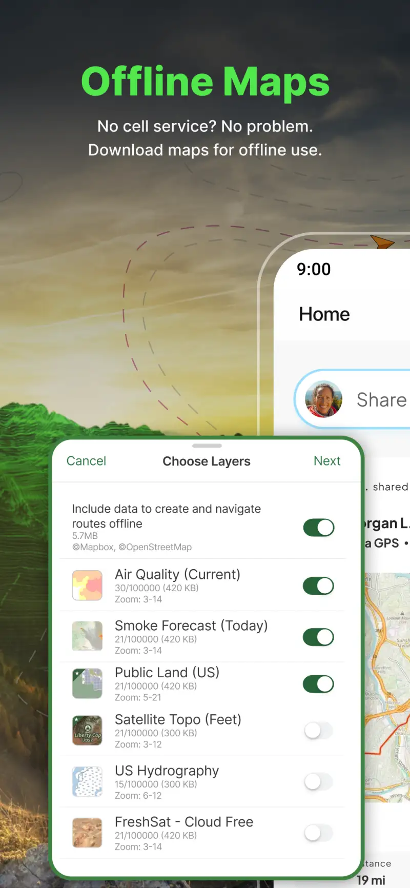
Technical mountain trail routes frequently pass through areas with no cellular coverage, particularly on ridgelines, in deep valleys, and on high mountain routes away from population centers. A trail runner who stops to navigate on a steep technical descent needs offline map capability and reliable GPS positioning that functions without signal. Both Gaia GPS and AllTrails Plus provide offline maps; the difference is in topographic detail depth, which matters for mountain runners in ways it does not for runners on well-signed park trails.
AllTrails - Best Trail Discovery for Runners


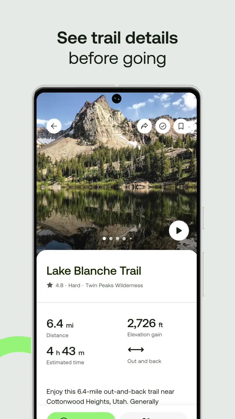
AllTrails is the starting point for trail runners who need to find new routes in unfamiliar areas. The 450,000+ trail database with elevation profiles, surface notes, user photos, and recent condition reports provides more pre-run intelligence than any other platform. The trail-running filter within the app identifies routes specifically logged and reviewed by runners rather than hikers, giving pace-appropriate difficulty context. Running-specific community reviews note technical singletrack quality, descent runnability, and whether the trail surface is fast or technical in a way that general hiking reviews typically do not.
The AllTrails Plus offline maps and wrong-turn alerts serve trail runners on routes where navigation decisions happen at running pace - a junction missed at 8 minutes per kilometer requires backtracking a meaningful distance before the error is recognized. Wrong-turn alerts reduce this specific error type significantly in testing on multi-junction trail networks.
What AllTrails does well
- 450,000+ trail database with runner-specific filters: trail running mode shows routes logged by runners with pace-relevant difficulty context; community photos show terrain quality at running pace rather than hiking pace
- Elevation profiles before departure: assess vertical gain distribution across the run; identify whether the climbing is concentrated in one section or distributed; plan effort accordingly
- Offline maps with wrong-turn alerts (Plus): navigation without signal on remote mountain routes; alerts at junctions reduce backtracking errors during runs where attention is partially on footing
- Recent condition reports: trail surface conditions after rain, snow, or heavy use affect running footing significantly; community reports from recent days are more reliable than official trail status pages
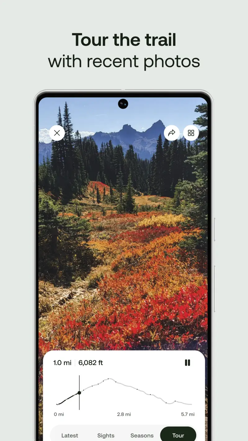
- 3D trail preview for visualizing technical sections before attempting them at running pace
- Live location sharing for safety on long solo mountain runs
Where AllTrails falls short
Battery drain in AllTrails navigation mode is consistently severe according to 2025-2026 reviews - a problem for trail runners doing 3-4+ hour mountain routes who depend on their phone for both navigation and emergency communication. The topographic detail is insufficient for serious off-trail mountain navigation; trail runners who venture beyond established trail networks need Gaia GPS for technical terrain assessment. Offline maps require Plus at $35.99 per year - the standard hiking paywall criticism applies equally to trail running use.
Pricing: Free (discovery, signal-dependent navigation) / $35.99/year Plus (offline maps, wrong-turn alerts)
Subscribe to AllTrails Plus at $35.99 per year and use it as your primary trail discovery and route research tool. Download offline maps before every mountain run where cellular coverage is uncertain. Pair with Strava for the performance tracking layer that AllTrails does not provide.
Strava - Best Performance Tracking and Trail Discovery
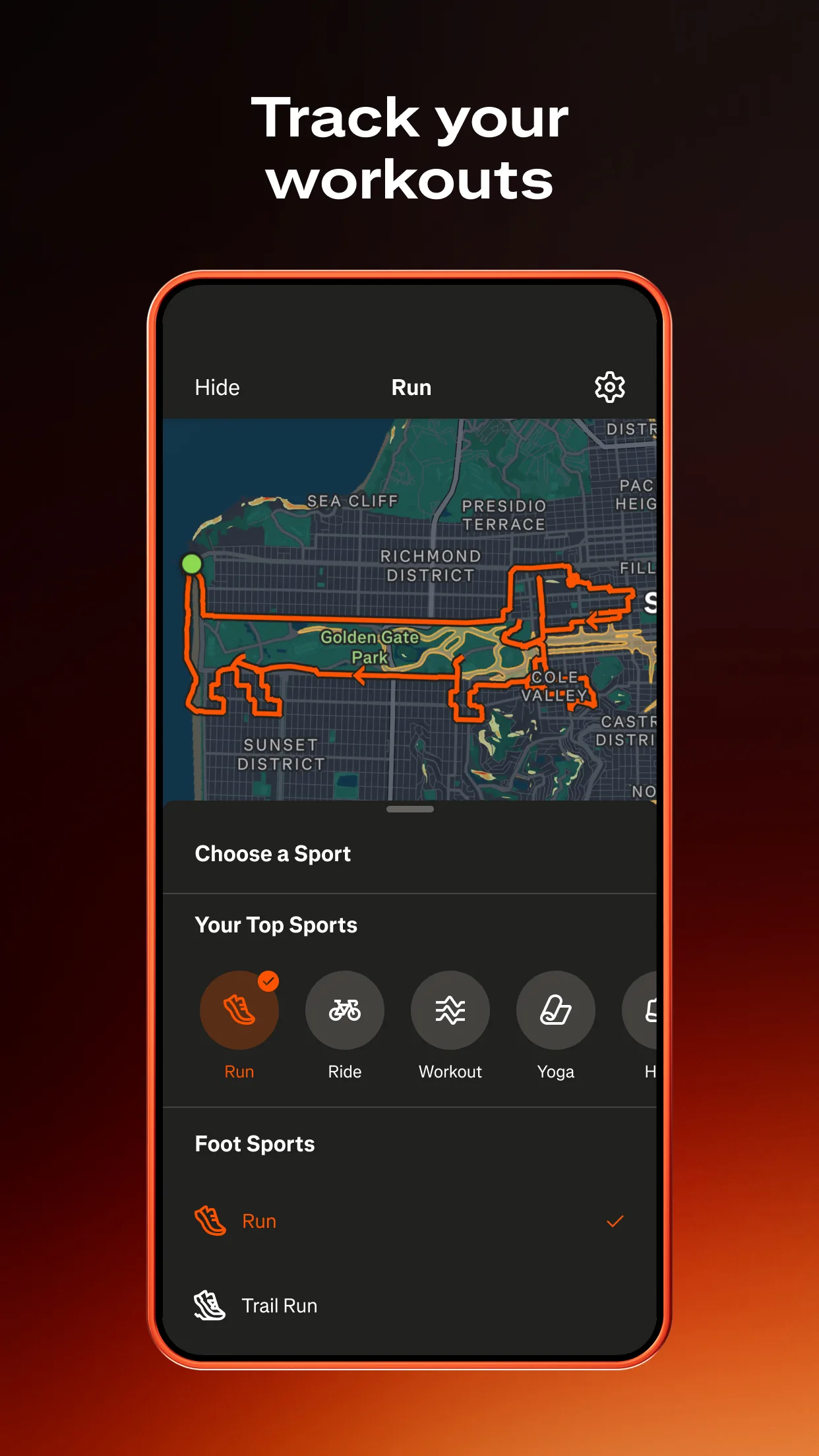
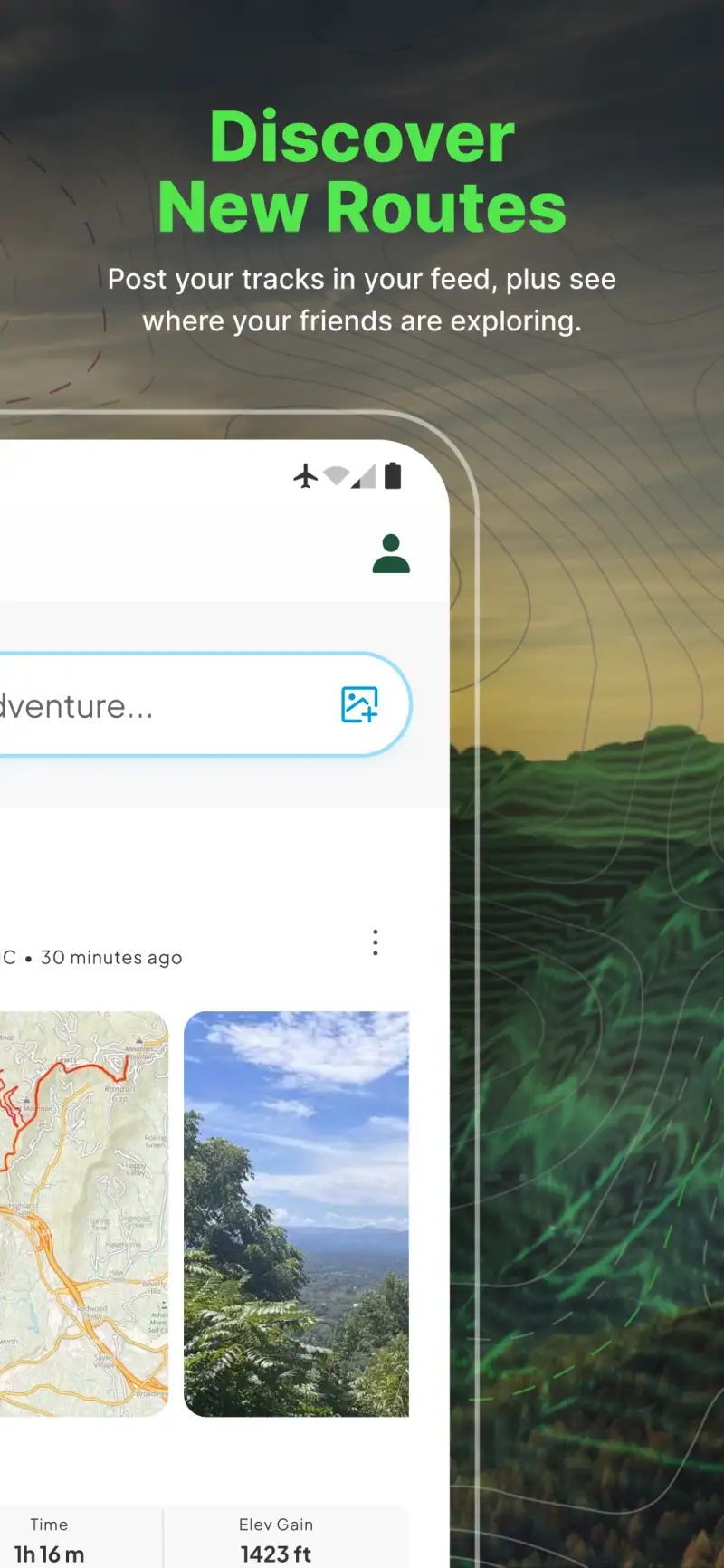
However, AllTrails' community is built around hikers, and the trail running intelligence Strava provides - KOM segments on specific climbs, heatmap data showing where local runners actually go, and performance metrics calibrated to trail running pace - is more relevant to runners than AllTrails' hiking-centric review system. Strava's heatmap reveals local singletrack networks in any region that do not appear in official trail databases, which is the fastest way to find quality running trails in an unfamiliar area.
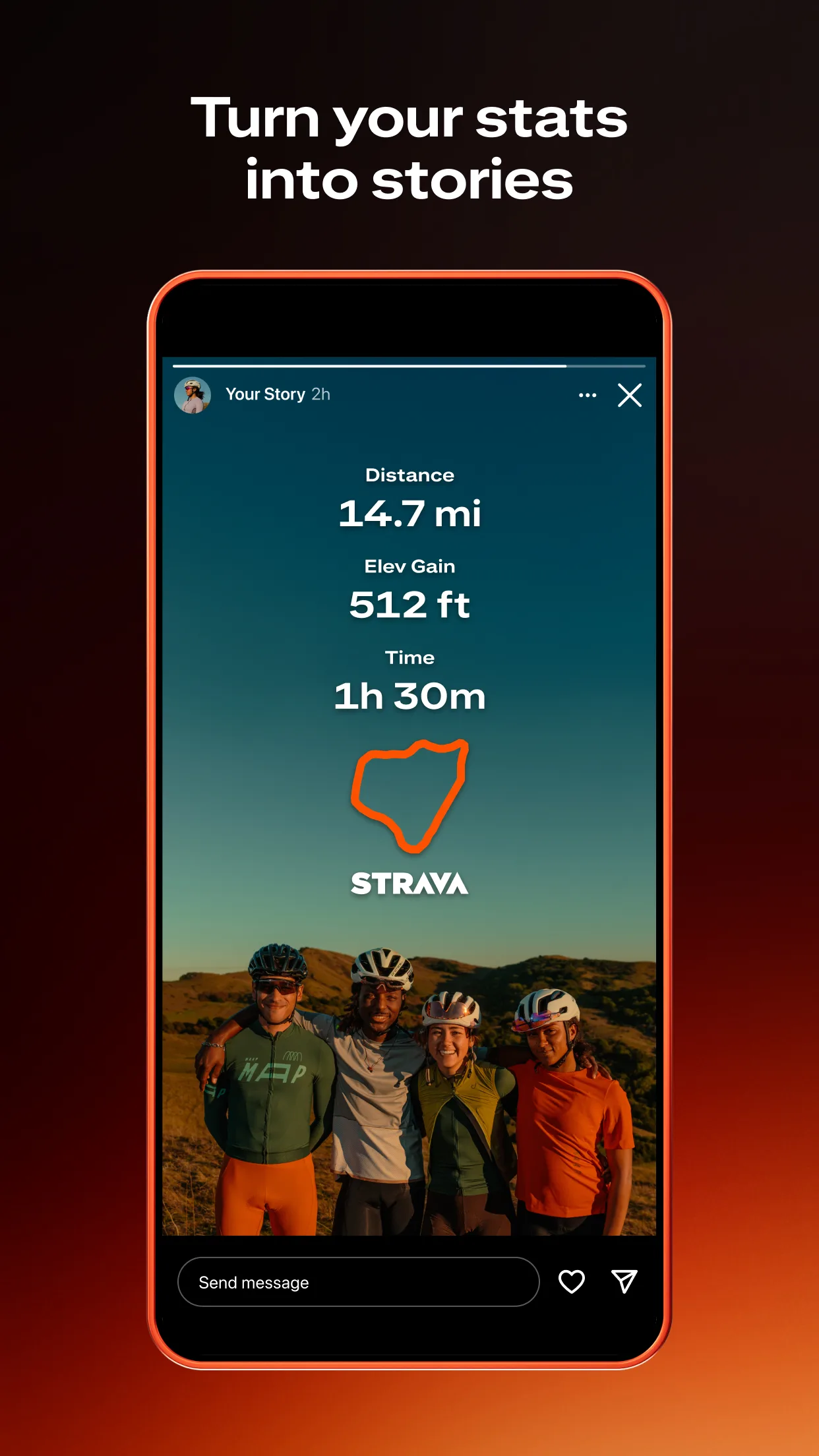
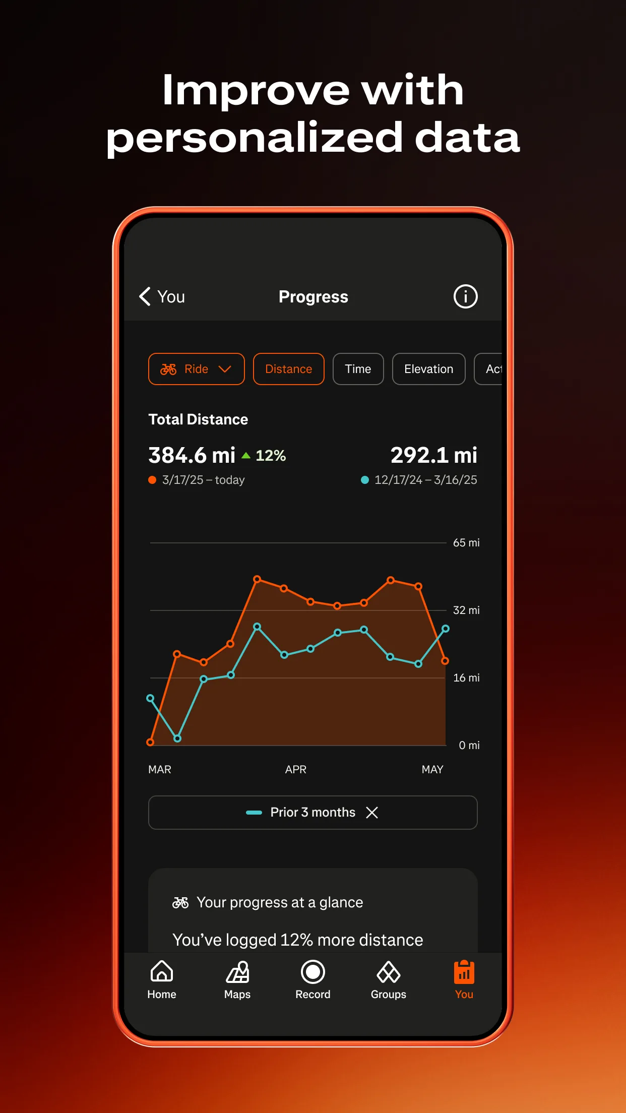
Segments on popular trail running climbs and descents function as informal benchmarks between races. A local mountain segment with an established leaderboard gives trail runners a regular, accessible performance test without race entry logistics. Live Segments on Strava Premium compare your current pace against your personal record in real time on compatible Garmin devices, transforming a familiar training climb into a spontaneous performance test.
What Strava does well
- Heatmap routing: shows where runners actually go in any region; reveals local singletrack networks, MTB trail networks open to running, and popular mountain routes that do not appear in official databases
- Segments on trail climbs and descents: KOM challenges on established trail running climbs; personal record tracking from the first attempt; leaderboards filterable by age group
- 195 million users: active trail running clubs in virtually every region; group runs organized through the club system without formal race entry
- Live Segments (Premium): real-time PR comparison on compatible Garmin devices; changes how familiar training climbs feel when the timer is visible
- Heart rate zone analysis and training load (Premium): running-specific performance metrics that AllTrails does not track
- Sync from Garmin, Wahoo, COROS, Polar, and Apple Watch for automatic activity upload
Where Strava falls short
Strava is a social tracking and performance tool, not a navigation app. It has no offline map capability, no turn-by-turn navigation, and no surface-aware routing. Trail runners who need navigation on unfamiliar routes cannot rely on Strava alone. The Premium tier at $79.99 per year is required for Live Segments and filtered leaderboards - the free tier covers the heatmap and segment tracking that most trail runners need, making Premium optional rather than essential for many use cases.
Pricing: Free (heatmap, segments, tracking) / $79.99/year Premium (Live Segments, filtered leaderboards, training analytics)
Install Strava free and use the heatmap to discover local trail running networks before your next session in a new area. Add Premium when Live Segments on familiar training climbs become relevant to your performance benchmarking routine.
Gaia GPS - Best for Technical Mountain Routes

Building on trail discovery and performance tracking, Gaia GPS addresses the navigation layer for trail runners who venture into genuinely technical mountain terrain. The USGS 1:24,000 topographic maps with offline capability cover mountain trail networks that often lack reliable cellular coverage, and the slope angle shading provides terrain assessment that matters when a mountain trail run crosses into genuinely complex terrain.
For trail runners whose routes overlap with backcountry terrain - alpine ridge traverses, summer snowfield crossings, routes through unmarked mountain terrain - Gaia GPS provides the topographic detail that AllTrails' general maps do not. The 50+ map layers including satellite imagery and slope angle shading serve runners assessing technical descent lines before committing at running pace.
What Gaia GPS does well
- USGS 1:24,000 topo for mountain trail running: accurate contour mapping for alpine routes, ridge traverses, and technical terrain; more precise than AllTrails' general topographic display
- Offline topo maps: full topographic coverage without signal; essential for mountain trail running at high altitude where cellular networks do not reach
- Waypoint marking for route-finding checkpoints on complex mountain routes
- Slope angle shading for assessing technical sections before attempting them at running pace
Where Gaia GPS falls short
Gaia GPS has no trail running-specific features, no performance tracking, no segments, and no community reviews. It is a navigation tool that trail runners use for the navigation layer specifically, not as a running performance platform. The steep learning curve and complex interface are particularly limiting for runners who want fast access to navigation during active sessions.
Pricing: $89.99/year Outside+ bundle
Subscribe to Gaia GPS when your trail running regularly takes you into technical mountain terrain beyond reliable cellular coverage. Use it specifically for the navigation layer; keep AllTrails and Strava for trail discovery and performance tracking.
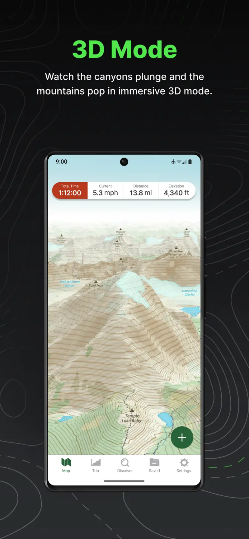
Komoot - Best for Trail Running Route Creation
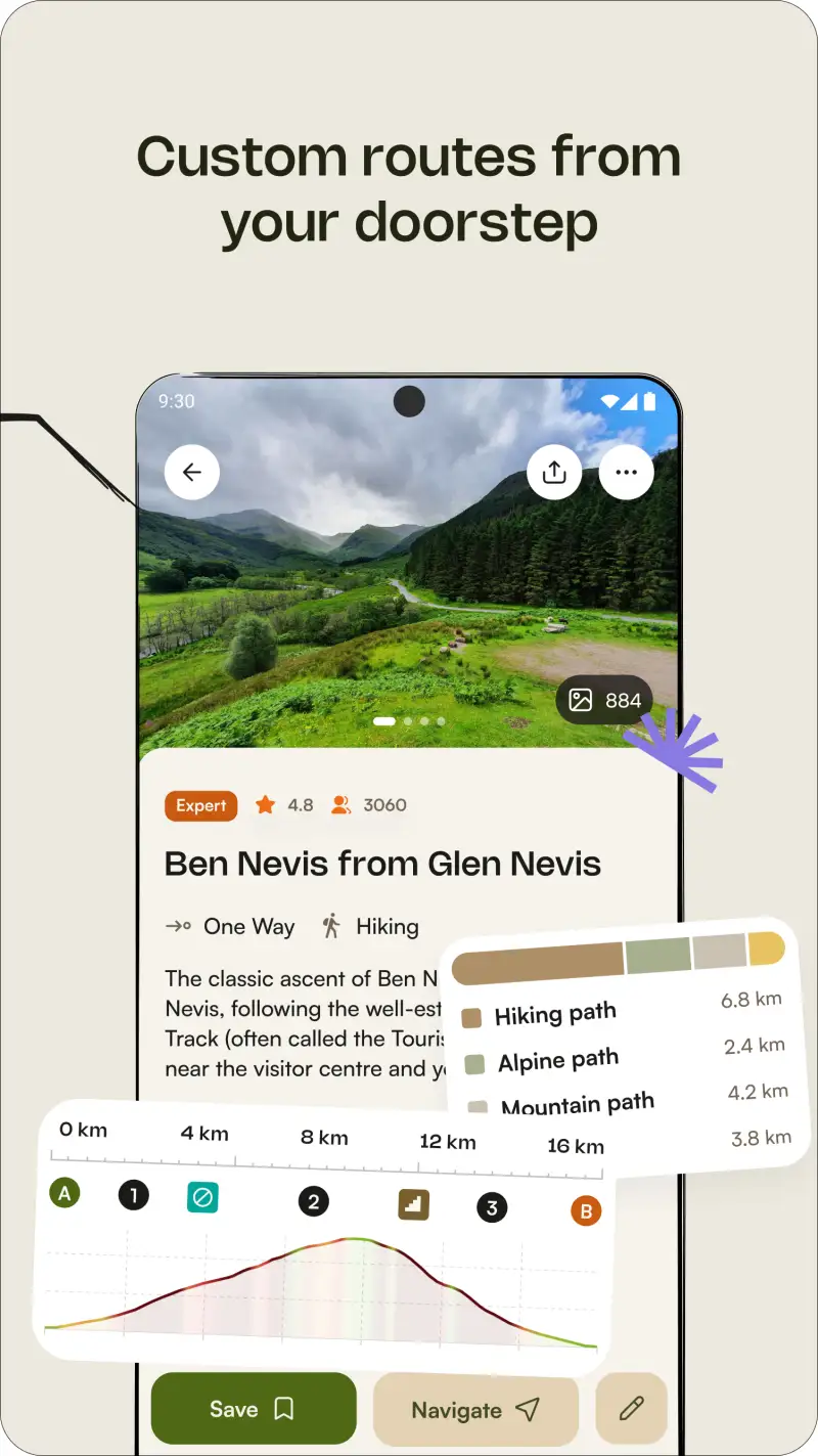
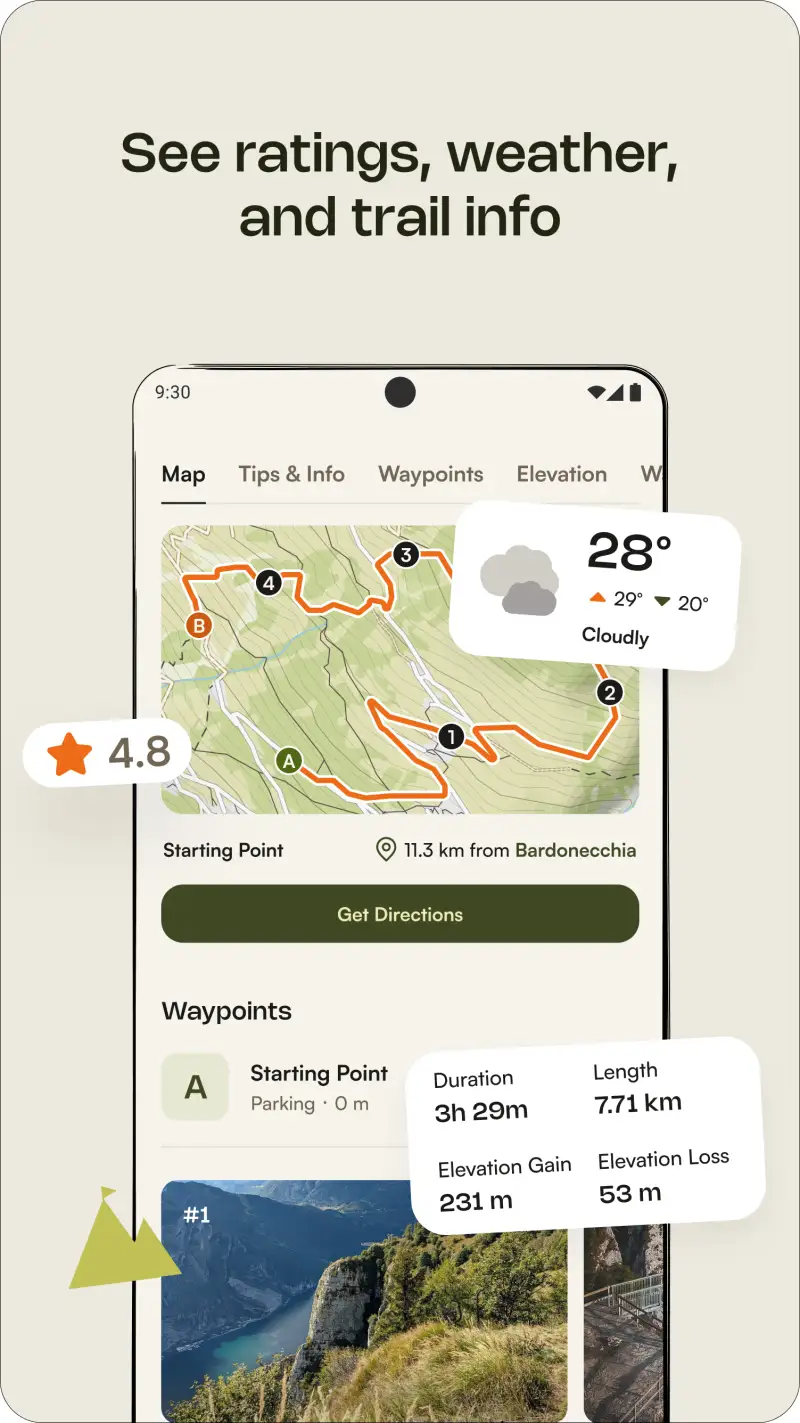
Unlike the discovery and navigation tools above, Komoot solves a specific problem for trail runners who want to create new routes from a start point rather than finding existing logged routes. The trail running routing mode generates sport-specific paths that optimize for runnable trail terrain, avoiding road cycling routes and mountain hiking-specific terrain in favor of singletrack and mixed-surface paths appropriate for running pace.
The elevation profile with gradient percentage per segment allows precise pre-run assessment of how demanding a created route will be at trail running pace. Surface breakdown showing singletrack, doubletrack, dirt road, and pavement helps runners planning training routes that match the specific terrain of their target race.
What Komoot does well
- Trail running routing mode: generates sport-specific routes optimizing for runnable trail terrain; avoids vehicle roads and hiking-specific technical terrain
- Elevation profiles with gradient breakdown: see every climb, descent, and surface transition before departing; plan effort appropriately for each section
- Turn-by-turn voice navigation on trails, reliable in testing across varied terrain
- 40 million+ community routes including trail running-specific routes with vert data
- Offline maps for created routes without cellular coverage
Where Komoot falls short
Komoot's trail database is considerably less comprehensive than AllTrails in North America; trail runners in the US will find more community route discovery on AllTrails. The 2025 move to charge for Garmin and Wahoo device sync behind Premium (~€59.99/yr) frustrated users who previously synced free. No performance tracking, no segments, no training analytics.

Pricing: Free (one local region) / ~€59.99/year Premium
Use Komoot free for creating trail running routes within your local region. Add the worldwide regions or Premium when you travel to new areas, specifically for the trail running routing mode that creates appropriate routes without requiring pre-existing trail data.
Which App Fits Your Trail Running Setup
| App | Price | Best For | Offline Maps |
|---|---|---|---|
| AllTrails | Free / $35.99/yr Plus | Trail discovery, community conditions | Plus only |
| Strava | Free / $79.99/yr | Performance tracking, heatmap, segments | No |
| Gaia GPS | $89.99/yr Outside+ | Technical mountain navigation | Yes |
| Komoot | Free / ~€59.99/yr | Route creation, turn-by-turn | Yes |
Standard trail running stack
Subscribe to AllTrails Plus for offline trail navigation and route discovery. Install Strava free for performance tracking, heatmap discovery, and segment competition. This combination covers both pre-run route planning and post-run performance review at $35.99 per year total.
Mountain trail running with technical terrain
Add Gaia GPS to the AllTrails Plus and Strava stack. Download topo maps for your mountain training area before each session. Use Gaia GPS for off-trail sections and technical terrain; switch to AllTrails for established trail navigation.
Route creation for specific training terrain
Download Komoot free and use the trail running routing mode to create routes that match your target race's terrain profile. Pair with AllTrails Plus for trail condition research and Strava for performance tracking after each session.
Building toward a trail ultra
Subscribe to AllTrails Plus and Strava Premium. Use AllTrails for route planning and condition research on long training runs. Use Strava's Live Segments for benchmark testing on key climbs in your training area. Add Gaia GPS when your training routes regularly cross into technical mountain terrain beyond reliable cellular coverage.