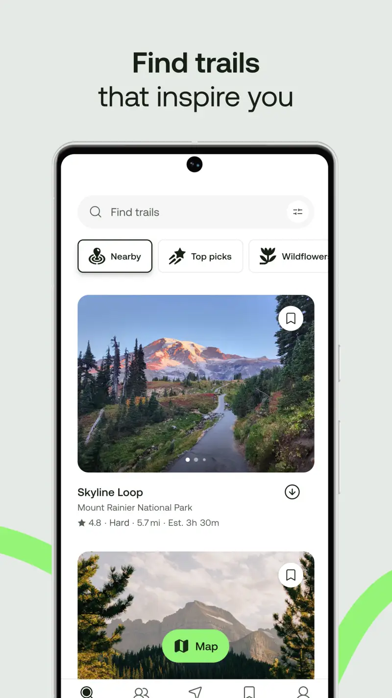
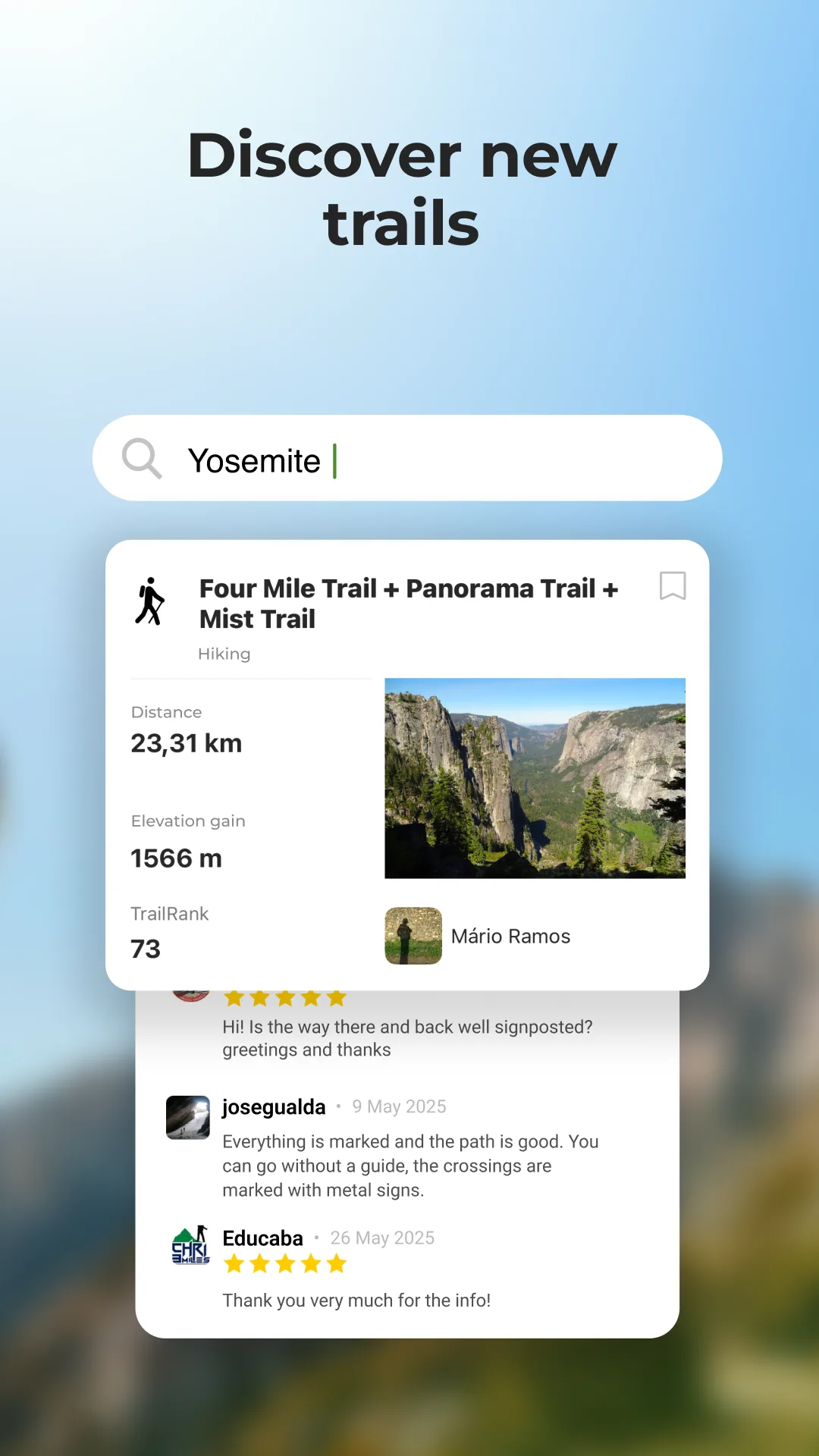
International hiking creates a coverage problem that apps optimized for North American trails solve poorly. AllTrails has 450,000+ trails, but its density drops sharply outside the US, UK, and Australia - a hiker in Slovenia, Patagonia, or rural Japan often finds sparse data where Komoot or Wikiloc has dense community coverage. Komoot's European trail database is arguably better than AllTrails' for the Alps, Pyrenees, Dolomites, and Scandinavian fjords; Wikiloc has 76 million community trails with particularly strong representation in Spain, Portugal, Brazil, and Central Europe; Organic Maps is completely free with full offline capability based on OpenStreetMap data that often covers established hiking paths in well-mapped countries before commercial apps do.

After testing 7 hiking apps on Pixel 8 and Samsung Galaxy S24 running Android 15, specifically across international and travel hiking use cases in 2025-2026, I found four that serve travel hikers across the full range from European touring to global adventure travel.
Who this is for: Hikers who travel internationally and hike in destinations outside their home country, from weekend trips to European hiking destinations to extended adventure travel in less-documented regions. If you hike primarily in North America on established trails, the casual hiking guide or backpacking guide covers your home-country needs more specifically.
What International Hikers Need That Domestic Apps Miss
Travel hiking creates three gaps that apps built around their home-market coverage cannot fill.
Trail Data in Non-English-Speaking and Less-Documented Regions
AllTrails was built primarily around North American and English-language trail data. A hiker visiting the Alentejo region of Portugal, the Julian Alps in Slovenia, or backcountry trails in Hokkaido, Japan, often finds either no AllTrails data or sparse community reviews from years ago. Wikiloc was founded in Barcelona and has historically strong Iberian and Latin American community coverage. Komoot's OpenStreetMap-based routing covers European footpaths, including many that never appear in AllTrails' database, because European hiking organizations like Britain's Ordnance Survey and Germany's DAV (German Alpine Club) have mapped trail networks that feed into OpenStreetMap before commercial app databases.
Language-Independent Navigation
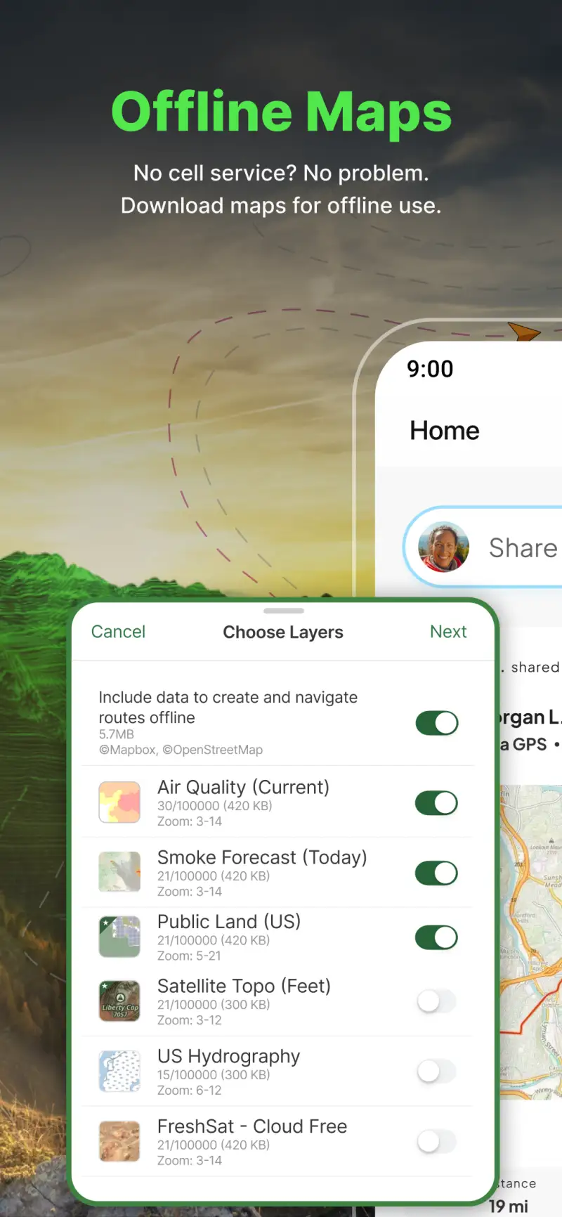
Offline navigation that functions without a data connection is always important. For international travelers, it is even more so: SIM card coverage gaps are frequent in rural hiking regions, roaming data costs are unpredictable, and navigating an unfamiliar trail in a country where you do not speak the language creates disorientation risk if digital navigation fails. Organic Maps downloads complete offline maps for any country at no cost; Gaia GPS downloads 50+ layer maps for any global region; both maintain full GPS positioning and route tracking without any data connection.
International Data Coverage Without Per-Country Costs
Some apps charge per region or require specific map pack purchases for international travel. Gaia GPS's Outside+ subscription provides global map access at $89.99 per year regardless of how many countries you visit. Komoot's worldwide regions purchase at approximately €59.99 provides permanent global access. Organic Maps is simply free everywhere. Wikiloc's free tier provides trail access globally without any geographic restriction. For hikers who visit multiple international destinations per year, all-in or zero-cost global access is more economical than per-destination purchase models.
Komoot - Best for European and Multi-Sport International Hiking
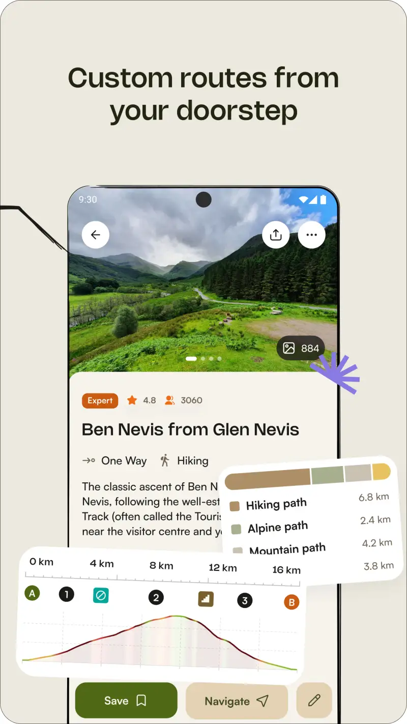
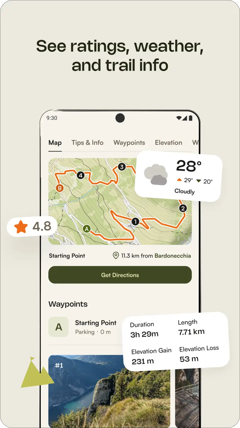
Komoot is the strongest hiking app specifically for European destinations, and the gap between its European coverage quality and AllTrails' is substantial. For hiking in the Alps (Austria, Switzerland, Germany, France, Italy's Dolomites), the Pyrenees, Scottish Highlands, Norwegian fjords, Slovenian Alps, or Scandinavian forests, Komoot's OpenStreetMap-based trail database combined with community routes covers paths that AllTrails leaves unmapped. Turn-by-turn voice navigation on European footpaths works reliably in testing across routes that AllTrails navigation handles less cleanly.
The sport-specific routing engine generates hiking-appropriate routes in European terrain that adapt to the surface and difficulty characteristics of the specific region. For multi-sport travelers who also cycle or trail run internationally, Komoot's single worldwide purchase covers route planning for all three activities rather than requiring separate app subscriptions for each discipline.
What Komoot does well
- European trail coverage: stronger than AllTrails for Alps, Pyrenees, Dolomites, Scottish Highlands, Scandinavia, and Central Europe; many established European footpaths mapped in Komoot before appearing in AllTrails' database
- OpenStreetMap-based routing: trail data updated globally through the OpenStreetMap community; frequent additions as hiking organizations and local contributors map new routes
- Turn-by-turn voice navigation: reliable in testing on European hiking paths, including numbered walking trails and waymarked long-distance routes
- Multi-sport routing: single worldwide purchase covers hiking, cycling, gravel, trail running; valuable for travelers who combine activities on international trips
- 40 million+ community routes with elevation profiles and surface breakdown
- Offline maps for any downloaded region; available in the one local region free and the worldwide purchase
Where Komoot falls short
The 2025 decision to move Garmin and Wahoo device sync behind Premium at approximately €59.99 per year generated significant backlash from users who previously synced free - worth noting for international hikers who carry Garmin devices. Komoot's coverage in Latin America, Southeast Asia, Africa, and remote global destinations is weaker than Wikiloc's community-driven trail database in those regions. The Bending Spoons acquisition in 2023 has created community anxiety about future changes, though no major degradation has been documented through April 2026.

Pricing: Free (one local region, offline maps) / ~€59.99/year Premium (worldwide regions, device sync, multi-day planning)
Purchase Komoot Premium worldwide regions at approximately €59.99 per year if you hike internationally across multiple European destinations. The coverage quality in the Alps and Pyrenees alone typically justifies the cost for hikers who visit those regions regularly.
Wikiloc - Best for Global Coverage and Non-European Regions

However, Komoot's European focus means that international hikers traveling outside Europe benefit more from Wikiloc's genuinely global community contribution model. The 76 million trails in Wikiloc's database include strong representation in Spain and Portugal (Wikiloc's home market), Brazil, Mexico, Argentina, and across Southeast Asia and Eastern Europe - regions where AllTrails has limited data and Komoot's OpenStreetMap base is less dense. For a hiker visiting the Azores, the Madeira levada trails, or backcountry routes in Thailand, Wikiloc typically has community-contributed GPS tracks where the alternatives provide nothing.
The free offline maps differentiate Wikiloc sharply from AllTrails for international travel. Downloading offline maps for a Portuguese hiking region costs nothing on Wikiloc and $35.99 per year on AllTrails - a meaningful cost difference for occasional international travelers.
What Wikiloc does well
- 76 million community trails: strongest global database outside North America, particularly in Iberian Peninsula, Latin America, Eastern Europe, and Southeast Asia
- Free offline map downloads: no subscription required to download trail maps for any destination; the core offline capability that AllTrails charges for is free from day one
- AR peak identification: augmented reality mountain identification by pointing camera at peaks; genuinely useful in unfamiliar mountain terrain for orientation
- Device sync to Garmin, Suunto, Apple Watch, and COROS for automatic activity upload
- Live tracking for sharing location with family or emergency contacts during solo international hikes
- 14-day free trial on Premium; most features accessible in the free tier for typical day hiking use
Where Wikiloc falls short
Trail quality control varies substantially across the 76 million community contributions. Data uploaded years ago in remote regions may be inaccurate, and there is no systematic editorial review. Trail descriptions are often sparse - many entries are GPS tracks only without elevation notes, surface information, or condition updates. Navigation quality is less refined than Komoot or AllTrails; the interface prioritizes trail breadth over navigation polish.
Pricing: Free (full trail access, free offline maps) / ~$29.99/year Premium
Download Wikiloc free before any international hiking destination and search for community-contributed trails in the specific region. The free offline maps alone justify the download; for most international day hiking use cases, the free tier is sufficient.
Gaia GPS - Best for Remote and Technical International Terrain
Building on the community trail databases, Gaia GPS addresses the navigation requirement for international hikers who venture into genuinely remote or technically complex terrain - Patagonian peaks, Himalayan approaches, African plateau routes - where community trail databases provide no coverage and where accurate topographic navigation determines safety. The 50+ map layers include international satellite imagery updated weekly, and the offline topo capability functions globally rather than being limited to US-format USGS maps.
For travel hikers combining international hiking with technical terrain assessment, Gaia GPS's slope angle shading provides avalanche risk and steep terrain awareness in mountain regions globally. The T-Mobile direct-to-cell satellite support added in 2026 extends connectivity in areas beyond terrestrial networks in supported regions.
What Gaia GPS does well
- Global offline topo maps: USGS-format and equivalent international topographic data available for any region; download any country's topo coverage before departure
- 50+ map layers globally: satellite imagery, slope angle shading, terrain analysis; applicable worldwide, not limited to US-specific map sources
- Professional-grade navigation: the same tool used by mountain guides, SAR teams, and expedition professionals globally; institutional adoption reflects capability depth
- Waypoint creation for route-finding in terrain without established trails
- Garmin inReach integration for satellite communication in genuinely remote international terrain
- T-Mobile direct-to-cell satellite support for connectivity beyond terrestrial networks
Where Gaia GPS falls short
Gaia GPS has no community trail reviews, no condition reports, and no trail discovery features - it is a navigation and mapping tool, not a trail database. The Outside Inc. acquisition has introduced sign-in bugs particularly problematic for hikers transitioning between cellular and offline environments. The $89.99 Outside+ bundle includes media content that international hikers typically do not need.
Pricing: $89.99/year Outside+ bundle
Subscribe to Gaia GPS when your international hiking includes genuinely remote terrain without established community trail data. Pair with Wikiloc or Komoot for the trail discovery and community layer in the same destinations.
Organic Maps - Best Free Privacy-First Global Navigation
Unlike the paid platforms above, Organic Maps provides completely free global offline navigation based on OpenStreetMap data, with no ads, no account required, no data collection, and no subscription. For international hikers on a budget or those who prioritize privacy, Organic Maps offers a legitimate zero-cost navigation layer for any destination where OpenStreetMap's trail data is adequate.
OpenStreetMap coverage is generally excellent in Western Europe, Japan, Australia, and developed urban areas globally - the same regions where hiking infrastructure tends to be well-maintained and mapped. Coverage is patchier in remote developing-world destinations, but for European and developed-country international hiking, Organic Maps frequently provides enough trail data for reliable navigation.
What Organic Maps does well
- Completely free, no subscription: download offline maps for any country at zero cost; no account required, no data collection, no ads
- Global OpenStreetMap coverage: trail data contributed by local communities worldwide; often maps European hiking paths before commercial apps receive the data
- Maximum battery efficiency: designed specifically to minimize battery consumption; the most battery-efficient navigation option in this guide
- No network connection required for any navigation function after offline maps are downloaded
- Simple, clean interface accessible without a learning curve
Where Organic Maps falls short
No community trail reviews, no condition reports, no difficulty ratings, no photos - Organic Maps is a navigation layer only, not a trail discovery platform. OpenStreetMap quality varies significantly by region; remote developing-world destinations may have incomplete or inaccurate trail data. The interface is more utilitarian than Komoot or AllTrails, with less hiking-specific functionality like elevation profiles and surface breakdown.
Pricing: Completely free, open source
Download Organic Maps before any international hiking trip as your free offline navigation backup. Use it alongside Wikiloc for trail discovery: Wikiloc for finding community-contributed routes, Organic Maps for free offline navigation. This combination provides genuinely capable international hiking support at zero cost.
Which App Fits Your International Hiking Setup
| App | Price | Best For | Offline Maps |
|---|---|---|---|
| Komoot | Free / ~€59.99/yr | European hiking, multi-sport | Yes |
| Wikiloc | Free / ~$29.99/yr | Global community trails, free offline | Yes (free) |
| Gaia GPS | $89.99/yr Outside+ | Remote technical terrain globally | Yes |
| Organic Maps | Free | Budget, privacy-first, global backup | Yes (free) |
European hiking trips
Purchase Komoot Premium worldwide at €59.99 per year for European route creation and turn-by-turn navigation. Download Wikiloc free for supplementary trail discovery in regions where Komoot has sparser community data. This combination covers the Alps, Pyrenees, Scandinavia, and Central Europe comprehensively.
Latin America, Southeast Asia, or non-European destinations
Download Wikiloc free for the community trail coverage in those regions. Add Gaia GPS if your routes include technically complex or remote terrain. Use Organic Maps as a free offline navigation backup for any destination.
Remote or technically complex international terrain
Subscribe to Gaia GPS for offline topo maps covering any global region. Pair with Wikiloc free for community trail discovery before departure. Download Organic Maps free as a second offline navigation layer in case of Gaia GPS issues.
Zero-budget international hiking
Download Wikiloc free and Organic Maps free. Use Wikiloc for community trail discovery and Organic Maps for free offline navigation in any destination. This combination provides offline capability globally at zero cost, covering most established international hiking destinations.