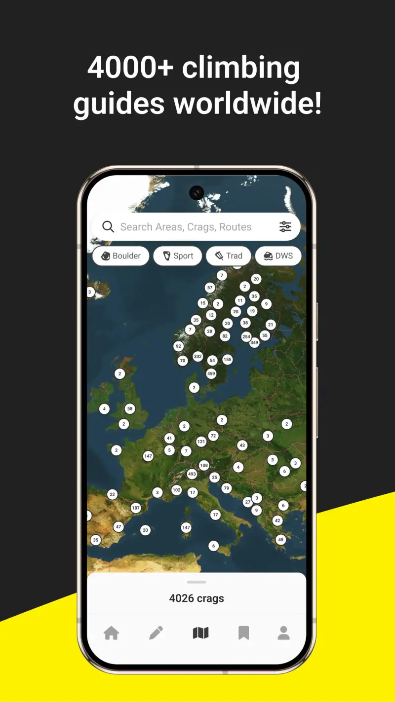
FarOut is the near-universal standard for AT, PCT, and CDT thru-hiking because it solves the problem that no general navigation app can replicate: a waypoint database of every water source, shelter, campsite, road crossing, and resupply town on the trail, with condition notes from hikers who passed through days ago. According to PCT hiker surveys from 2025, more than 90% of thru-hikers use FarOut as their primary trail guide. It covers 250+ long trails globally including the Te Araroa, Camino de Santiago, and GR20, with individual guides priced at $7.99 to $12.99 per trail. Gaia GPS provides the topographic layer for off-trail navigation and technical terrain that FarOut's waypoint-based system cannot address. Together they form the standard thru-hiking digital toolkit.

After testing 6 hiking apps on Pixel 8 and Samsung Galaxy S24 running Android 15, specifically across long-distance hiking use cases in 2025-2026, I found three that serve thru-hikers across the full range from trail navigation to emergency communication.
Who this is for: Hikers completing or preparing for multi-week or multi-month long-distance trails including the AT, PCT, CDT, Te Araroa, or comparable named trails worldwide. If you do primarily shorter backpacking trips rather than continuous thru-hikes, the backpacking guide covers your navigation needs more specifically.
What Thru-Hikers Need That Backpacking Apps Don't Provide
A thru-hike creates navigation and logistics requirements that differ from both day hiking and weekend backpacking in three specific ways.
Trail-Specific Waypoint Intelligence
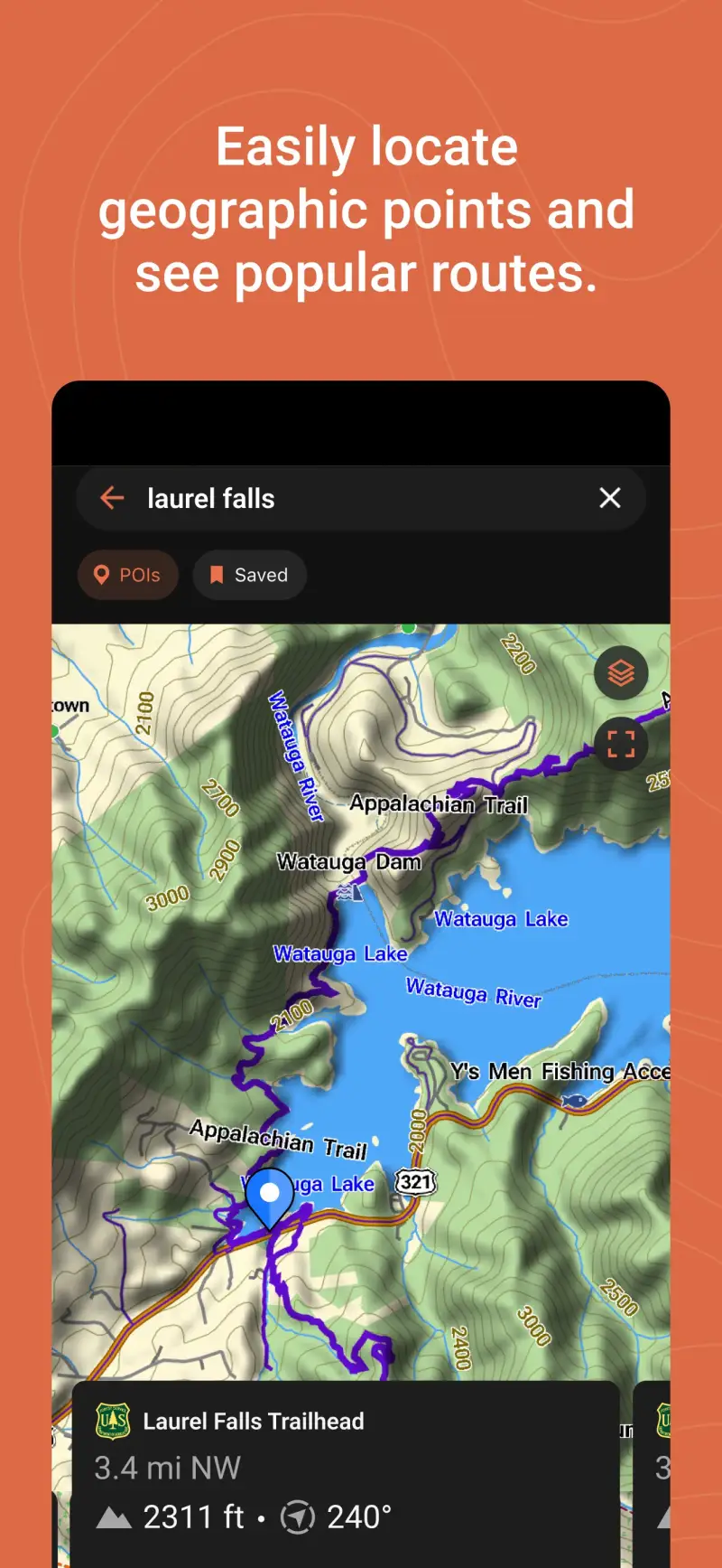
General navigation apps show where the trail goes. FarOut shows what exists along the trail: the exact GPS coordinates of every water source with current flow status, every shelter with its capacity and condition notes, every road crossing with hitching reputation and town services, every resupply option with store hours. This waypoint-layer intelligence is what allows thru-hikers to plan daily mileage based on water availability rather than arbitrary distance, choose campsites based on current condition reports, and make resupply decisions based on store hours reported by hikers who were there this week.
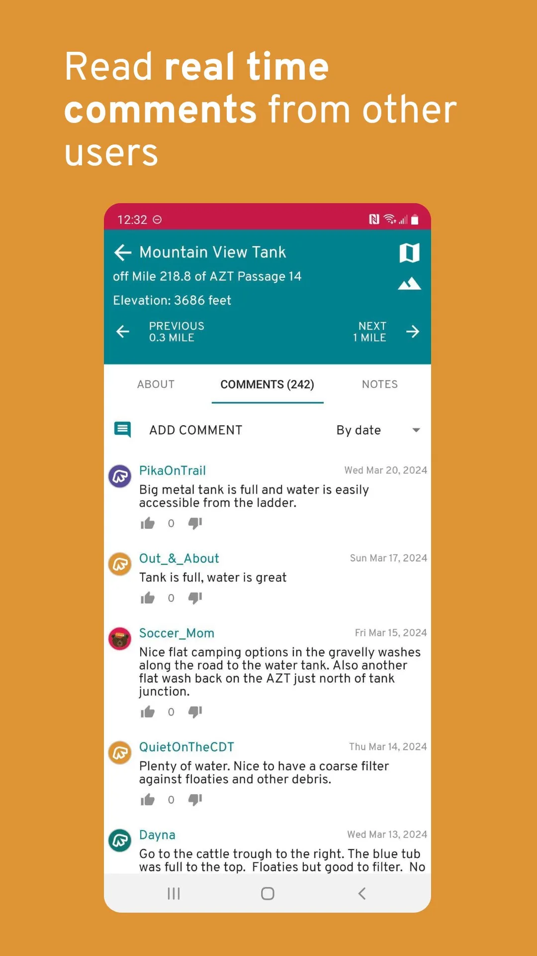
Real-Time Community Condition Updates
Trail conditions change faster than any app can officially update. A water source that shows as flowing in the guide may be dry in a drought year; a shelter that appears on the map may have burned down last season. FarOut's crowdsourced condition system allows hikers currently on trail to post notes on any waypoint - flowing, dry, crowded, closed, alternative source 0.3 miles south - that appear immediately for every subsequent hiker checking that waypoint. This real-time community layer makes the app more accurate the more people use it simultaneously during peak hiking season.
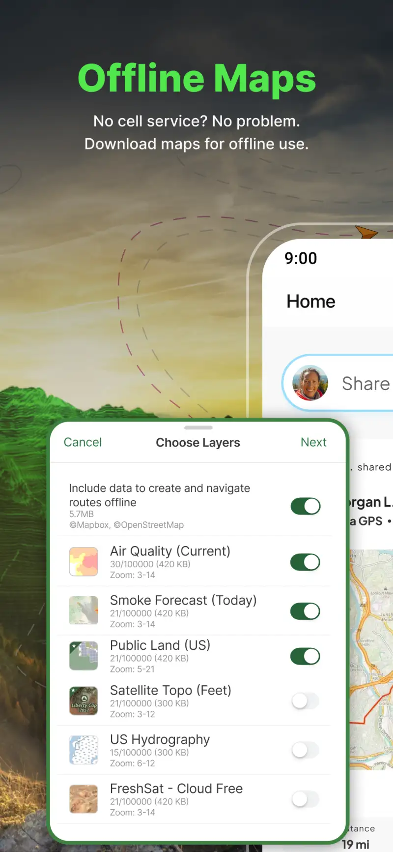
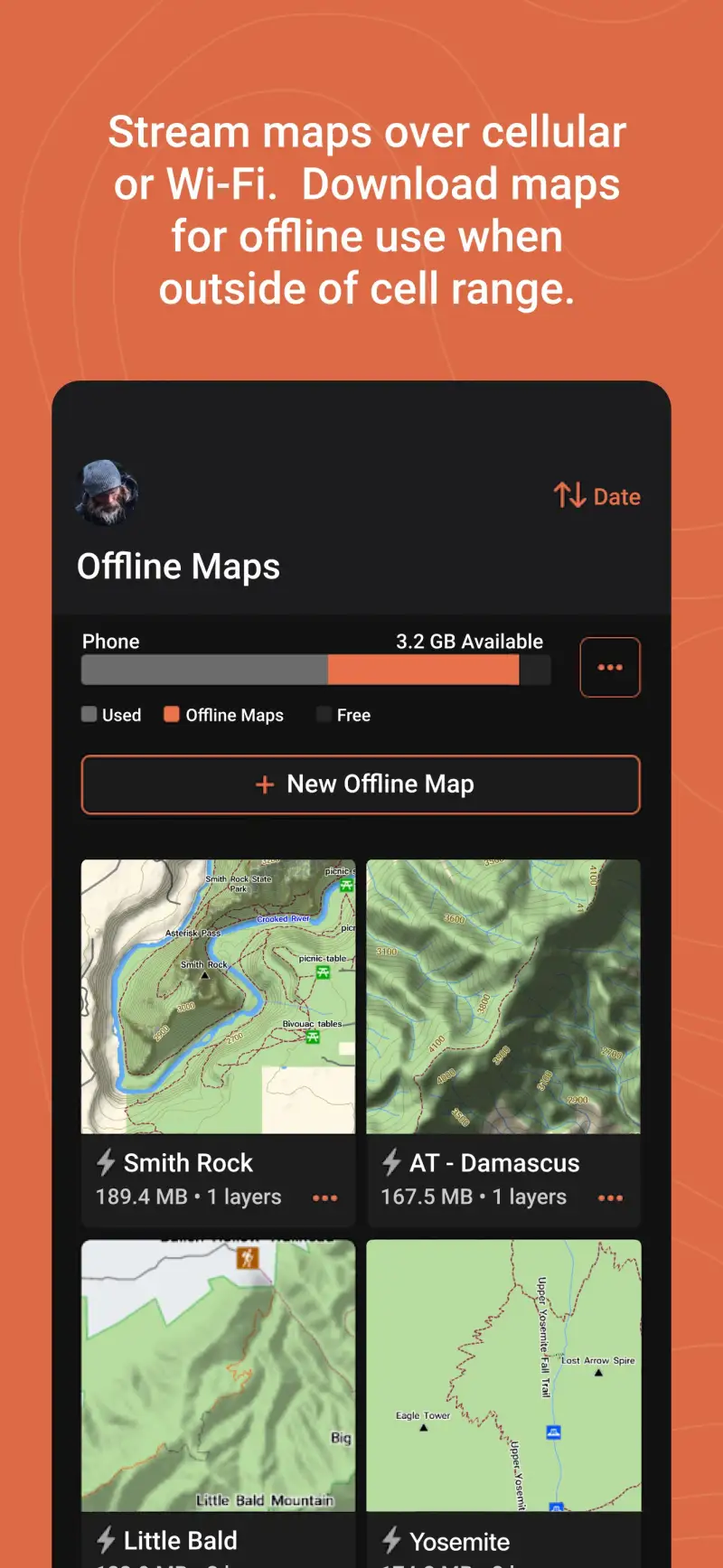
Battery-Efficient Offline Navigation for Weeks Without Charging
A thru-hiker may go 5-7 days between reliable charging opportunities, carrying a phone as the primary navigation device across that entire stretch. Apps with severe battery drain in navigation mode - AllTrails is consistently cited for this - create a genuine safety risk at this timescale. FarOut's offline-first design is optimized for minimum battery consumption. Gaia GPS in offline mode draws less power than map-streaming alternatives. Both apps need to be tested on offline operation specifically, not on the assumption that cellular data is available.


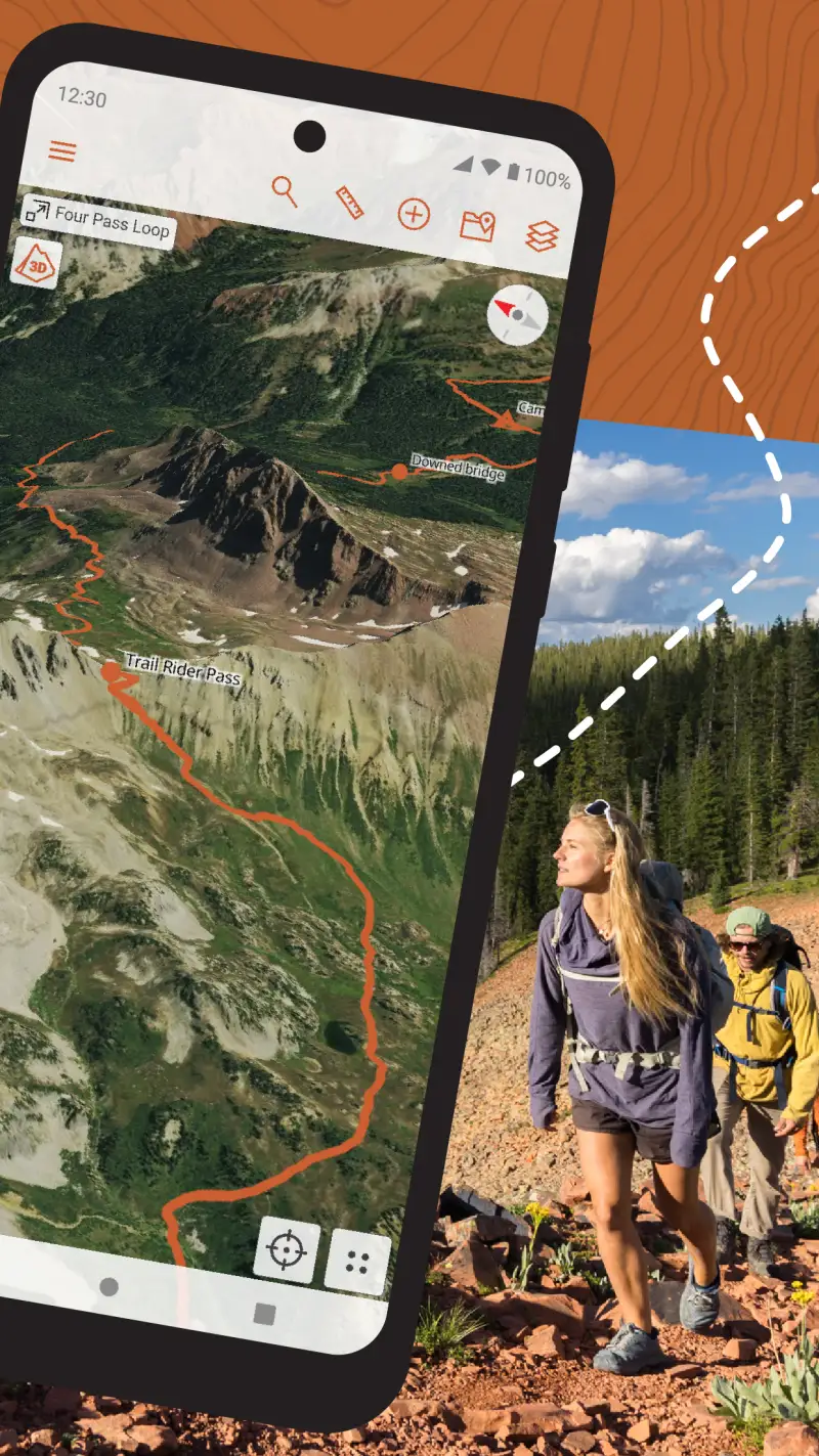
FarOut - Best Long-Trail Waypoint Guide

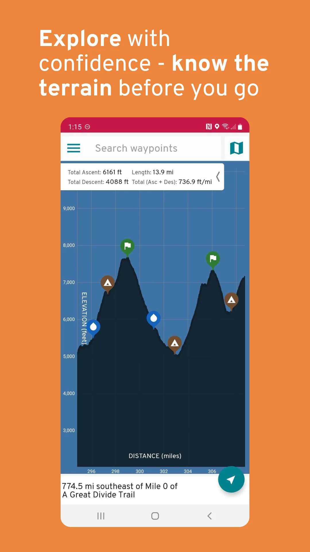
FarOut is not a navigation app in the Gaia GPS sense; it is a continuously updated trail guidebook with GPS coordinates attached to every piece of information it contains. The distinction matters. Where Gaia GPS shows you where the trail goes, FarOut tells you what to expect at the next water source, how far to the next shelter, what hikers who passed through 3 days ago said about the condition of the next road walk, and whether the resupply town 47 miles ahead has a post office that holds hiker boxes.
The 250+ trail guides cover the major North American long trails (AT, PCT, CDT, Florida Trail, Arizona Trail, John Muir Trail) alongside international routes (Te Araroa, Camino de Santiago, GR20, West Highland Way, and more). Individual guide prices are $7.99 to $12.99 per trail as one-time purchases; the FarOut Unlimited subscription at $96 per year covers all guides for hikers who plan multiple trails across a season or across years. The 2025 addition of FarOut Pass provides discount perks at trail towns, hostels, and resupply points for Unlimited subscribers.
What FarOut does well
- Trail-specific waypoint database: GPS coordinates for every water source, shelter, campsite, road crossing, resupply point, and point of interest on every covered trail; the information layer that makes day-by-day planning possible
- Crowdsourced condition notes: hikers currently on trail post condition updates on any waypoint, appearing immediately for subsequent users; flowing/dry water status, shelter crowding, trail hazards, and alternative information updated in near-real-time
- Full offline functionality: download the complete trail guide before departure; works with zero signal for the entire thru-hike once downloaded
- 250+ trail guides globally: AT, PCT, CDT, Te Araroa, Camino de Santiago, GR20, Arizona Trail, John Muir Trail, and more; the most comprehensive long-trail coverage available
- Daily mileage planning tools for mapping out camp-to-camp distance relative to water sources and shelters
- FarOut Pass (2025): discount perks at trail towns, hostels, and resupply points for Unlimited subscribers
Where FarOut falls short
FarOut is built specifically for established named trails with existing guidebooks. For off-trail travel, cross-country routes, or navigating through complex terrain beyond the trail corridor, FarOut provides no topographic capability - you need Gaia GPS for that. The per-trail guide model means hikers sampling multiple trails pay per guide unless subscribing to Unlimited at $96 per year. The topo detail within FarOut is secondary to waypoint data; serious terrain assessment requires Gaia GPS as a companion.
Pricing: $7.99-$12.99 per individual trail guide (one-time) / $12/month seasonal pass / $96/year FarOut Unlimited (all guides)
Download FarOut and purchase the guide for your specific trail before departure. Subscribe to Unlimited at $96 per year if you plan multiple trails. Download the complete guide while on WiFi before your start date - confirming full offline functionality is working before you reach the first remote section is essential preparation.
Gaia GPS - Best Topographic Supplement for Thru-Hikers


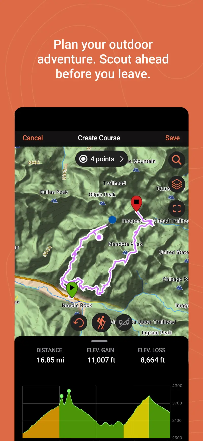
However, FarOut's waypoint focus means that the moment a thru-hike takes you off the established trail corridor - storm rerouting, emergency descent, fire closure alternative, or simply taking an off-trail shortcut - you need topographic navigation capability that FarOut cannot provide. Gaia GPS serves as the topographic supplement that most serious thru-hikers carry alongside FarOut, providing USGS 1:24,000 scale topo maps, satellite imagery, and slope angle shading for the terrain assessment that determines whether an alternative route is safe to attempt.
The FarOut and Gaia GPS integration is the standard thru-hiking digital toolkit: FarOut for trail intelligence and community conditions, Gaia GPS for topographic navigation when the trail becomes unclear or when a situation requires terrain assessment beyond the trail corridor. The two apps use separate interfaces but share no data between them - you run both and switch as needed.
What Gaia GPS does well
- USGS 1:24,000 topographic maps: highest available detail for technical terrain assessment; enables navigation through snow-covered trail sections, cross-country alternatives, and emergency routes
- 50+ map layers: satellite imagery, slope angle shading, public land boundaries, snow depth, wildfire data; provides terrain context that FarOut's waypoint-based system does not contain
- Offline operation for weeks: download regional topo maps before departure; the entire hike can run offline once maps are downloaded
- Garmin inReach integration for satellite messaging from within the Gaia interface
- T-Mobile direct-to-cell satellite support added in 2026 for areas beyond terrestrial coverage
- Waypoint creation for unmarked locations beyond FarOut's defined waypoint list
Where Gaia GPS falls short
Gaia GPS has no trail-specific community intelligence - no water source condition reports, no shelter occupancy notes, no resupply logistics. It is a topographic navigation tool, not a trail information system. The Outside Inc. acquisition introduced sign-in bugs that are particularly problematic for thru-hikers who may be offline for weeks at a time and then encounter authentication requirements when they reconnect in town. The $89.99 per year Outside+ bundle cost adds to an already significant thru-hiking digital budget when combined with FarOut.
Pricing: $89.99/year Outside+ bundle (includes Gaia Premium + Trailforks Pro)
Subscribe to Gaia GPS and download the topographic maps for every major section of your planned trail before departure. Practice offline operation on a familiar local hike before relying on it in a thru-hiking context where failure modes have higher consequences.
Garmin Explore - Best Satellite Communication Integration
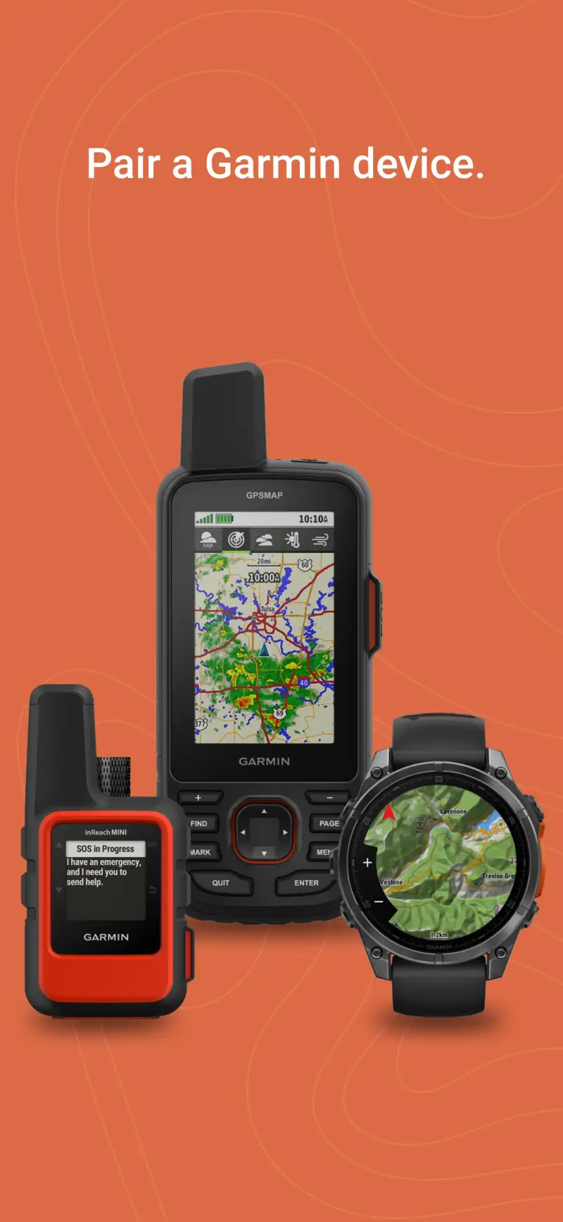
Unlike the trail navigation tools above, Garmin Explore solves a different problem for thru-hikers: maintaining safety communication with family, emergency contacts, and rescue services across the weeks and months when cellular coverage is entirely absent. Garmin inReach satellite communicators - the Mini 2, the Messenger, and the newer inReach Messenger Plus - pair with the Garmin Explore app to send and receive text messages, share live tracking, and trigger a 24/7 monitored SOS from anywhere on Earth with a view of the sky.
The two-way messaging through the Iridium satellite constellation means a thru-hiker can confirm they are safe each evening to family contacts who otherwise have no information for days between towns. The SOS function bypasses cellular networks entirely - triggering it connects directly to GEOS International Emergency Response, Garmin's 24/7 monitoring center, regardless of location.
What Garmin Explore does well
- Two-way satellite messaging: send and receive texts from anywhere with sky view via Iridium satellite constellation; no cellular coverage required
- Live tracking: share real-time GPS position with designated contacts on a tracking map they can view from a browser; standard safety protocol for thru-hiking families
- SOS function: 24/7 monitored emergency response through GEOS International; connects to rescue services globally regardless of cellular coverage
- Gaia GPS integration for combined topographic navigation and satellite messaging in linked apps
- inReach Mini 2 battery life: up to 14 days in 10-minute tracking mode - manageable for town-to-town charge cycles on most thru-hike itineraries
- Weather forecasts updated via satellite without cellular coverage
Where Garmin Explore falls short
Garmin Explore is a companion app to inReach hardware - it provides no standalone value without a Garmin inReach device. The inReach Mini 2 starts at $349.99 hardware cost, plus a satellite service plan from $14.95 per month (Safety) to $64.95 per month (Expedition) - a significant ongoing cost on top of FarOut and Gaia GPS subscriptions. For thru-hikers on a tight budget, a SPOT or ZOLEO device offers similar SOS and tracking at lower hardware and service costs, though with less messaging capability than inReach.
Pricing: App free / Hardware: inReach Mini 2 from $349.99 / Service plans from $14.95/month
Pair a Garmin inReach with the Garmin Explore app if your safety protocol for the thru-hike requires satellite communication beyond basic SOS. The combined cost is significant but justified for hikers in genuinely remote terrain where emergency response time from cellular signal loss to rescue initiation could otherwise be measured in days.
Which App Fits Your Thru-Hiking Setup
| App | Price | Best For | Offline Capability |
|---|---|---|---|
| FarOut | $7.99-12.99/trail or $96/yr | Trail waypoints, water, shelters, resupply | Yes, full offline |
| Gaia GPS | $89.99/yr Outside+ | Topographic navigation, terrain assessment | Yes, full offline |
| Garmin Explore | Free app + hardware | Satellite messaging, live tracking, SOS | Hardware required |
Standard thru-hiker stack
Purchase the FarOut guide for your specific trail and subscribe to Gaia GPS via Outside+. Download all trail data and regional topo maps before departure. Use FarOut for daily navigation and planning; switch to Gaia GPS for any off-trail navigation, terrain assessment, or fire closure reroutes. This is the combination that most serious long-trail hikers use.
AT, PCT, or CDT planning
FarOut Unlimited at $96 per year covers all three trails plus any future long-trail plans. Pair with Gaia GPS and download the complete trail corridor topo maps before your start date. Carry a printed CalTopo map for critical technical sections as a non-electronic backup.

Adding satellite safety communication
Purchase a Garmin inReach Mini 2 and subscribe to the Safety plan at $14.95 per month. Configure live tracking sharing with your emergency contact before departure day. Practice triggering the SOS test function before reaching genuinely remote terrain - knowing it works is worth 30 seconds of preparation.
Budget thru-hiker
Purchase only the FarOut guide for your specific trail ($12.99 for most major trails). Download Gaia GPS and use the free tier for basic topo access - the free tier limits offline downloads but provides navigation context when you have signal in town for downloading sections. Consider borrowing or renting an inReach or SPOT device from an outdoor gear library for the satellite communication layer rather than purchasing.