Mountain bikers need two different things from an app: before the ride, they need trail discovery, difficulty ratings, and current surface conditions; during and after the ride, they need GPS tracking, segment performance data, and somewhere to log the experience. Trailforks holds 400,000+ trails globally with bike-specific difficulty ratings, crowdsourced condition reports showing whether trails are currently hero dirt or muddy, and real-time bike park run status - the trail intelligence layer that general outdoor apps cannot replicate. Strava's Premium tier ($79.99/yr) provides the performance tracking and segment competition that 120M+ cyclists use globally, with Outdoor Maps (formerly Fatmap) adding 3D terrain visualisation in 2024. Komoot ($4.99 per region or €29.99/yr) serves mountain bikers who prioritise route planning and navigation over performance analytics, with voice-guided turn-by-turn directions and a community of 35M+ users contributing route recommendations.
After testing these platforms on Pixel 8 and Samsung Galaxy S24 running Android 15, specifically for mountain biking contexts across trail discovery, condition checking, and ride logging in 2025-2026, I found that most serious mountain bikers benefit from combining Trailforks with Strava rather than choosing one as a complete solution.
Who this is for: Mountain bikers - trail, enduro, XC, and bike park riders - who want digital tools for trail discovery, condition information, route planning, and performance tracking. Road cyclists will find Strava's segment features more relevant without the trail database needs; the cycling apps guide covers road-focused platforms.
What Mountain Bikers Need From an App
Mountain biking's trail specificity creates requirements that road cycling and hiking apps both fail to address.
Bike-Specific Trail Ratings and Surface Conditions
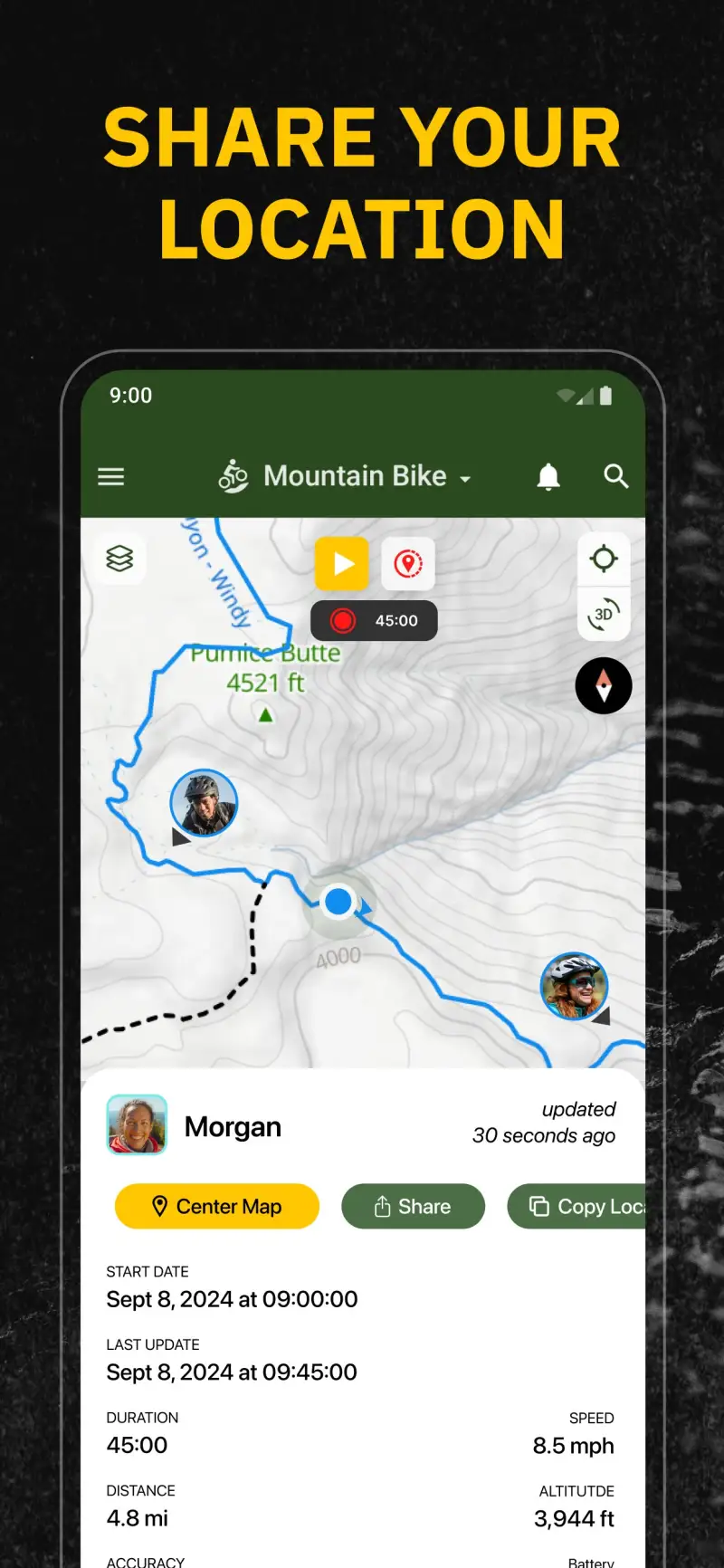
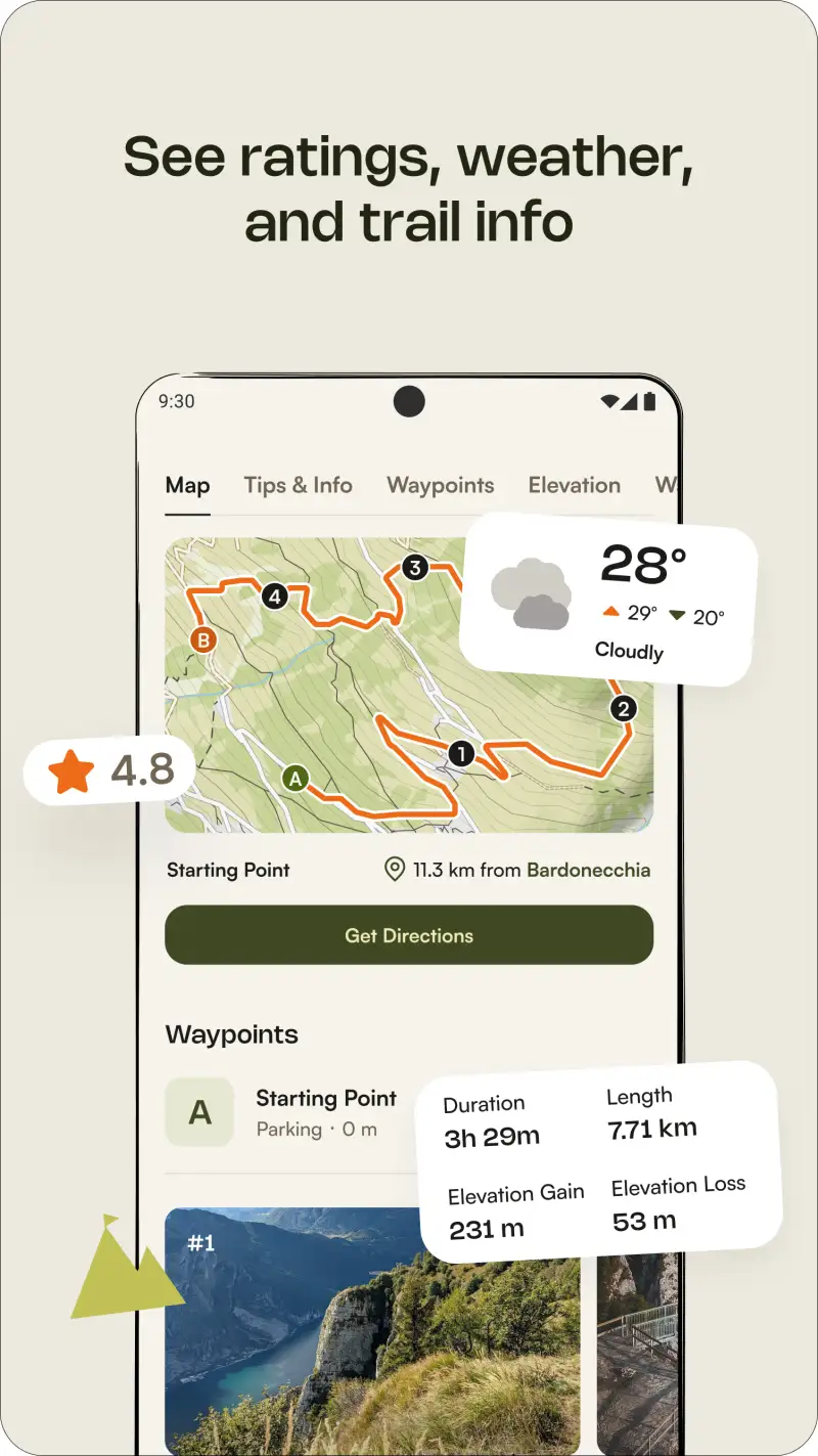
A mountain biking trail difficulty rating is not interchangeable with a hiking difficulty rating - the same trail can be a moderate hike and a technically demanding black diamond ride. Trailforks uses a dedicated mountain biking rating system (green/blue/black/double black) separate from any hiking or general outdoor classification, built by mountain bikers for mountain bikers. More critically, condition reports - crowdsourced by local riders showing whether trails are currently rideable, muddy, wet, or hero dirt - give mountain bikers information that no other outdoor activity type needs and no general outdoor app provides at equivalent quality.
Bike Park Real-Time Status
Lift-accessed bike parks require a specific data layer: which runs are currently open versus closed due to maintenance or conditions, what the lift operating status is, and what the current line lengths look like during peak periods. Trailforks provides this for major bike parks globally - real-time run status overlaid on park maps - in a way that has no equivalent on any competing platform. For riders visiting Whistler, Aosta Valley, or Morzine, this feature alone justifies Trailforks over any competing app.
GPS Tracking With Segment Performance
Mountain bikers who want to know whether they set a PR on their local jump trail or how their enduro segment time compares to last season's best need segment-based performance tracking. Strava's KOM/QOM leaderboard system and segment comparison data provide this across its 120M+ user database - the social performance layer that gives mountain biking rides competitive context beyond solo effort. Trailforks tracks rides and trails ridden, but does not provide Strava's segment competition infrastructure.
Trailforks - Best for Trail Discovery and Conditions


Trailforks is the essential mountain biking trail database - the platform where 400,000+ trails across North America, Europe, and Australia are documented with bike-specific metadata that no competing platform approaches. The combination of difficulty ratings calibrated for mountain biking (not adapted from hiking or running), crowdsourced condition reports updated by local riders, and real-time bike park run status creates a pre-ride intelligence layer that defines how mountain bikers plan their sessions.
The condition report system is Trailforks' most distinctive feature: active local riders in any trail network regularly post current surface conditions, with tags like "hero dirt", "tacky", "muddy", and "wet/saturated" giving riders decision-relevant information before they drive an hour to a trailhead. In active communities like Whistler, Squamish, or Moab, condition reports often appear within hours of conditions changing. Riders planning a weekend trail trip to an unfamiliar area can check current conditions from local riders who rode that morning.
What Trailforks does well
- 400,000+ mountain bike trails globally: the most comprehensive MTB-specific trail database; substantially better coverage and trail-specific metadata than AllTrails, Komoot, or Strava for mountain biking specifically
- Crowdsourced condition reports: real-time surface condition data from local riders; the information that determines whether a trail is worth riding today, which no other outdoor app provides at this quality
- Bike park coverage: real-time run open/closed status for lift-accessed parks; essential for planned bike park visits to Whistler, Les Gets, or other lift-served destinations
- Bike-specific difficulty ratings: green/blue/black/double black system calibrated for mountain biking difficulty, not adapted from hiking ratings; includes feature flags (rock rolls, jumps, drops) for specific technical elements
- Strava integration: import Strava rides to Trailforks for trail-segment-specific analysis; riders using both platforms see their Strava data overlaid on Trailforks trail maps
- $29.99/yr Pro tier: offline maps, advanced filters, Garmin/Wahoo sync, trail condition alerts; one of the most affordable Pro tiers among the outdoor apps in this series
Where Trailforks falls short
Trailforks' performance tracking is secondary to its trail database function - ride logging and GPS tracking exist within the app but the analytics depth is below Strava's. Athletes who want segment leaderboards, power analysis, or training load tracking alongside trail information need Strava rather than relying on Trailforks alone. Condition report quality depends entirely on active local community participation - in regions with smaller Trailforks user bases (parts of Asia, South America, and Eastern Europe), condition data may be absent or significantly delayed. Non-mountain-bike activities on Trailforks trails - trail running, hiking - have limited metadata, as the platform is purpose-built for cyclists.


Pricing: Free (trail access and basic navigation) / $29.99/year Pro (offline maps, Garmin sync, condition alerts)
The baseline app for every mountain biker. Subscribe to Pro ($29.99/yr) for offline maps and Garmin/Wahoo sync if you ride in areas with poor cell coverage or use a cycling computer. Check condition reports before every trail visit; they are the most reliable current-conditions signal available.


Strava - Best for Performance Tracking and Segment Competition
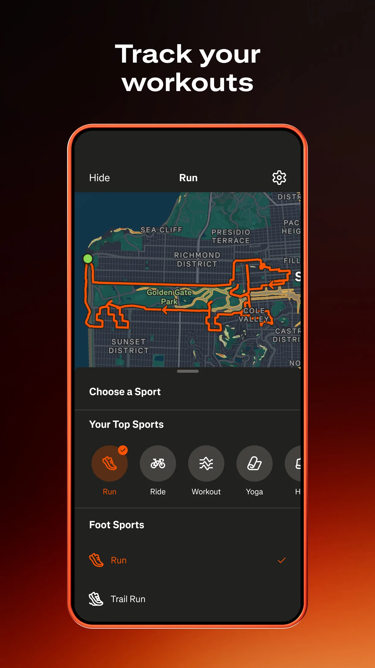
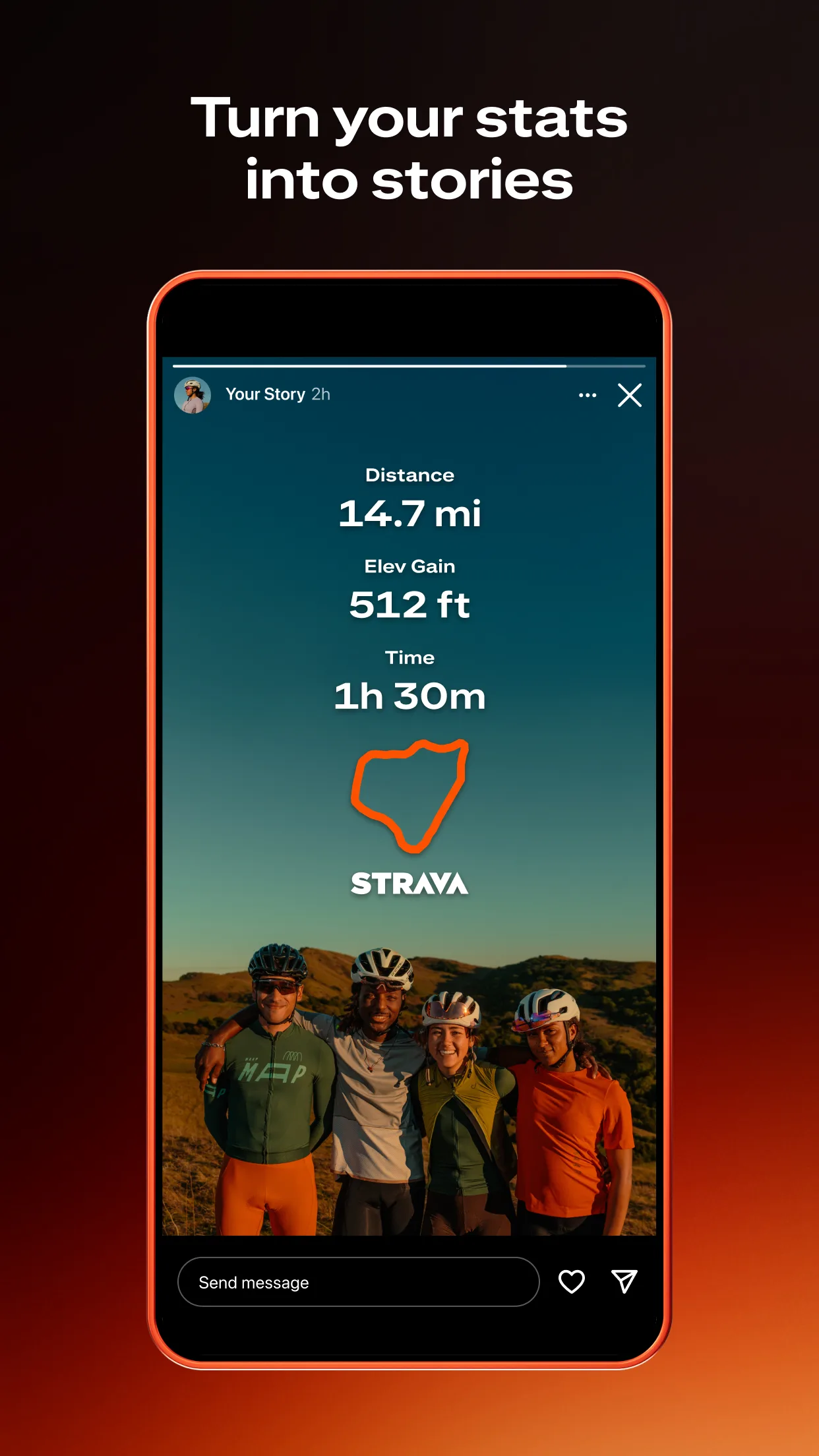

However, Trailforks tells you where to ride and what the trail is like; Strava tells you how you rode it and how that compares to every other time you or anyone else has ridden it. With 120M+ registered users and segment leaderboards on virtually every popular trail in the world, Strava provides the competitive context for mountain biking performance that no other platform approaches at scale. A black diamond descent you ride every weekend has a Strava segment with its own leaderboard - your time against local riders, regional riders, and the global mountain biking community.
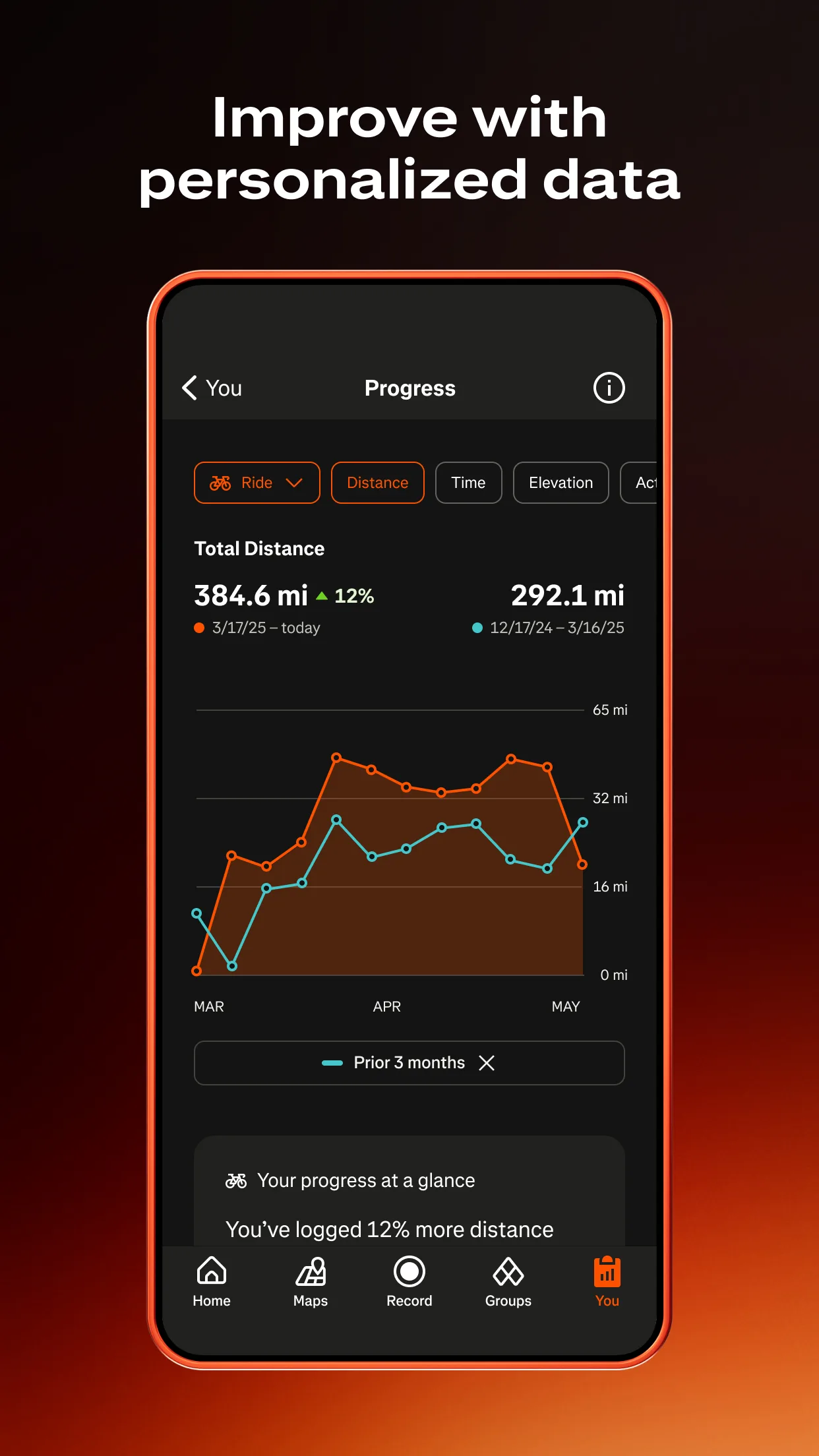
Strava's 2024 integration of Outdoor Maps (formerly Fatmap) adds 3D terrain visualisation to Premium, allowing riders to preview trail topography in 3D before riding - useful for planning new routes in unfamiliar terrain. The broader Strava ecosystem - device connectivity with virtually every GPS computer and smartwatch, automatic activity upload, training load analysis, and power data integration for e-MTB - makes it the performance hub that mountain bikers already using Garmin, Wahoo, or Apple Watch sync everything through.
What Strava does well
- Segment leaderboards on every trail: KOM/QOM competition on virtually every established trail in the world; the social performance layer that makes repeat rides competitively engaging beyond personal progression
- 120M+ user community: the largest fitness tracking platform globally; segments are more densely populated and competitively meaningful than any competing platform
- Outdoor Maps (3D terrain): 3D topographic trail preview for Premium subscribers; useful for route planning in unfamiliar mountain terrain before committing to a ride
- Broad device connectivity: automatic upload from Garmin, Wahoo, Apple Watch, and virtually every other fitness device; the performance hub that aggregates data from across the athlete's device ecosystem
- Training analysis: weekly volume, intensity distribution, fitness and freshness estimates for athletes using performance data alongside trail riding
Where Strava falls short
Strava's trail database is not mountain bike-specific - trails in Strava are defined by where athletes have ridden, not by curated trail metadata with difficulty ratings or condition reports. A Strava segment on a black diamond trail provides no warning to an unprepared rider that the trail requires technical skills beyond their level. Strava Premium at $79.99/yr is the most expensive subscription in this category - the mountain biking value is primarily the segment competition layer and Outdoor Maps, which may not justify the cost for riders who primarily want trail discovery rather than performance analytics. No condition reports, no bike park real-time status, no difficulty ratings calibrated for mountain biking.
Pricing: Free (basic GPS tracking and segments) / $79.99/year or $9.99/month Premium (Outdoor Maps, detailed analytics, training load)
Already using Strava for cycling performance tracking? The Premium upgrade adds Outdoor Maps and detailed analytics worth having for mountain bikers who want trail visualization alongside segments. New to mountain biking apps? Start with Trailforks free for trail discovery and use Strava free for GPS tracking; upgrade Strava Premium only when segment analytics and training load analysis become relevant.
Komoot - Best for Mountain Biking Route Planning and Navigation
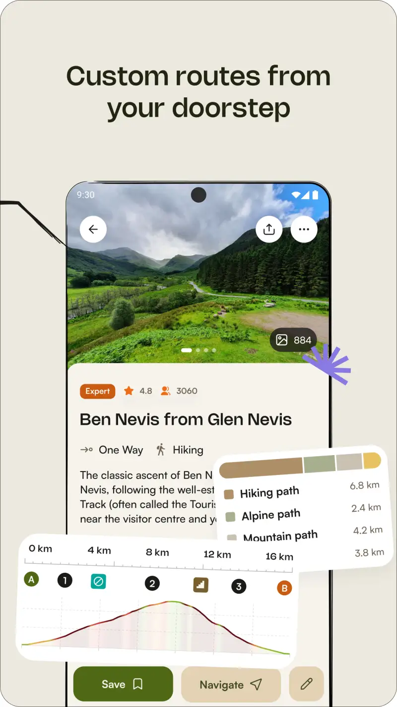
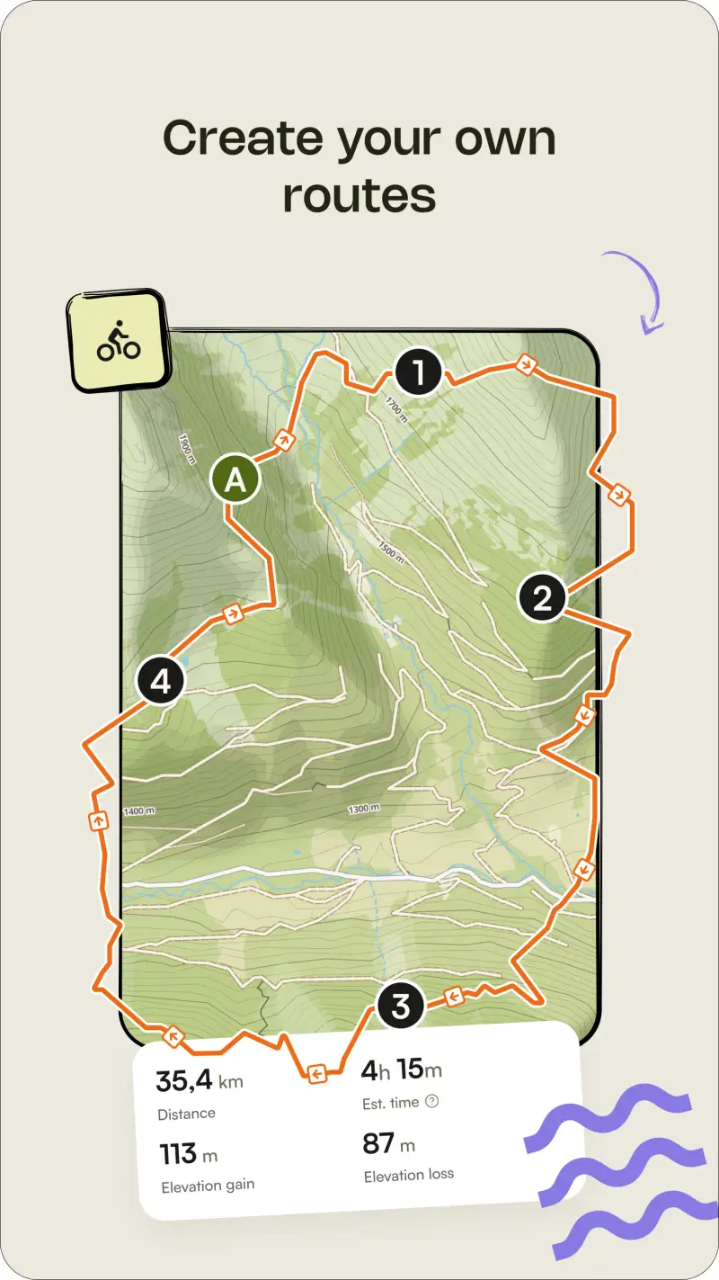
Additionally, both Trailforks and Strava assume you know where you are going or are logging somewhere you have already been. Komoot serves the route planning and navigation gap: 35M+ users have contributed mountain biking routes, voice-guided turn-by-turn navigation works offline, and the surface type data (singletrack, gravel, paved) helps riders plan routes that match their bike type and riding style. For mountain bikers exploring an unfamiliar region - planning a traverse across multiple trail networks or creating a new route rather than following an established database entry - Komoot provides the planning infrastructure that Trailforks and Strava lack.
The pricing model differs from subscription-based competitors: Komoot charges per regional map ($4.99 per region) or offers a World Pack (€29.99 one-time for unlimited regions). For mountain bikers who primarily ride in one region, the regional approach is affordable; for those who travel extensively, the World Pack avoids per-region costs.
What Komoot does well
- Voice-guided offline navigation: turn-by-turn directions through a phone speaker or Bluetooth headset; useful for exploring new trail networks where following a GPS trace on a phone screen while riding is impractical
- 35M+ community routes: user-contributed mountain biking routes across regions; a different approach to trail discovery than Trailforks' professional trail database - more like riding routes that real mountain bikers have assembled
- Surface type filtering: filter planned routes by singletrack percentage, paved road percentage, and gravel proportion; helps riders plan routes that match their bike type (hardtail, full suspension, XC race)
- €29.99 World Pack one-time: no ongoing subscription for unlimited global region access; lower long-term cost than Strava Premium for riders who primarily want navigation rather than analytics
Where Komoot falls short
Komoot does not provide real-time trail conditions, bike-specific difficulty ratings comparable to Trailforks, or bike park run status. The route database is community-contributed rather than professionally curated - quality varies significantly by region, and in less-active communities, recommended routes may be outdated or impractical. Segment competition does not exist in Komoot; riders who want KOM/QOM leaderboard performance context need Strava alongside or instead.
Pricing: $4.99 per region / €29.99 one-time World Pack / Free tier with basic route planning
Exploring unfamiliar mountain biking terrain and want voice navigation and community route suggestions? Komoot's World Pack (€29.99 one-time) provides global route planning and offline navigation at a reasonable one-time cost. Combine with Trailforks free for trail condition checking and Strava for segment performance tracking.
Which App Fits Your Mountain Biking Setup
| App | Annual Cost | Best For | Trail Conditions | Segment Performance |
|---|---|---|---|---|
| Trailforks | $29.99/yr (Pro) | Trail discovery + conditions | Yes (best) | No |
| Strava | $79.99/yr (Premium) | Performance tracking + segments | No | Yes (best) |
| Komoot | €29.99 one-time | Route planning + navigation | No | No |
Mountain biker wanting complete trail and performance coverage
Combine Trailforks Pro ($29.99/yr) for trail discovery and conditions with Strava free for segment performance tracking. Total: $29.99/yr. Upgrade to Strava Premium ($79.99/yr) if training analytics and Outdoor Maps 3D terrain become relevant.
Bike park rider or trails-focused local rider
Trailforks Pro ($29.99/yr) covers everything a trails-focused mountain biker needs: condition reports, bike park status, offline maps, and Garmin/Wahoo sync. Add Strava free for segment logging without paying for Premium features you may not use.
Mountain biker exploring new terrain or planning multi-day routes
Komoot World Pack (€29.99 one-time) for route planning and offline navigation. Trailforks free for condition checks on specific trails in your planned route. Strava free for ride logging and segment data after the fact.