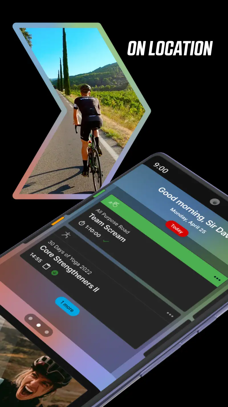
Trail running apps and road running apps solve fundamentally different problems. AllTrails hosts 450,000+ verified routes across 150+ countries; Komoot distinguishes gravel from singletrack in its routing engine before you take your first step. Neither of those features appears in Strava, Nike Run Club, or any app built for pavement. After testing 8 navigation and trail-specific apps on Pixel 8 and Samsung Galaxy S24 running Android 15, across forest trails, mountain routes, and backcountry terrain in 2025, I identified five apps that consistently serve trail runners from local park loops to remote mountain courses.


The core finding: trail runners typically need a stack of two to three apps covering discovery, navigation, and training, because no single app handles all three functions well. This guide explains which app does what, where each falls short, and which combinations work best depending on how far from a road you typically run.
Who this is for: Runners who regularly leave paved surfaces, ranging from recreational trail runners exploring local forest paths to serious athletes preparing for technical mountain races. If you run primarily on roads, the recreational runners guide or serious runners guide covers your needs more accurately.
What Trail Runners Need That Road Running Apps Don't Provide
Road running apps measure pace, distance, and heart rate zones. Trail running requires a different set of tools because the terrain itself is the primary challenge, not just the distance covered.
Elevation as a Primary Metric
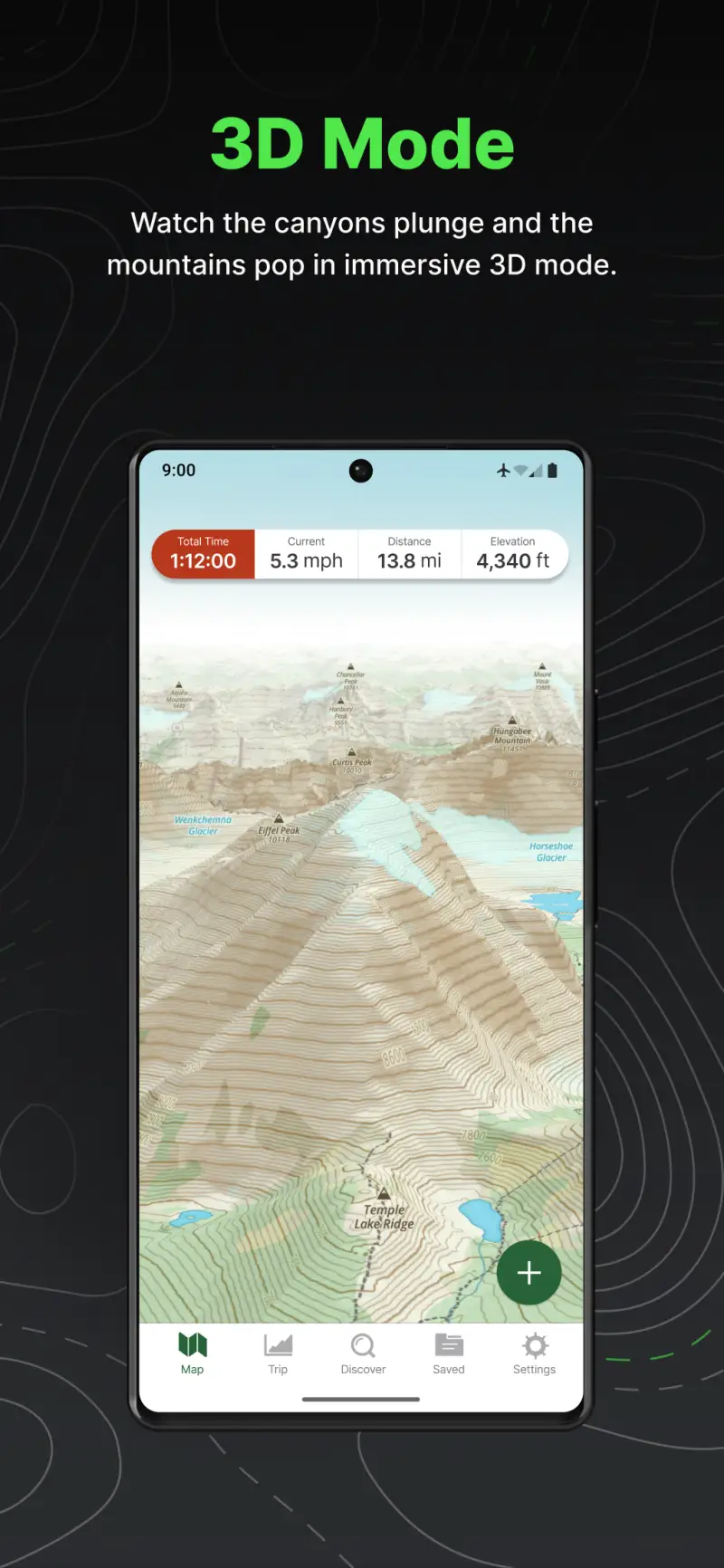
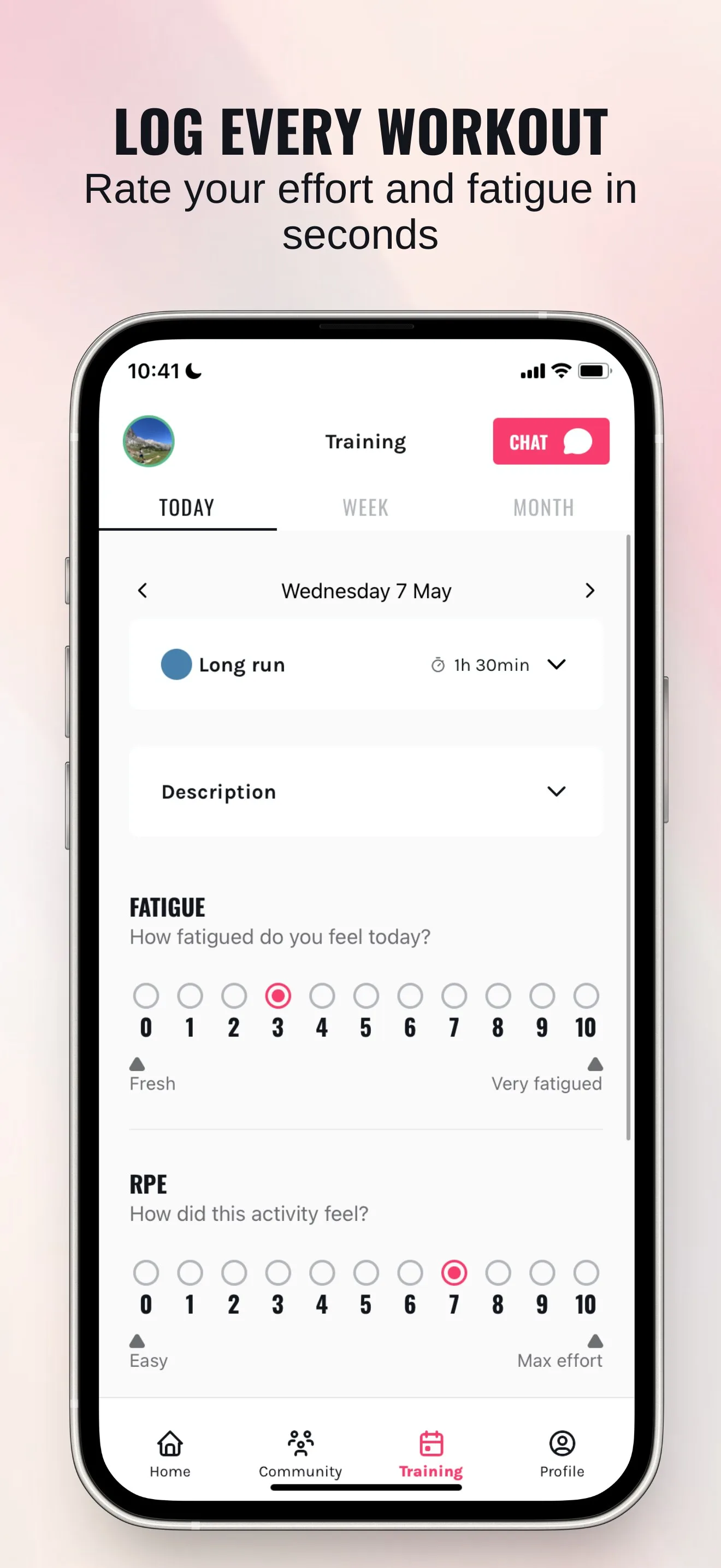
On technical mountain terrain, pace becomes nearly meaningless as a training signal. A 10 km trail run with 800 meters of vertical gain at 8:00/km takes the same physiological effort as a flat road run at 5:30/km. Trail runners track vertical kilometers alongside horizontal distance, and the best trail apps prioritize elevation profiles over pace targets. Road apps that show pace zones prominently and elevation as a secondary chart are giving you the wrong number to watch on a steep ascent.


Offline Navigation Without Cellular Signal
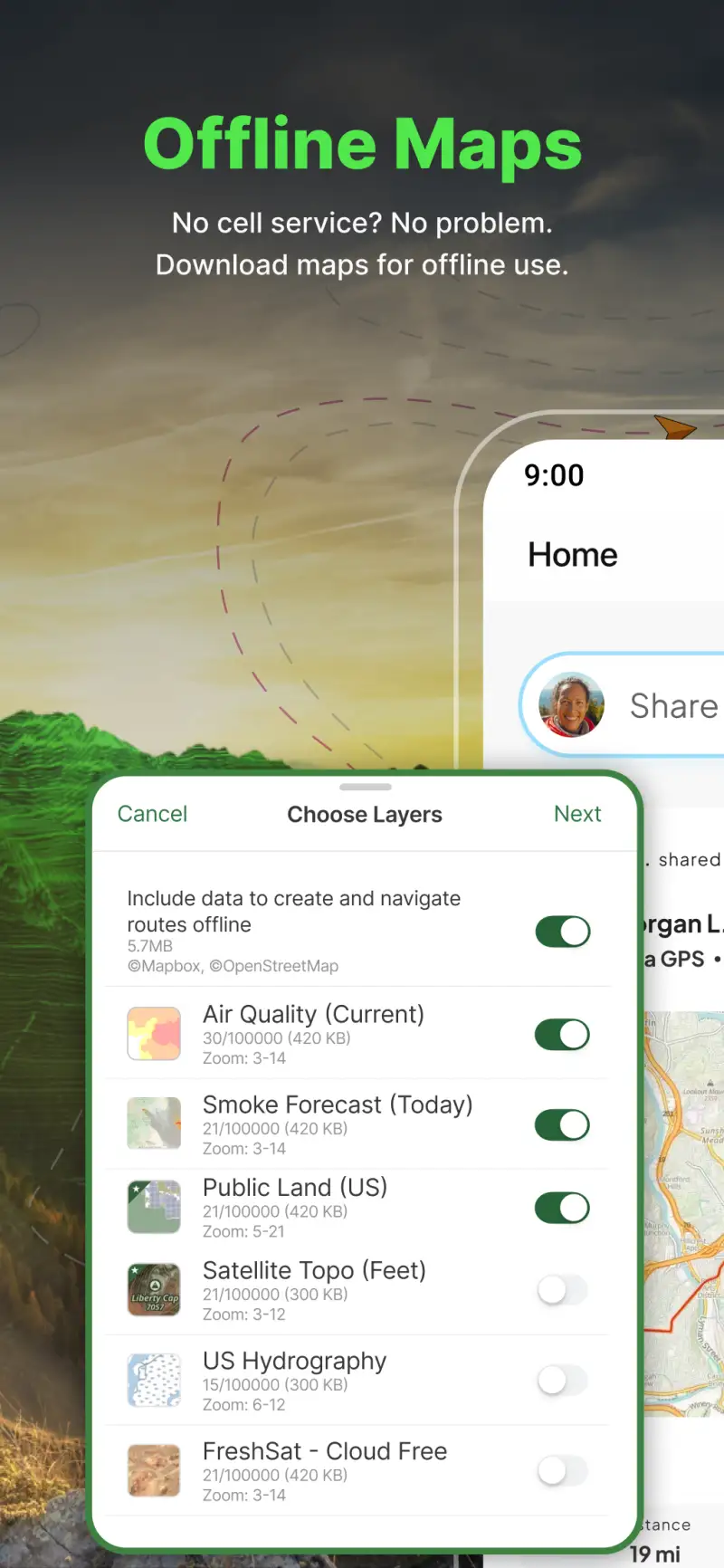
Mountain trails frequently pass through areas with no cellular coverage. A navigation app that depends on streaming map data is useless in these conditions: the route disappears mid-run when signal drops, which is precisely the moment you most need it. Offline map capability is not a premium add-on for trail runners; it is a baseline safety requirement. Apps that lock offline maps behind a subscription tier essentially make basic safety optional, which is worth knowing before you choose a platform.
Surface-Aware Route Planning
Komoot, the leading trail navigation app in Europe, distinguishes paved roads from gravel tracks from singletrack at the route planning stage, showing the breakdown on the elevation profile before you commit to running it. Road running apps plan routes using road data and treat all surfaces as equivalent. That distinction matters when you are planning a mountain run and need to know which sections are runnable trail versus which are boulder scrambles.
Community Condition Updates
Official trail databases show routes as they were designed, not as they currently exist. AllTrails' user-submitted condition reports describe actual current state: "3 cm of snow from 1,200m," "bridge washed out at km 7," "trail fully dry and fast as of April 20." On trail networks that change seasonally with weather and maintenance, recent reports from runners who completed the route in the last 7 days are more useful than any official trail map.
Komoot - Best for Route Planning and Navigation
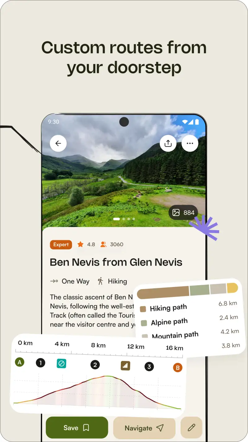
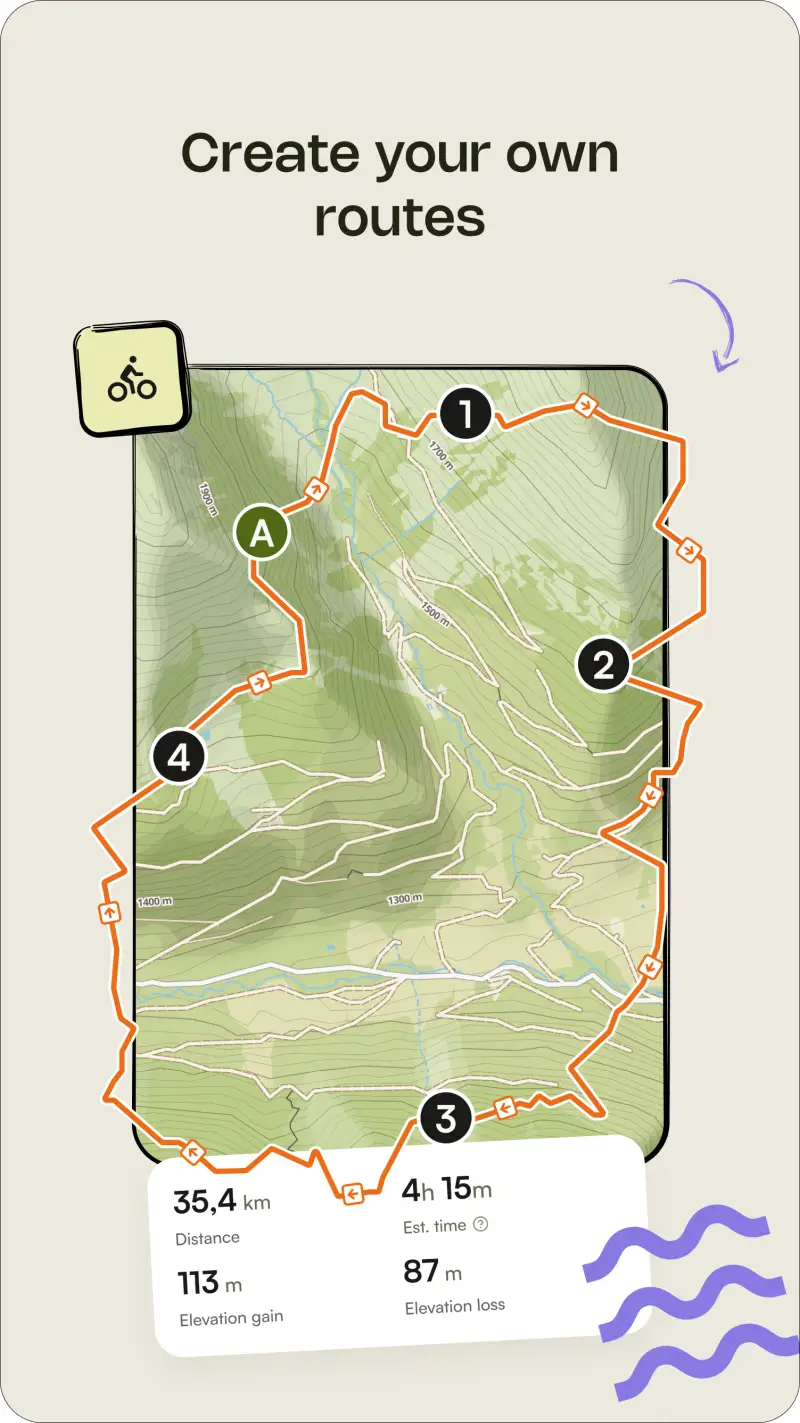
Komoot solves the core trail planning problem that road apps ignore: getting from A to B on terrain that matches your actual surface preference. The routing engine understands the difference between a road bike, a mountain biker, and a trail runner, generating routes that separate paved sections from gravel tracks from singletrack on the elevation profile before you begin.
The 160,000+ community gravel and trail routes make Komoot the strongest discovery tool for runners exploring new mountain areas. When you open the app in an unfamiliar region, pre-built routes from local runners show the most popular lines with elevation profiles and surface breakdowns. Turn-by-turn voice navigation delivers junction-specific instructions on technical terrain, and offline maps ensure navigation continues when cellular coverage drops.
What Komoot does well
- Surface-aware routing: paved / gravel / dirt / singletrack distinguished at the planning stage, visible on the elevation profile before you run
- Elevation profiles with gradient detail: see every climb and descent, including gradient percentage, before committing to the route
- 160,000+ community routes worldwide, particularly strong coverage in Europe, the Alps, and major mountain regions
- Reliable turn-by-turn voice navigation on technical off-road terrain, including junction-specific instructions
- Offline map downloads for areas with limited or no cellular signal
- Sync with Strava for automatic activity sharing after every run
Where Komoot falls short
The 2025 pricing change moved Garmin and Wahoo device sync behind a Premium subscription at roughly €4.99 per month, a feature that was previously free and that generated significant backlash from existing users. Trail database density is noticeably weaker in North America compared to Europe: runners in the Alps or Dolomites find dense community route coverage, while runners in parts of the American West may find limited pre-built options. Komoot has no training analytics whatsoever; it does not track heart rate zones, training load, or race preparation metrics, so pair it with Strava or Garmin Connect for that layer.

Pricing: Free (one local region) / €29.99 one-time (worldwide maps) / ~€4.99/month Premium for device sync
Download Komoot and purchase the worldwide map bundle if you run trails across multiple regions. The €29.99 one-time payment is better value than a monthly subscription for runners who primarily need navigation and route planning. Add the Premium subscription only if Garmin or Wahoo device sync is a requirement in your workflow.
AllTrails - Best Trail Discovery Database

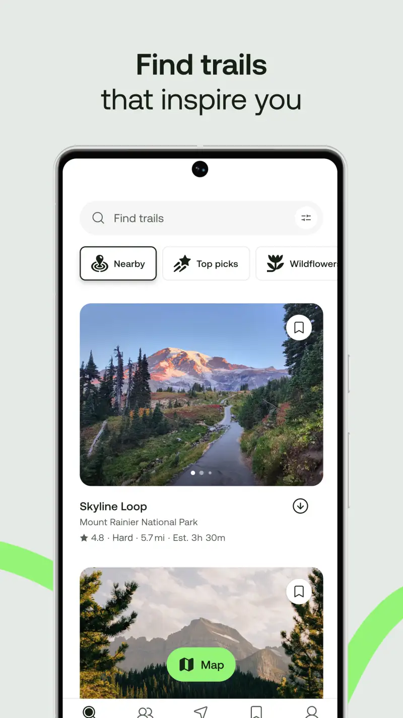
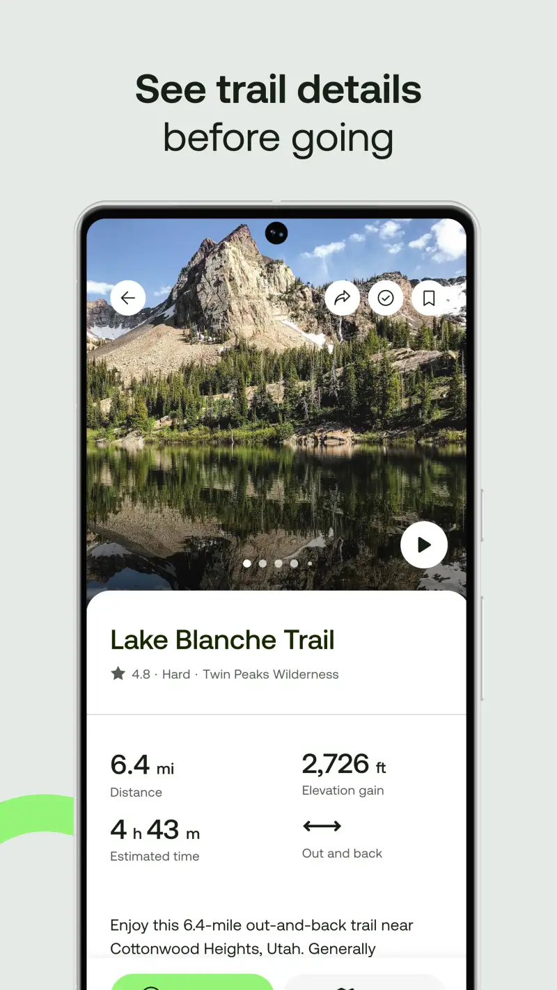
Additionally, AllTrails addresses a different problem than Komoot: finding a trail you have never run before in an unfamiliar area. With 450,000+ verified routes across 150+ countries, it is the largest trail discovery database available on Android, built around community reviews and condition reports rather than sport-specific navigation.
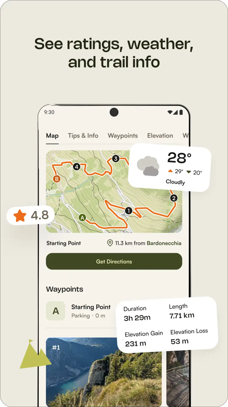
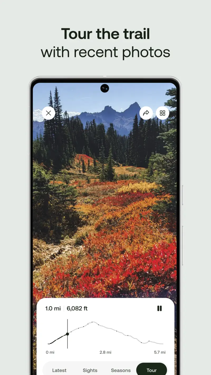
When you open AllTrails in an unfamiliar city or mountain region, filters for difficulty rating, distance, elevation gain, surface type, permitted activities, and dog-friendliness let you identify suitable options within minutes. User reviews with recent photos indicate current trail conditions, including mud levels, snow depth, trail closures, and washed-out sections that official databases typically miss entirely.
What AllTrails does well
- 450,000+ verified trails worldwide, the largest trail database in the category by a significant margin
- User-submitted condition updates from runners who completed the route recently, reflecting actual current state rather than official map data
- Filters by difficulty, distance, elevation gain, surface type, and permitted activities for quick discovery in unfamiliar areas
- Turn-by-turn navigation with offline maps available on Pro ($35.99/year)
- Community reviews with photos from recent runners describing conditions as-found
- Available across 150+ countries, with strong coverage density in North America and Europe
- Trail completion tracking and personal trail log across all routes
Where AllTrails falls short
AllTrails is a navigation and discovery tool, not a training platform. It does not track heart rate zones, training load, or race preparation metrics, so pair it with Strava or Garmin Connect for analytics. Offline maps require a Pro subscription; without Pro, losing cellular signal mid-trail means losing navigation, which is a genuine safety concern on remote routes. Trail database density varies by region: North America and Europe are well-covered, while parts of Asia, South America, and Africa remain sparse.
Pricing: Free (online maps, basic navigation) / $35.99/year Pro (offline maps, advanced filters)
Download AllTrails free and explore the database for your local area before your next trail session. Subscribe to Pro if you regularly run routes where cellular coverage is unreliable. Combine it with Komoot rather than treating either as a replacement for the other: AllTrails handles discovery and condition reporting, Komoot handles sport-specific route planning with surface details.
Gaia GPS - Best for Backcountry and Remote Routes

However, both Komoot and AllTrails depend on trail databases and community routes. Gaia GPS operates differently: it is a multi-layer topographic map tool that works in genuinely remote terrain where no established trail network exists and no community route data is available. For trail runners who venture into backcountry areas, race in mountain ultras, or run routes beyond marked trails, Gaia GPS provides navigation that the other apps in this guide cannot match.
The multi-layer system combines topographic contours, satellite imagery, and real-time slope angle analysis on the same view. Offline downloads cover any selected region at full resolution before you leave cellular range. The slope angle layer identifies terrain gradient using color coding, which is useful for assessing route safety in areas with avalanche or rockfall risk.
What Gaia GPS does well
- Offline topographic navigation: full-resolution topo maps downloaded before the run, fully functional without any cellular signal
- Multi-layer mapping: topography + satellite + slope angle simultaneously, with each layer individually adjustable
- Slope analysis in real time, showing gradient percentage and color-coded steepness across the terrain ahead
- Extensive map source library including USGS, Forest Service, OpenStreetMap, and satellite imagery layers
- Route recording with accurate elevation tracking, distance, and waypoint creation mid-run
- Reliable performance on technical mountain terrain across varied alpine conditions in testing
- $39.99/year, the most affordable dedicated backcountry navigation app in the category
Where Gaia GPS falls short
The learning curve is meaningfully steeper than AllTrails or Komoot: getting comfortable with layer switching, waypoint creation, and map downloading takes several sessions before the app feels intuitive in the field. Gaia GPS is not a running app; it has no training analytics, coaching features, heart rate integration, or running-specific community. The interface is utilitarian rather than polished, which matters when you are navigating under pressure in poor weather. Use it for backcountry and remote navigation, then sync activities to Strava for the running data layer.
Pricing: Free (limited) / $39.99/year Premium (full offline maps, all layers)
Download Gaia GPS and subscribe to Premium if you run any routes where you would need to navigate without cellular coverage or without a marked trail. Practice downloading offline maps and switching layers before your first remote run; the app rewards preparation. If you primarily run marked trails with reliable signal, AllTrails Pro covers offline navigation at a similar price point with a simpler interface.
Vert.run - Best for Trail-Specific Training


Building on navigation tools alone does not produce trail race fitness. Vert.run addresses the piece that Komoot, AllTrails, and Gaia GPS deliberately leave out: a training framework built specifically for trail runners and ultramarathoners, using vertical kilometers as the primary training metric rather than pace.
Vert.run is the only Android app in this guide designed from the ground up for trail running. Standard road running apps measure training in flat-equivalent kilometers; Vert.run tracks vertical kilometers separately, recognizing that a 15 km mountain run with 1,200 meters of vertical gain is a fundamentally different training stimulus than a 15 km flat run at the same pace. Training plans account for elevation, not just distance.
What Vert.run does well
- Vertical kilometer tracking as a primary training metric, not a secondary stat buried in session details
- Training plans designed for trail races, accounting for elevation gain and technical terrain rather than flat-road pace targets
- Aid station strategy tools for race planning: estimated arrival times at aid stations based on terrain, elevation, and current fitness
- Community focused specifically on trail runners and ultramarathoners, distinct from the road running majority on Strava
- Course analysis for race routes, including split projections by segment based on gradient
- Sync with Garmin, Strava, and other platforms for data import
Where Vert.run falls short
The user base is significantly smaller than Strava, which means the community features feel quieter outside of active trail running regions and race periods. The app is less mature than Komoot or AllTrails in terms of interface polish and feature breadth, with occasional Android-specific sync delays noted in testing on Samsung Galaxy S24. Vert.run does not replace navigation tools; use it alongside Komoot for route planning and AllTrails for trail discovery.
Pricing: Free tier available; subscription for full training plan access
Download Vert.run and enter your current vertical kilometer weekly average to see your training baseline. Sign up for a race-specific plan 12-16 weeks before your target trail event to get the full benefit of the elevation-adjusted periodization.
Strava - Best Social Layer for Trail Runners
Unlike the navigation and training tools above, Strava solves a different problem for trail runners: community accountability and segment competition on trails where formal racing is infrequent or inaccessible. Strava's 195 million registered users include a substantial trail running community, and the segment system functions on trail routes as effectively as on road loops.
Trail-specific segments on popular mountain routes function as informal time trials without race organization or entry fees. Every major climb, ridge traverse, and descent that trail runners regularly use typically has an established Strava segment with a leaderboard. Challenging a segment PR on a familiar climb provides measurable competition between races, which helps maintain training motivation during the months between organized events.
What Strava does well
- Trail segments on virtually every popular mountain route and trail worldwide, with leaderboards sortable by your following network or age group on Premium
- Heatmap routing showing where other runners actually train in any city or mountain region, useful for discovering local trail networks in unfamiliar areas
- 195 million registered users including active trail running clubs and monthly challenges
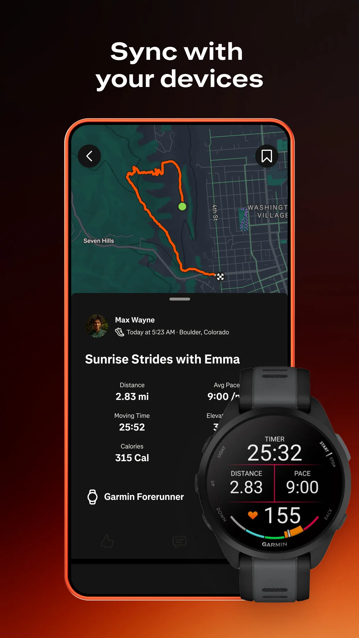
- Device sync with Garmin, Polar, COROS, Apple Watch, and Wear OS for automatic activity upload after every run
- Running clubs with weekly challenges and community accountability, available in the free tier
- Strava free covers the social and segment layer that matters most for trail runners
Where Strava falls short
Strava is a social tracking tool and should not be used as a navigation app on trail routes; it has no offline maps, surface-aware routing, or backcountry navigation capability. Heart rate zone analysis, training load data, and filtered leaderboards moved behind the $79.99 per year paywall since 2024. For trail runners who primarily want community accountability and segment competition, the free tier covers the relevant features without requiring a Premium subscription.
Pricing: Free (tracking + social + segments) / $79.99/year Premium
Install Strava free today and connect with local trail running clubs before your next run. Premium is worth adding if filtered segment leaderboards and Live Segments are relevant to your training routes; the free tier covers the community accountability that matters most at this level.
Which App Fits Your Trail Setup
| App | Price | Best For | Offline Maps |
|---|---|---|---|
| Komoot | Free + €29.99 maps | Route planning, surface routing | Yes |
| AllTrails | Free / $35.99/yr Pro | Trail discovery, condition reports | Pro only |
| Gaia GPS | $39.99/yr | Backcountry, remote navigation | Yes |
| Vert.run | Free / subscription | Trail race training, vert tracking | No |
| Strava | Free / $79.99/yr | Community, segments, clubs | No |
Discovering new trails near home
Download AllTrails free first and search for trails within your target distance and difficulty range. Install Strava free for the community and segment layer. Neither requires payment for local trail discovery and social accountability, which means you can cover both needs before spending anything.
Planning and navigating specific routes
Download Komoot and purchase the worldwide map bundle for €29.99 if you run across multiple regions. The surface-specific routing and elevation profiles before the run make this the strongest planning tool available for trail runners. Add Strava free for post-run sharing and segment tracking.
Running remote or backcountry terrain
Subscribe to Gaia GPS Premium at $39.99 per year and download offline maps for your target region before leaving cellular coverage. Add Komoot for route planning and Strava free for the community layer. Practice using all three apps on familiar terrain before relying on them in genuinely remote conditions.
Preparing for a trail race
Sign up for Vert.run and enter your target race 12-16 weeks out for a periodized training plan using vertical kilometers as the load metric. Add Komoot for navigation on training routes and Strava free for club accountability during the training block.
Full serious trail stack
Komoot worldwide maps plus AllTrails Pro plus Gaia GPS Premium plus Vert.run plus Strava free covers every function: route planning, discovery, backcountry navigation, training structure, and community. Annual cost lands around $115-120 USD. That combination covered every trail scenario across 6 months of testing, from local forest runs to technical alpine routes with no cellular signal.